
Overview
Fly Fishing Upper Bear Creek's Canyon Section
Pocket water, park access and plenty of browns a short drive from the Front Range
Upper Bear Creek's Canyon Section is the stretch many Front Range anglers picture when they think of Bear Creek. It's a small freestone creek you can reach through three public park approaches: O’Fallon Mountain Park, Corwina Mountain Park and Lair o’ the Bear. Expect pocket water, deep holes and fishy-looking runs. With three approaches in one corridor, it makes a convenient day trip, and you don't have to fish the same water every visit. The creek holds many trout, mostly browns with rainbows mixed in, and most of them are small. Come ready to enjoy small-water fishing rather than to chase big fish.
Read the complete overview
Small water like this is a great place to sharpen short, accurate casts and clean drifts. Read each pocket, make a few good presentations and keep moving. Lair o’ the Bear is likely the most popular of the three stops, and you'll share the parks with hikers, bikers and picnickers as well as other anglers. Weekend parking can be tight. Walking a little away from the busiest spots can give you more water to look at, but give everyone on the trail and the creek plenty of room.
Rain is the thing that catches people out. Storms anytime from spring through fall can muddy Bear Creek and change its clarity quickly. Check the canyon weather for the 24 hours before your trip. If substantial rain fell here, a creek that stayed dry may be the better call. It's also worth knowing the regulations before you go. From the base of Evergreen Lake dam downstream to Bear Creek Reservoir, CPW lists artificial flies or lures only, immediate release of all rainbow trout and cutbows, and a combined bag and possession limit of two for other trout. Check the posted rules for the exact water you're fishing.
Freestone. Runoff and storms can raise and color the creek, so clarity can change quickly after rain.
A small canyon creek with pocket water, deep holes and runs. Short casts cover most of it.
The trout are typically willing to eat, so short, accurate casts and drag control matter more than a perfect fly match.
Easy access through O’Fallon Mountain Park, Corwina Mountain Park and Lair o’ the Bear, with short walks to the creek.
Many trout for a creek this size, mostly browns with rainbows mixed in.
Rainbow Trout, Brown Trout Mostly small. Think short casts to small trout in pockets and runs, and enjoy this as small-water fishing rather than a big-fish trip.
Fit
Is the Bear Creek Canyon Right for Your Trip?
Who will enjoy this water most, and when another creek makes more sense
- A spring-through-fall Front Range day trip with short walks and lots of pocket water.
- Brown and rainbow trout fishing with quick, short casts in Corwina's pockets or longer drifts through O’Fallon's runs.
- Practicing dry-dropper fishing and drag control on trout that are usually willing to eat.
- Fishing several spots in one day across three parks in the same canyon corridor.
Related water
Similar Small Front Range Creeks
Other easy small freestones that fish from spring through fall
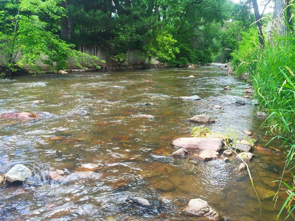 Same creek, farther downstreamLower Bear Creek - Lower SectionAnother small, easy freestone section of Bear Creek with the same spring-through-fall season. It's a good choice if you like this creek and want to try different water.It's outside the canyon parks covered here, so access and setting differ. Read its own section page before you go.
 Similar Front Range canyon creekUpper Boulder Creek - Canyon SectionA small, easy Front Range freestone canyon that fishes from spring through fall. If you enjoy short casts to Bear Creek's pocket water, it offers similar close-quarters water and makes another good canyon choice.Both are small canyon creeks, so the same short-cast, pocket-to-pocket approach carries over. Access, conditions and the way each reach fishes are independent, so check recent rain, clarity and access for whichever one you pick.
- A remote wilderness trip or an overnight outing. These three park approaches are set up for day trips.
- Reliably fishable winter canyon water.
- Targeting big trout. This is a small-trout creek best suited to pocket-water fishing.
- The day after substantial rain in the canyon, when the water may be off-color.
Alternative rivers
A Winter Option Nearby
Where to look when the Bear Creek canyon is iced up or out of season

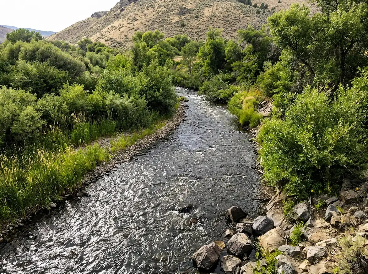
Find your next river
Pick the river before you pack the truck.
Some days call for a quiet creek. Others call for room to cast or a shot at a bigger fish. Find the water that fits the day you want.
- Compare 250+ Colorado rivers and sections by season, fish size, difficulty and access.
- See over 5,000 mapped access points and get directions.
- Save favorite waters and keep a backup plan handy.
Conditions
Bear Creek Flows and Canyon Weather
Check the canyon weather and recent rain before you drive, then use the downstream Morrison gauge as context when it has a fresh reading
Current streamflow is unavailable
Check the latest reading at the gauge before you head out.
Open the official gaugeThe same-creek USGS gauge near Morrison is downstream of the canyon accesses. Use it as context, since local tributaries and rain can change conditions in the canyon.
Past Weather and the 7-Day Forecast
Evergreen area: section point forecast
Station daily weather summary
- Precipitation
- 0 inLiquid equivalent
- Snowfall
- 0 in
- Avg. wind
- 6 mph NNW
- Observed sky / weather
- Clear
- Pressure
- —
Observation sources
Temperature: EVERGREEN. daily_station_report Source
Precipitation: EVERGREEN. Reported daily precipitation (liquid equivalent) and snowfall, in inches. Source
Wind: Broomfield / Jeffco. Mean station observations, 8am–6pm local Source
Pressure: Broomfield / Jeffco. Mean observed sea-level pressure, 8am–6pm local Source
Observed sky / weather: Broomfield / Jeffco. Qualitative station reports across available hours of the listed local date; not measured cloud percentage. Source
Daily station values are shown where available. Other fields retain their observation sources. 26 hourly station reports.
Clear
- Precipitation
- —Liquid equivalent
- Snowfall
- —
- Avg. wind
- 3 mph ENE
- Observed sky / weather
- Clear
- Pressure
- —
Observation sources
Temperature: Broomfield / Jeffco. incomplete Source
Precipitation: Broomfield / Jeffco. Hourly reports overlap; a daily precipitation total is unavailable. Source
Wind: Broomfield / Jeffco. Mean station observations, 8am–6pm local Source
Pressure: Broomfield / Jeffco. Mean observed sea-level pressure, 8am–6pm local Source
Observed sky / weather: Broomfield / Jeffco. Qualitative station reports across available hours of the listed local date; not measured cloud percentage. Source
Nearby Broomfield / Jeffco station observations: Clear. High and low summarize available temperature samples, not certified daily extremes. Station conditions can differ from the canyon. 25 hourly station reports.
Clear
- Precipitation
- —Liquid equivalent
- Snowfall
- —
- Avg. wind
- 7 mph ESE
- Observed sky / weather
- Clear
- Pressure
- —
Observation sources
Temperature: Broomfield / Jeffco. incomplete Source
Precipitation: Broomfield / Jeffco. Hourly reports overlap; a daily precipitation total is unavailable. Source
Wind: Broomfield / Jeffco. Mean station observations, 8am–6pm local Source
Pressure: Broomfield / Jeffco. Mean observed sea-level pressure, 8am–6pm local Source
Observed sky / weather: Broomfield / Jeffco. Qualitative station reports across available hours of the listed local date; not measured cloud percentage. Source
Nearby Broomfield / Jeffco station observations: Clear. High and low summarize available temperature samples, not certified daily extremes. Station conditions can differ from the canyon. 25 hourly station reports.
Clear
- Precipitation
- —Liquid equivalent
- Snowfall
- —
- Avg. wind
- 4 mph NNE
- Observed sky / weather
- Clear
- Pressure
- —
Observation sources
Temperature: Broomfield / Jeffco. day_spanning_observations Source
Precipitation: Broomfield / Jeffco. Hourly reports overlap; a daily precipitation total is unavailable. Source
Wind: Broomfield / Jeffco. Mean station observations, 8am–6pm local Source
Pressure: Broomfield / Jeffco. Mean observed sea-level pressure, 8am–6pm local Source
Observed sky / weather: Broomfield / Jeffco. Qualitative station reports across available hours of the listed local date; not measured cloud percentage. Source
Nearby Broomfield / Jeffco station observations: Clear. High and low summarize available temperature samples, not certified daily extremes. Station conditions can differ from the canyon. 33 hourly station reports.
Clear; Cloudy; Mostly Cloudy
- Precipitation
- —Liquid equivalent
- Snowfall
- —
- Avg. wind
- 5 mph N
- Observed sky / weather
- Clear; Cloudy; Mostly Cloudy; Fog; Fog/Mist; Light Drizzle
- Pressure
- —
Observation sources
Temperature: Broomfield / Jeffco. day_spanning_observations Source
Precipitation: Broomfield / Jeffco. Hourly reports overlap; a daily precipitation total is unavailable. Source
Wind: Broomfield / Jeffco. Mean station observations, 8am–6pm local Source
Pressure: Broomfield / Jeffco. Mean observed sea-level pressure, 8am–6pm local Source
Observed sky / weather: Broomfield / Jeffco. Qualitative station reports across available hours of the listed local date; not measured cloud percentage. Source
Nearby Broomfield / Jeffco station observations: Clear; Cloudy; Mostly Cloudy; Fog; Fog/Mist; Light Drizzle. High and low summarize available temperature samples, not certified daily extremes. Station conditions can differ from the canyon. 30 hourly station reports.
Clear; Haze; Partly Cloudy
- Precipitation
- —Liquid equivalent
- Snowfall
- —
- Avg. wind
- 6 mph ENE
- Observed sky / weather
- Clear; Haze; Partly Cloudy; Cloudy; Fog; Fog/Mist
- Pressure
- —
Observation sources
Temperature: Broomfield / Jeffco. day_spanning_observations Source
Precipitation: Broomfield / Jeffco. Hourly reports overlap; a daily precipitation total is unavailable. Source
Wind: Broomfield / Jeffco. Mean station observations, 8am–6pm local Source
Pressure: Broomfield / Jeffco. Mean observed sea-level pressure, 8am–6pm local Source
Observed sky / weather: Broomfield / Jeffco. Qualitative station reports across available hours of the listed local date; not measured cloud percentage. Source
Nearby Broomfield / Jeffco station observations: Clear; Haze; Partly Cloudy; Cloudy; Fog; Fog/Mist. High and low summarize available temperature samples, not certified daily extremes. Station conditions can differ from the canyon. 33 hourly station reports.
Clear
- Precipitation
- —Liquid equivalent
- Snowfall
- —
- Avg. wind
- 4 mph NNE
- Observed sky / weather
- Clear
- Pressure
- —
Observation sources
Temperature: Broomfield / Jeffco. day_spanning_observations Source
Precipitation: Broomfield / Jeffco. Hourly reports overlap; a daily precipitation total is unavailable. Source
Wind: Broomfield / Jeffco. Mean station observations, 8am–6pm local Source
Pressure: Broomfield / Jeffco. Mean observed sea-level pressure, 8am–6pm local Source
Observed sky / weather: Broomfield / Jeffco. Qualitative station reports across available hours of the listed local date; not measured cloud percentage. Source
Nearby Broomfield / Jeffco station observations: Clear. High and low summarize available temperature samples, not certified daily extremes. Station conditions can differ from the canyon. 32 hourly station reports.
Mostly Sunny
Precipitation chance2%Mostly Clear
Precipitation chance3%- Avg. wind
- 5 mph S
- Cloud cover
- 33%
- Pressure
- 29.74 inHg
Sunny
Precipitation chance0%Mostly Clear
Precipitation chance0%- Avg. wind
- 12 mph WSW
- Cloud cover
- 4%
- Pressure
- 29.94 inHg
Mostly Sunny
Precipitation chance0%Partly Cloudy
Precipitation chance1%- Avg. wind
- 3 mph SSE
- Cloud cover
- 44%
- Pressure
- 29.88 inHg
Mostly Sunny
Precipitation chance13%Slight Chance Snow Showers
Snow chance17%- Avg. wind
- 11 mph WSW
- Cloud cover
- 32%
- Pressure
- 29.62 inHg
Sunny
Precipitation chance10%Mostly Clear
Precipitation chance5%- Avg. wind
- 5 mph WNW
- Cloud cover
- 19%
- Pressure
- 29.98 inHg
Mostly Sunny
Precipitation chance1%Partly Cloudy
Precipitation chance5%- Avg. wind
- 2 mph E
- Cloud cover
- 29%
- Pressure
- 29.96 inHg
Partly Sunny then Chance Snow Showers
Snow chance29%- Avg. wind
- 2 mph NE
- Cloud cover
- 55%
- Pressure
- 30.05 inHg
Weather sources
National Weather Service · Broomfield / Jeffco. Wind and cloud averages use 8am–6pm local time. Forecast pressure: MET Norway, averaged daytime sea-level pressure in inches of mercury (CC BY 4.0). Past station reports do not include forecast rain chances or exact cloud percentages; a dash means unavailable.
Unlock the full guide
Know where to fish and what to tie on.
Put the forecast to work. Compare streamflow history on gauged waters, then open the full fishing plan for the section you pick.
- See where to start and how to fish each season.
- Match local hatches and fill your box with the recommended flies.
- Open the access map and get directions before you leave.
Gallery
Upper Bear Creek Canyon Photos
A look at the pocket water and runs before you go
River Explorer Pro
Make this your next fishing trip.
Unlock River Explorer Pro and make your next fishing trip your best adventure yet.
- Find where to get on the water with interactive access maps and directions.
- Plan around recent weather and streamflows where gauges are available.
- Pack the right flies with seasonal tactics, hatch charts and pattern recommendations.
- Compare 250+ Colorado rivers and sections and save a backup stretch.