
Overview
Fryingpan River Tailwater Overview
Big trout, four species and some of Colorado's best tailwater dry-fly fishing below Ruedi Reservoir.
The Fryingpan below Ruedi Reservoir is one of the most famous rivers in Colorado, and it has earned that reputation. It holds a lot of fish, and many of them are trophy sized. Cold water coming out of the dam supports rainbows, cutbows, browns and cutthroat. Those four species share the river, though you shouldn't expect to see them in equal numbers. The chance at a genuinely large trout is a real part of every day here.
Read the complete overview
The reservoir shapes this river in ways you can use. Releases from Ruedi set the flow, keep the water cold and carry food out of the lake. The best-known example is Mysis shrimp, which wash through the dam and matter most in the upper tailwater just below Ruedi. That upper water, including the well-known Toilet Bowl hole directly below the outflow, is where the Pan built its reputation for big, heavily pressured fish. The hole's fame doesn't make every inch of that area open to fishing. Dam facilities and posted areas are off-limits, so fish only where current signs and maps show public water.
Farther downstream, the river reads differently. The trout still see plenty of anglers, but their food shifts toward aquatic insects, and the Fryingpan becomes one of the best dry-fly tailwaters in the state. Over the course of the year you'll see midges, Blue-Winged Olives, caddis, stoneflies, Green Drakes, Pale Morning Duns, Pseudos and more. Dry-fly fishing is possible even in winter, when midges and BWOs can bring fish up. Summer and early fall add the big-fly fishing many anglers come for, with PMDs and Green Drakes continuing into September in upper, middle and lower water.
You'll need to bring your A game. These trout are college-educated and know what a hook looks like. In clear, slow water, longer casts and smaller tippet will help you put fish in the net. Choose a tippet that still lets you land the size of fish you're casting to. Don't line the fish by casting over them. Wade as little as you need to, and stay as stealthy as you can. When a fish refuses, look first at the angle and drag of your drift, then at the fly. Do those things well and you'll find some eager trout.
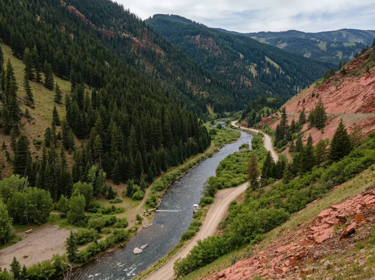
Getting to the water is easy. Fryingpan Road follows the tailwater down toward Basalt, and the public water is well marked. Public stretches alternate with private ones, though, and the popular runs can get crowded. If you'd rather have solitude than big fish and company, the Fryingpan above Ruedi is a smaller, less technical freestone. It holds fewer and smaller trout but gets far less pressure.
A tailwater below Ruedi Reservoir. Releases set the flow, keep the water cold and deliver Mysis shrimp, which matter most in the upper river.
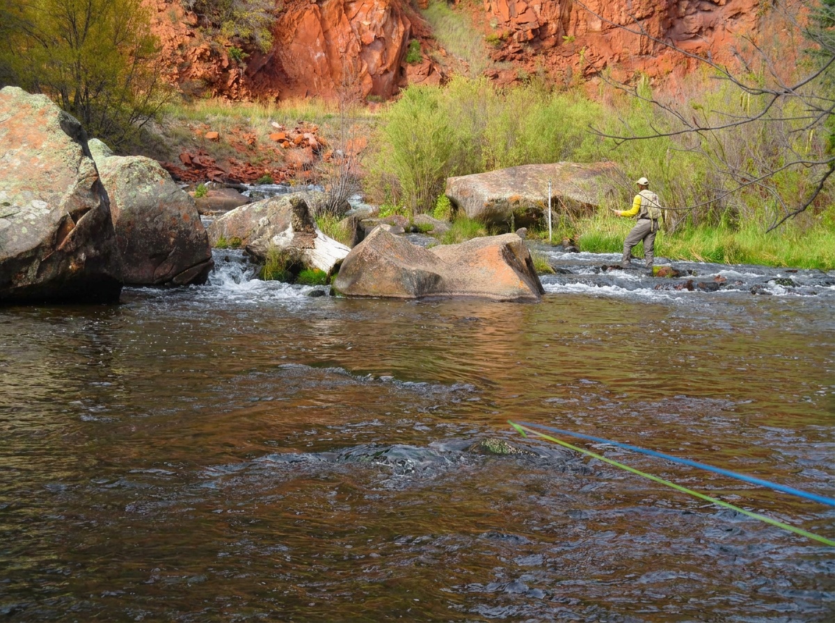
A medium river with technical flats, seams, riffles and pocket water. That's enough variety to fish several ways in a day.
Hard. These trout are heavily pressured, the water is often clear, and a careful approach and clean drift matter as much as the fly.
Easy. Fryingpan Road follows the river, and public water is well marked. It alternates with private water, and popular runs can get crowded.
Many. The river holds a lot of trout, though pressured fish don't always cooperate.
Rainbow Trout, Cutbow Trout, Brown Trout, Cutthroat Trout Large, with trophy potential among the river's rainbows, cutbows, browns and cutthroat.
Fit
Is the Fryingpan Tailwater Right for You?
Big fish and great dry-fly water come with crowds, technical trout and mixed public access.
- Large fish and demanding presentations, with real opportunities to fish dry flies.
- Watching a feeding lane carefully and changing angle, drift or stage with a reason.
- Fishing in every season, including winter midge and BWO dry-fly days.
- Uncrowded access everywhere or a guarantee that a Mysis pattern solves the whole river.
- Continuous public frontage or fishing a dam structure without checking current boundaries.
- Easy prospecting for willing fish. The trout above Ruedi are smaller but far less pressured.
Alternative rivers
Alternatives to the Fryingpan Tailwater
Where to go when you want quieter water upstream or a bigger river down the valley.
 Smaller, quieter freestone waterFryingpan River - Above Ruedi HeadwatersPick the Fryingpan above Ruedi when you'd rather have solitude and easier fishing than big fish and crowds. It's a small, easy headwater freestone up the same valley road past the reservoir, and it's in our guide for spring, summer and fall.You'll find fewer and smaller trout. It doesn't have the tailwater's Mysis or cold, release-driven flows, and it isn't one of our winter options.
 Bigger freestone water down the valleyRoaring Fork River - Middle SectionHead down the Fryingpan valley to Basalt and Highway 82 for the Middle Roaring Fork. It's a large freestone with medium difficulty and fishing in all four seasons, a good change from the Pan's technical tailwater fishing.It's a much bigger river to read and wade. As a freestone, its flows follow snowmelt and weather rather than releases from a dam.
Find your next river
Pick the river before you pack the truck.
Some days call for a quiet creek. Others call for room to cast or a shot at a bigger fish. Find the water that fits the day you want.
- Compare 250+ Colorado rivers and sections by season, fish size, difficulty and access.
- See over 5,000 mapped access points and get directions.
- Save favorite waters and keep a backup plan handy.
Conditions
Current Fryingpan Flows and Weather
Check the release from Ruedi and the forecast before you choose between the upper river and downstream water.
- Fishable flow ranges
- 150–550 cfs
- Trend
- → Near the previous seven-day mean
- Source
- USGS · 09080400
- Observed
- Fri, Nov 20 · 1:15 am MST
Follow the flow trend, then adjust your fishing depth and the water you focus on.
This is a same-river gauge reading. Use it for flow context and confirm the water where you fish.
Streamflow in CFS
View all flow readings
| Date | Streamflow (CFS) |
|---|---|
| 2026-11-14 | 39.3 |
| 2026-11-15 | 39.6 |
| 2026-11-16 | 39.2 |
| 2026-11-17 | 39.4 |
| 2026-11-18 | 39.3 |
| 2026-11-19 | 39.2 |
| 2026-11-20 | 39.3 |
View all flow readings
| Date | Streamflow (CFS) |
|---|---|
| 2026-10-22 | 44.2 |
| 2026-10-23 | 44 |
| 2026-10-24 | 44 |
| 2026-10-25 | 44.2 |
| 2026-10-26 | 44 |
| 2026-10-27 | 44 |
| 2026-10-28 | 44 |
| 2026-10-29 | 44.1 |
| 2026-10-30 | 44.3 |
| 2026-10-31 | 44.1 |
| 2026-11-01 | 44 |
| 2026-11-02 | 43.9 |
| 2026-11-03 | 43.4 |
| 2026-11-04 | 43.5 |
| 2026-11-05 | 43.4 |
| 2026-11-06 | 43.4 |
| 2026-11-07 | 43.3 |
| 2026-11-08 | 43.3 |
| 2026-11-09 | 43 |
| 2026-11-10 | 42.9 |
| 2026-11-11 | 44.5 |
| 2026-11-12 | 44.4 |
| 2026-11-13 | 39.3 |
| 2026-11-14 | 39.3 |
| 2026-11-15 | 39.6 |
| 2026-11-16 | 39.2 |
| 2026-11-17 | 39.4 |
| 2026-11-18 | 39.3 |
| 2026-11-19 | 39.2 |
| 2026-11-20 | 39.3 |
Past Weather and the 7-Day Forecast
Fryingpan below Ruedi: section point forecast
Clear
- Precipitation
- —Liquid equivalent
- Snowfall
- —
- Avg. wind
- 5 mph NW
- Observed sky / weather
- Clear
- Pressure
- 29.86 inHg
Observation sources
Temperature: Aspen-Pitkin County Airport. day_spanning_observations Source
Precipitation: Aspen-Pitkin County Airport. Hourly reports overlap; a daily precipitation total is unavailable. Source
Wind: Aspen-Pitkin County Airport. Mean station observations, 8am–6pm local Source
Pressure: Aspen-Pitkin County Airport. Mean observed sea-level pressure, 8am–6pm local Source
Observed sky / weather: Aspen-Pitkin County Airport. Qualitative station reports across available hours of the listed local date; not measured cloud percentage. Source
Nearby Aspen-Pitkin County Airport station observations: Clear. High and low summarize available temperature samples, not certified daily extremes. Station conditions can differ from the canyon. 110 hourly station reports.
Cloudy; Light Rain; Mostly Cloudy
- Precipitation
- —Liquid equivalent
- Snowfall
- —
- Avg. wind
- 4 mph NNW
- Observed sky / weather
- Cloudy; Light Rain; Mostly Cloudy; Partly Cloudy; Clear; Mostly Clear; Haze; Fog/Mist; Light Snow and Fog/Mist; Light Snow
- Pressure
- 29.74 inHg
Observation sources
Temperature: Aspen-Pitkin County Airport. day_spanning_observations Source
Precipitation: Aspen-Pitkin County Airport. Hourly reports overlap; a daily precipitation total is unavailable. Source
Wind: Aspen-Pitkin County Airport. Mean station observations, 8am–6pm local Source
Pressure: Aspen-Pitkin County Airport. Mean observed sea-level pressure, 8am–6pm local Source
Observed sky / weather: Aspen-Pitkin County Airport. Qualitative station reports across available hours of the listed local date; not measured cloud percentage. Source
Nearby Aspen-Pitkin County Airport station observations: Cloudy; Light Rain; Mostly Cloudy; Partly Cloudy; Clear; Mostly Clear; Haze; Fog/Mist; Light Snow and Fog/Mist; Light Snow. High and low summarize available temperature samples, not certified daily extremes. Station conditions can differ from the canyon. 135 hourly station reports.
Clear; Mostly Clear; Cloudy
- Precipitation
- —Liquid equivalent
- Snowfall
- —
- Avg. wind
- 5 mph NNW
- Observed sky / weather
- Clear; Mostly Clear; Cloudy; Fog/Mist; Light Rain
- Pressure
- 30.1 inHg
Observation sources
Temperature: Aspen-Pitkin County Airport. day_spanning_observations Source
Precipitation: Aspen-Pitkin County Airport. Hourly reports overlap; a daily precipitation total is unavailable. Source
Wind: Aspen-Pitkin County Airport. Mean station observations, 8am–6pm local Source
Pressure: Aspen-Pitkin County Airport. Mean observed sea-level pressure, 8am–6pm local Source
Observed sky / weather: Aspen-Pitkin County Airport. Qualitative station reports across available hours of the listed local date; not measured cloud percentage. Source
Nearby Aspen-Pitkin County Airport station observations: Clear; Mostly Clear; Cloudy; Fog/Mist; Light Rain. High and low summarize available temperature samples, not certified daily extremes. Station conditions can differ from the canyon. 109 hourly station reports.
Clear
- Precipitation
- —Liquid equivalent
- Snowfall
- —
- Avg. wind
- 5 mph NNW
- Observed sky / weather
- Clear
- Pressure
- 30.12 inHg
Observation sources
Temperature: Aspen-Pitkin County Airport. day_spanning_observations Source
Precipitation: Aspen-Pitkin County Airport. Hourly reports overlap; a daily precipitation total is unavailable. Source
Wind: Aspen-Pitkin County Airport. Mean station observations, 8am–6pm local Source
Pressure: Aspen-Pitkin County Airport. Mean observed sea-level pressure, 8am–6pm local Source
Observed sky / weather: Aspen-Pitkin County Airport. Qualitative station reports across available hours of the listed local date; not measured cloud percentage. Source
Nearby Aspen-Pitkin County Airport station observations: Clear. High and low summarize available temperature samples, not certified daily extremes. Station conditions can differ from the canyon. 126 hourly station reports.
Partly Cloudy; Mostly Cloudy; Cloudy
- Precipitation
- —Liquid equivalent
- Snowfall
- —
- Avg. wind
- 10 mph S
- Observed sky / weather
- Partly Cloudy; Mostly Cloudy; Cloudy; Light Rain; Rain and Fog/Mist; Light Rain and Fog/Mist; Rain; Mostly Clear; Clear
- Pressure
- 29.75 inHg
Observation sources
Temperature: Aspen-Pitkin County Airport. day_spanning_observations Source
Precipitation: Aspen-Pitkin County Airport. Hourly reports overlap; a daily precipitation total is unavailable. Source
Wind: Aspen-Pitkin County Airport. Mean station observations, 8am–6pm local Source
Pressure: Aspen-Pitkin County Airport. Mean observed sea-level pressure, 8am–6pm local Source
Observed sky / weather: Aspen-Pitkin County Airport. Qualitative station reports across available hours of the listed local date; not measured cloud percentage. Source
Nearby Aspen-Pitkin County Airport station observations: Partly Cloudy; Mostly Cloudy; Cloudy; Light Rain; Rain and Fog/Mist; Light Rain and Fog/Mist; Rain; Mostly Clear; Clear. High and low summarize available temperature samples, not certified daily extremes. Station conditions can differ from the canyon. 140 hourly station reports.
Clear; Mostly Clear; Mostly Cloudy
- Precipitation
- —Liquid equivalent
- Snowfall
- —
- Avg. wind
- 5 mph NW
- Observed sky / weather
- Clear; Mostly Clear; Mostly Cloudy; Cloudy; Partly Cloudy
- Pressure
- 30.12 inHg
Observation sources
Temperature: Aspen-Pitkin County Airport. day_spanning_observations Source
Precipitation: Aspen-Pitkin County Airport. Hourly reports overlap; a daily precipitation total is unavailable. Source
Wind: Aspen-Pitkin County Airport. Mean station observations, 8am–6pm local Source
Pressure: Aspen-Pitkin County Airport. Mean observed sea-level pressure, 8am–6pm local Source
Observed sky / weather: Aspen-Pitkin County Airport. Qualitative station reports across available hours of the listed local date; not measured cloud percentage. Source
Nearby Aspen-Pitkin County Airport station observations: Clear; Mostly Clear; Mostly Cloudy; Cloudy; Partly Cloudy. High and low summarize available temperature samples, not certified daily extremes. Station conditions can differ from the canyon. 121 hourly station reports.
Cloudy; Mostly Cloudy; Clear
- Precipitation
- —Liquid equivalent
- Snowfall
- —
- Avg. wind
- 7 mph NNW
- Observed sky / weather
- Cloudy; Mostly Cloudy; Clear; Mostly Clear; Partly Cloudy
- Pressure
- 30.11 inHg
Observation sources
Temperature: Aspen-Pitkin County Airport. day_spanning_observations Source
Precipitation: Aspen-Pitkin County Airport. Hourly reports overlap; a daily precipitation total is unavailable. Source
Wind: Aspen-Pitkin County Airport. Mean station observations, 8am–6pm local Source
Pressure: Aspen-Pitkin County Airport. Mean observed sea-level pressure, 8am–6pm local Source
Observed sky / weather: Aspen-Pitkin County Airport. Qualitative station reports across available hours of the listed local date; not measured cloud percentage. Source
Nearby Aspen-Pitkin County Airport station observations: Cloudy; Mostly Cloudy; Clear; Mostly Clear; Partly Cloudy. High and low summarize available temperature samples, not certified daily extremes. Station conditions can differ from the canyon. 110 hourly station reports.
Chance Snow Showers And Patchy Blowing Snow
Snow chance50%Slight Chance Snow Showers
Snow chance24%- Avg. wind
- 16 mph WSW
- Cloud cover
- 59%
- Pressure
- 29.83 inHg
Slight Chance Snow Showers then Mostly Sunny
Snow chance17%Mostly Clear
Precipitation chance0%- Avg. wind
- 7 mph W
- Cloud cover
- 21%
- Pressure
- 30.03 inHg
Mostly Sunny
Precipitation chance0%Partly Cloudy then Slight Chance Snow Showers
Snow chance18%- Avg. wind
- 5 mph SW
- Cloud cover
- 32%
- Pressure
- 30.08 inHg
Chance Snow Showers
Snow chance51%Chance Snow Showers
Snow chance51%- Avg. wind
- 7 mph WSW
- Cloud cover
- 63%
- Pressure
- 30.12 inHg
Slight Chance Snow Showers then Mostly Sunny
Snow chance15%Partly Cloudy
Precipitation chance7%- Avg. wind
- 5 mph W
- Cloud cover
- 43%
- Pressure
- 30.31 inHg
Mostly Sunny then Chance Snow Showers
Snow chance31%Chance Snow Showers
Snow chance32%- Avg. wind
- 5 mph SW
- Cloud cover
- 47%
- Pressure
- 30.13 inHg
Chance Snow Showers
Snow chance34%- Avg. wind
- 5 mph W
- Cloud cover
- 57%
- Pressure
- 30.2 inHg
Weather sources
National Weather Service · Aspen-Pitkin County Airport. Wind and cloud averages use 8am–6pm local time. Forecast pressure: MET Norway, averaged daytime sea-level pressure in inches of mercury (CC BY 4.0). Past station reports do not include forecast rain chances or exact cloud percentages; a dash means unavailable.
Unlock the full guide
Know where to fish and what to tie on.
Put the forecast to work. Compare streamflow history on gauged waters, then open the full fishing plan for the section you pick.
- See where to start and how to fish each season.
- Match local hatches and fill your box with the recommended flies.
- Open the access map and get directions before you leave.
Gallery
Fryingpan Tailwater Photos
A look at the valley and the runs and flats you'll be fishing.
River Explorer Pro
Make this your next fishing trip.
Unlock River Explorer Pro and make your next fishing trip your best adventure yet.
- Find where to get on the water with interactive access maps and directions.
- Plan around recent weather and streamflows where gauges are available.
- Pack the right flies with seasonal tactics, hatch charts and pattern recommendations.
- Compare 250+ Colorado rivers and sections and save a backup stretch.