
Overview
Fishing the Lower Gunnison River and the Black Canyon
Black Canyon pocket water when the East Portal road is open, lower valley water for winter, and Gold Medal water from below Crystal Dam to the North Fork with rainbows, browns and whitefish to work for.
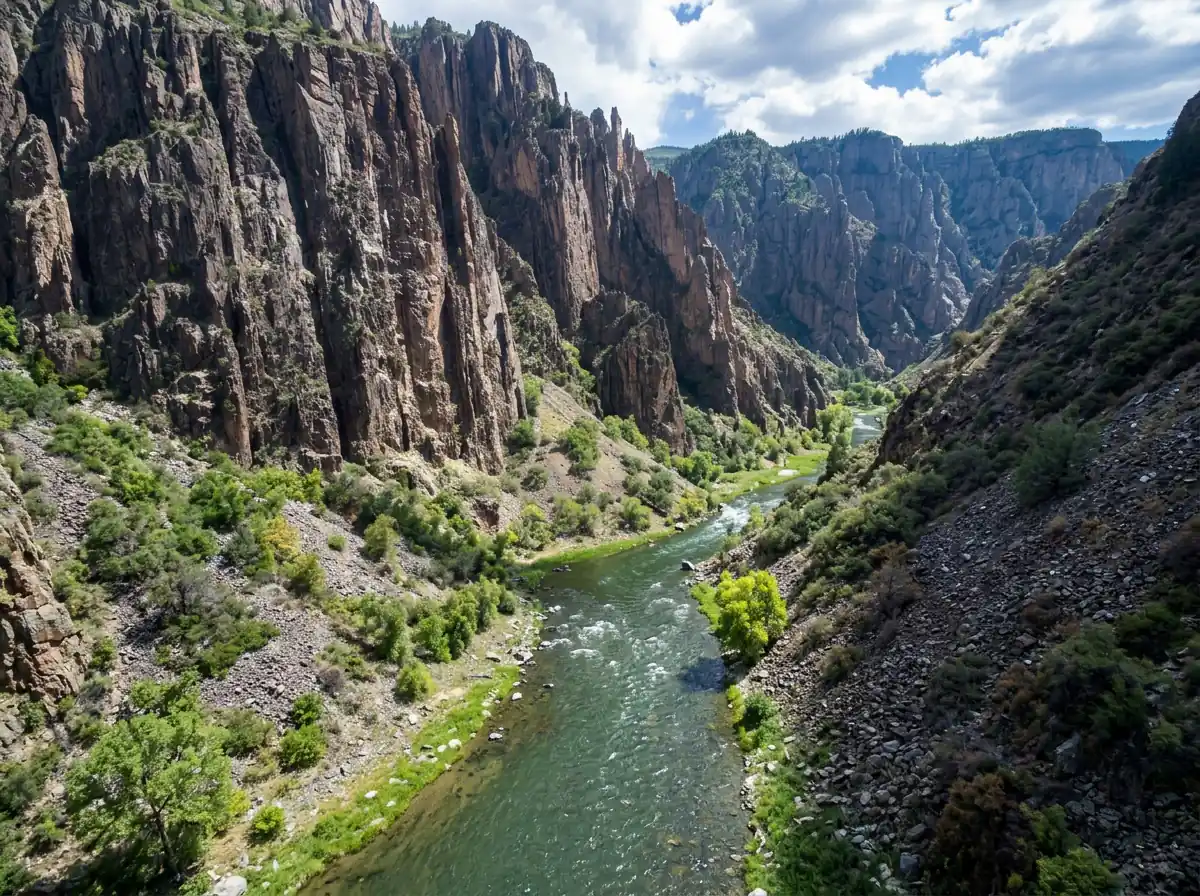
The Gunnison River is one of Colorado's most sought after rivers, and the lower section is a big part of the reason. Much of it flows through the famous Black Canyon, where access is difficult but rewarding. Below the canyon, the river opens into lower valley water with its own fishing. Gold Medal water begins 200 yards below Crystal Dam and continues downstream to the North Fork. This is a large freestone with heavy runs, pocket water behind boulders and seams along the bank. It holds many rainbow trout, brown trout and whitefish, mostly in the medium size range. Don't expect every species in equal numbers on a given day.
Read the complete overview
Dries and nymphs are the main approach, and the difficulty sits in the middle. Fish are plentiful, but the size of the river can make it hard to know where to start. Pick one near-bank seam, make a short, controlled drift through it, and only move to a deeper lane once you've covered the water you can reach well. The hatches are mixed. Pack midges and Blue-Winged Olives for the edges of the season, and add Pale Morning Duns, caddis, stoneflies and terrestrials for summer. Matching what the fish are actually eating usually matters more than covering more river.
East Portal is the road approach to the canyon while the road is open, and the road closes for winter. Day-use anglers entering from East Portal don't need a wilderness permit. The inner canyon routes require one and don't allow pets. When the road is closed, the lower valley water downstream offers its own winter fishing. The first 200 yards below Crystal Dam are closed to fishing. From that boundary down to Relief Ditch, use artificial flies or lures only and release rainbow trout immediately.
A freestone river with riffles, runs and pocket water. Snowmelt and upstream releases both shape its flows, so read the seams rather than expecting uniform water.
Big water in a steep canyon. Break it into the near-bank seams and pockets you can actually reach and drift well.
Fish are plentiful, but heavy currents, rough footing and overlapping hatches reward a clean drift and careful fly choice.
East Portal is the road approach from spring through fall when the road is open. Inner canyon routes need a wilderness permit, and winter moves you to the lower valley water.
Many rainbow trout, brown trout and whitefish, with Gold Medal water from 200 yards below Crystal Dam downstream to the North Fork.
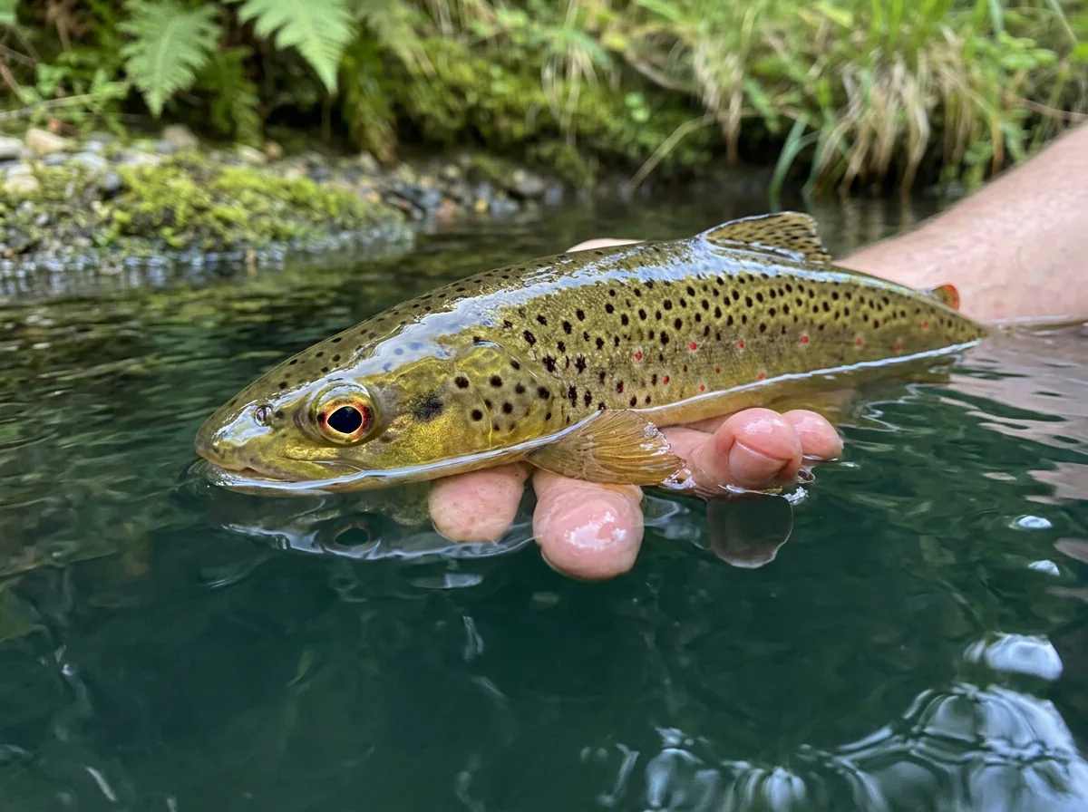
Rainbow Trout, Brown Trout, Whitefish Mostly medium fish. The three species are all present, though you won't find them in equal numbers in every run.
Fit
Is the Lower Gunnison Right for Your Trip?
Canyon access, seasons and rules decide this one as much as the fishing does.
- A bigger river with separate canyon and lower-valley fishing options.
- Anglers who enjoy breaking big water into near-bank seams and pockets with dries and nymphs.
- A spring-through-fall trip built around mixed hatches of PMDs, caddis, stoneflies and terrestrials.
- Good numbers of rainbows, browns and whitefish to work for.
Related water
Similar Water in the Gunnison Basin
Another big freestone when you want the same style of fishing somewhere new.

- A trip requiring simple all-season road access to the canyon floor.
- A day with your dog on inner canyon routes, where pets aren't allowed.
- Fishing the closed first 200 yards below Crystal Dam, or using bait or keeping rainbows from there down to Relief Ditch.
- Anglers who want gentle wading and easy crossings on big water.
Alternative rivers
Other Gunnison Basin Rivers to Consider
Options of a different size or season when the canyon doesn't fit your plans.
 Four-season option on medium waterUncompahgre River - Lower SectionThe lower Uncompahgre is a medium-sized freestone that fishes in all four seasons. It's a useful choice when the East Portal road is closed or you'd rather fish smaller water.It's smaller water than the Gunnison, with a different approach to check before you go.
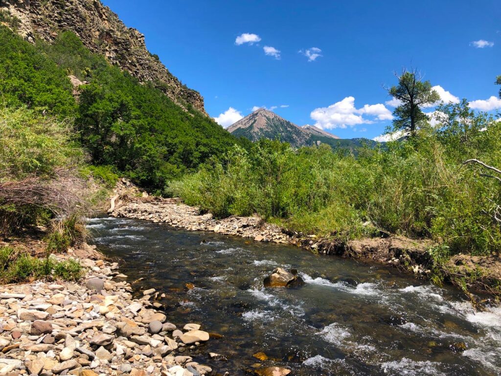 Small-stream change of paceSmith Fork of the Gunnison River - Smith ForkThe Smith Fork is a small freestone for summer and fall days when you'd rather fish tight pockets and short casts than big canyon seams.It's only fishable in summer and fall, and the small water gives you fewer large lanes to work.

Find your next river
Pick the river before you pack the truck.
Some days call for a quiet creek. Others call for room to cast or a shot at a bigger fish. Find the water that fits the day you want.
- Compare 250+ Colorado rivers and sections by season, fish size, difficulty and access.
- See over 5,000 mapped access points and get directions.
- Save favorite waters and keep a backup plan handy.
Conditions
Current Flows and Weather on the Lower Gunnison
The Delta gauge sits downstream of both the canyon and the North Fork, and the forecast is for the Delta area. Use them for downstream context, then check the water at your actual canyon access.
- Fishable flow ranges
- 300–5500 cfs
- Trend
- → Near the previous seven-day mean
- Source
- USGS · 09144250
- Observed
- Sun, Nov 22 · 1:15 am MST
Follow the flow trend, then adjust your fishing depth and the water you focus on.
The Delta gauge reads the lower Gunnison downstream of the canyon and the North Fork. Check a gauge near your canyon access for local flows.
Streamflow in CFS
View all flow readings
| Date | Streamflow (CFS) |
|---|---|
| 2026-11-16 | 448 |
| 2026-11-17 | 435 |
| 2026-11-18 | 400 |
| 2026-11-19 | 426 |
| 2026-11-20 | 442 |
| 2026-11-21 | 432 |
| 2026-11-22 | 436 |
View all flow readings
| Date | Streamflow (CFS) |
|---|---|
| 2026-10-24 | 1030 |
| 2026-10-25 | 889 |
| 2026-10-26 | 764 |
| 2026-10-27 | 687 |
| 2026-10-28 | 629 |
| 2026-10-29 | 644 |
| 2026-10-30 | 569 |
| 2026-10-31 | 532 |
| 2026-11-01 | 630 |
| 2026-11-02 | 2580 |
| 2026-11-03 | 1300 |
| 2026-11-04 | 886 |
| 2026-11-05 | 772 |
| 2026-11-06 | 662 |
| 2026-11-07 | 604 |
| 2026-11-08 | 565 |
| 2026-11-09 | 541 |
| 2026-11-10 | 527 |
| 2026-11-11 | 506 |
| 2026-11-12 | 492 |
| 2026-11-13 | 486 |
| 2026-11-14 | 481 |
| 2026-11-15 | 475 |
| 2026-11-16 | 448 |
| 2026-11-17 | 435 |
| 2026-11-18 | 400 |
| 2026-11-19 | 426 |
| 2026-11-20 | 442 |
| 2026-11-21 | 432 |
| 2026-11-22 | 436 |
Past Weather and the 7-Day Forecast
Delta area: section point forecast
Observed detail unavailable
- Precipitation
- —Liquid equivalent
- Snowfall
- —
- Avg. wind
- —
- Observed sky / weather
- —
- Pressure
- —
Observation sources
Temperature: RGMESA. incomplete Source
Precipitation: RGMESA. Hourly reports overlap; a daily precipitation total is unavailable. Source
Wind: RGMESA. Mean station observations, 8am–6pm local Source
Pressure: RGMESA. Mean observed sea-level pressure, 8am–6pm local Source
Observed sky / weather: RGMESA. Qualitative station reports across available hours of the listed local date; not measured cloud percentage. Source
Nearby RGMESA station observations: . High and low summarize available temperature samples, not certified daily extremes. Station conditions can differ from the canyon. 9 hourly station reports.
Observed detail unavailable
- Precipitation
- —Liquid equivalent
- Snowfall
- —
- Avg. wind
- —
- Observed sky / weather
- —
- Pressure
- —
Observation sources
Temperature: RGMESA. incomplete Source
Precipitation: RGMESA. Hourly reports overlap; a daily precipitation total is unavailable. Source
Wind: RGMESA. Mean station observations, 8am–6pm local Source
Pressure: RGMESA. Mean observed sea-level pressure, 8am–6pm local Source
Observed sky / weather: RGMESA. Qualitative station reports across available hours of the listed local date; not measured cloud percentage. Source
Nearby RGMESA station observations: . High and low summarize available temperature samples, not certified daily extremes. Station conditions can differ from the canyon. 10 hourly station reports.
Observed detail unavailable
- Precipitation
- —Liquid equivalent
- Snowfall
- —
- Avg. wind
- —
- Observed sky / weather
- —
- Pressure
- —
Observation sources
Temperature: RGMESA. incomplete Source
Precipitation: RGMESA. Hourly reports overlap; a daily precipitation total is unavailable. Source
Wind: RGMESA. Mean station observations, 8am–6pm local Source
Pressure: RGMESA. Mean observed sea-level pressure, 8am–6pm local Source
Observed sky / weather: RGMESA. Qualitative station reports across available hours of the listed local date; not measured cloud percentage. Source
Nearby RGMESA station observations: . High and low summarize available temperature samples, not certified daily extremes. Station conditions can differ from the canyon. 11 hourly station reports.
Observed detail unavailable
- Precipitation
- —Liquid equivalent
- Snowfall
- —
- Avg. wind
- —
- Observed sky / weather
- —
- Pressure
- —
Observation sources
Temperature: RGMESA. incomplete Source
Precipitation: RGMESA. Hourly reports overlap; a daily precipitation total is unavailable. Source
Wind: RGMESA. Mean station observations, 8am–6pm local Source
Pressure: RGMESA. Mean observed sea-level pressure, 8am–6pm local Source
Observed sky / weather: RGMESA. Qualitative station reports across available hours of the listed local date; not measured cloud percentage. Source
Nearby RGMESA station observations: . High and low summarize available temperature samples, not certified daily extremes. Station conditions can differ from the canyon. 15 hourly station reports.
Observed detail unavailable
- Precipitation
- —Liquid equivalent
- Snowfall
- —
- Avg. wind
- —
- Observed sky / weather
- —
- Pressure
- —
Observation sources
Temperature: RGMESA. incomplete Source
Precipitation: RGMESA. Hourly reports overlap; a daily precipitation total is unavailable. Source
Wind: RGMESA. Mean station observations, 8am–6pm local Source
Pressure: RGMESA. Mean observed sea-level pressure, 8am–6pm local Source
Observed sky / weather: RGMESA. Qualitative station reports across available hours of the listed local date; not measured cloud percentage. Source
Nearby RGMESA station observations: . High and low summarize available temperature samples, not certified daily extremes. Station conditions can differ from the canyon. 10 hourly station reports.
Observed detail unavailable
- Precipitation
- —Liquid equivalent
- Snowfall
- —
- Avg. wind
- —
- Observed sky / weather
- —
- Pressure
- —
Observation sources
Temperature: RGMESA. incomplete Source
Precipitation: RGMESA. Hourly reports overlap; a daily precipitation total is unavailable. Source
Wind: RGMESA. Mean station observations, 8am–6pm local Source
Pressure: RGMESA. Mean observed sea-level pressure, 8am–6pm local Source
Observed sky / weather: RGMESA. Qualitative station reports across available hours of the listed local date; not measured cloud percentage. Source
Nearby RGMESA station observations: . High and low summarize available temperature samples, not certified daily extremes. Station conditions can differ from the canyon. 11 hourly station reports.
Observed detail unavailable
- Precipitation
- —Liquid equivalent
- Snowfall
- —
- Avg. wind
- —
- Observed sky / weather
- —
- Pressure
- —
Observation sources
Temperature: RGMESA. incomplete Source
Precipitation: RGMESA. Hourly reports overlap; a daily precipitation total is unavailable. Source
Wind: RGMESA. Mean station observations, 8am–6pm local Source
Pressure: RGMESA. Mean observed sea-level pressure, 8am–6pm local Source
Observed sky / weather: RGMESA. Qualitative station reports across available hours of the listed local date; not measured cloud percentage. Source
Nearby RGMESA station observations: . High and low summarize available temperature samples, not certified daily extremes. Station conditions can differ from the canyon. 10 hourly station reports.
Partly Sunny
Precipitation chance0%Mostly Cloudy
Precipitation chance7%- Avg. wind
- 3 mph NNW
- Cloud cover
- 69%
- Pressure
- 30.15 inHg
Chance Rain And Snow Showers
Rain / snow chance33%Mostly Cloudy then Areas Of Fog
Precipitation chance14%- Avg. wind
- 2 mph W
- Cloud cover
- 84%
- Pressure
- 30.22 inHg
Patchy Fog then Sunny
Precipitation chance0%Partly Cloudy
Precipitation chance1%- Avg. wind
- 2 mph ENE
- Cloud cover
- 22%
- Pressure
- 30.42 inHg
Mostly Sunny
Precipitation chance1%Mostly Cloudy
Precipitation chance1%- Avg. wind
- 1 mph NE
- Cloud cover
- 40%
- Pressure
- 30.25 inHg
Mostly Sunny
Precipitation chance6%Partly Cloudy
Precipitation chance6%- Avg. wind
- 2 mph WSW
- Cloud cover
- 36%
- Pressure
- 30.32 inHg
Mostly Sunny
Precipitation chance4%Partly Cloudy
Precipitation chance7%- Avg. wind
- 2 mph WNW
- Cloud cover
- 33%
- Pressure
- 30.22 inHg
Mostly Sunny
Precipitation chance14%- Avg. wind
- 2 mph NNE
- Cloud cover
- 47%
- Pressure
- 29.93 inHg
Weather sources
National Weather Service · RGMESA. Wind and cloud averages use 8am–6pm local time. Forecast pressure: MET Norway, averaged daytime sea-level pressure in inches of mercury (CC BY 4.0). Past station reports do not include forecast rain chances or exact cloud percentages; a dash means unavailable.
Unlock the full guide
Know where to fish and what to tie on.
Put the forecast to work. Compare streamflow history on gauged waters, then open the full fishing plan for the section you pick.
- See where to start and how to fish each season.
- Match local hatches and fill your box with the recommended flies.
- Open the access map and get directions before you leave.
Gallery
Lower Gunnison River Photos
A look at the canyon water and its character before you plan your day.
River Explorer Pro
Make this your next fishing trip.
Unlock River Explorer Pro and make your next fishing trip your best adventure yet.
- Find where to get on the water with interactive access maps and directions.
- Plan around recent weather and streamflows where gauges are available.
- Pack the right flies with seasonal tactics, hatch charts and pattern recommendations.
- Compare 250+ Colorado rivers and sections and save a backup stretch.