
Overview
Fly Fishing Lottis Creek and South Lottis Creek
A walk-in cutthroat creek: dry/dropper the lower pockets, then try a single dry higher up where the brush and rising fish allow
Lottis Creek is a high-elevation mountain stream that works well as a day trip or as a three-day getaway, and it rewards anglers who don't mind walking. Road access is limited, so you'll reach the better water on foot. From the trailhead at Lottis Creek Campground, you can fish the main stretch of Lottis Creek up to its confluence with South Lottis Creek. There you choose a branch. You can stay with the trail as it follows South Lottis Creek up to Henry Lake (10,740 feet), or you can split off and fish up the Lottis Creek fork. The main goal for many anglers is the creek's gorgeous cutthroats in the upper reaches. If you want an intermediate small-stream trip in pursuit of West Slope cutthroat, this is a great place to go. Rainbows and browns are also part of the mix. Expect plenty of small fish rather than a few big ones.
Read the complete overview
Lottis is mostly a freestone creek with pockets, short runs and brushy edges, so most of your casts and drifts will be short. Henry Lake's outflow, at the head of the South Lottis trail, adds a small amount of tailwater character to that branch. Treat each fork as its own water, though, and don't assume that steadier influence reaches every branch you fish. The insect life is fairly basic in species. The bigger difference along the creek is how the trout tend to behave. The lower reaches see some pressure, and a size 16 or 18 dropper on a dry/dropper rig is often a productive way to fish them. Farther up, where the trout see fewer anglers, it's worth trying a single dry fly when the brush leaves room to cast and you see fish feeding on adult insects. That gives you a simple starting plan: lean on the dry/dropper near the campground, then test a dry on its own as you climb and let the water and the fish tell you whether to keep it.
Difficulty is medium. Finding fish isn't the hard part. The skill comes from reading brush and open lanes, making short casts that land where you intended, getting a clean drift in tight quarters and keeping your rig out of the branches. Lottis is dog friendly if you're bringing a trail partner, but keep your dog leashed on the South Lottis Trail. Summer and fall are the seasons to plan around.
This is mostly a freestone creek with pockets, short runs and brushy banks. Henry Lake's outflow adds a small amount of tailwater character, so don't assume that influence reaches every branch.
This is small water where most of your casts will be short and drifts will last only a few seconds. Reading brush and open lanes matters as much as choosing a fly.
Medium. The fish are numerous, but you'll need tight-quarters casting, drag control and rig adjustments to fish it well. It's a good intermediate small-stream trip.
Medium. Road access is limited, and the better water is a walk from the South Lottis Creek Trailhead at Lottis Creek Campground. The upper cutthroat water takes the most walking.
There are many fish. Lower-creek trout get some fishing pressure but respond well to a small dropper, and upper-creek fish are more willing to eat dries.
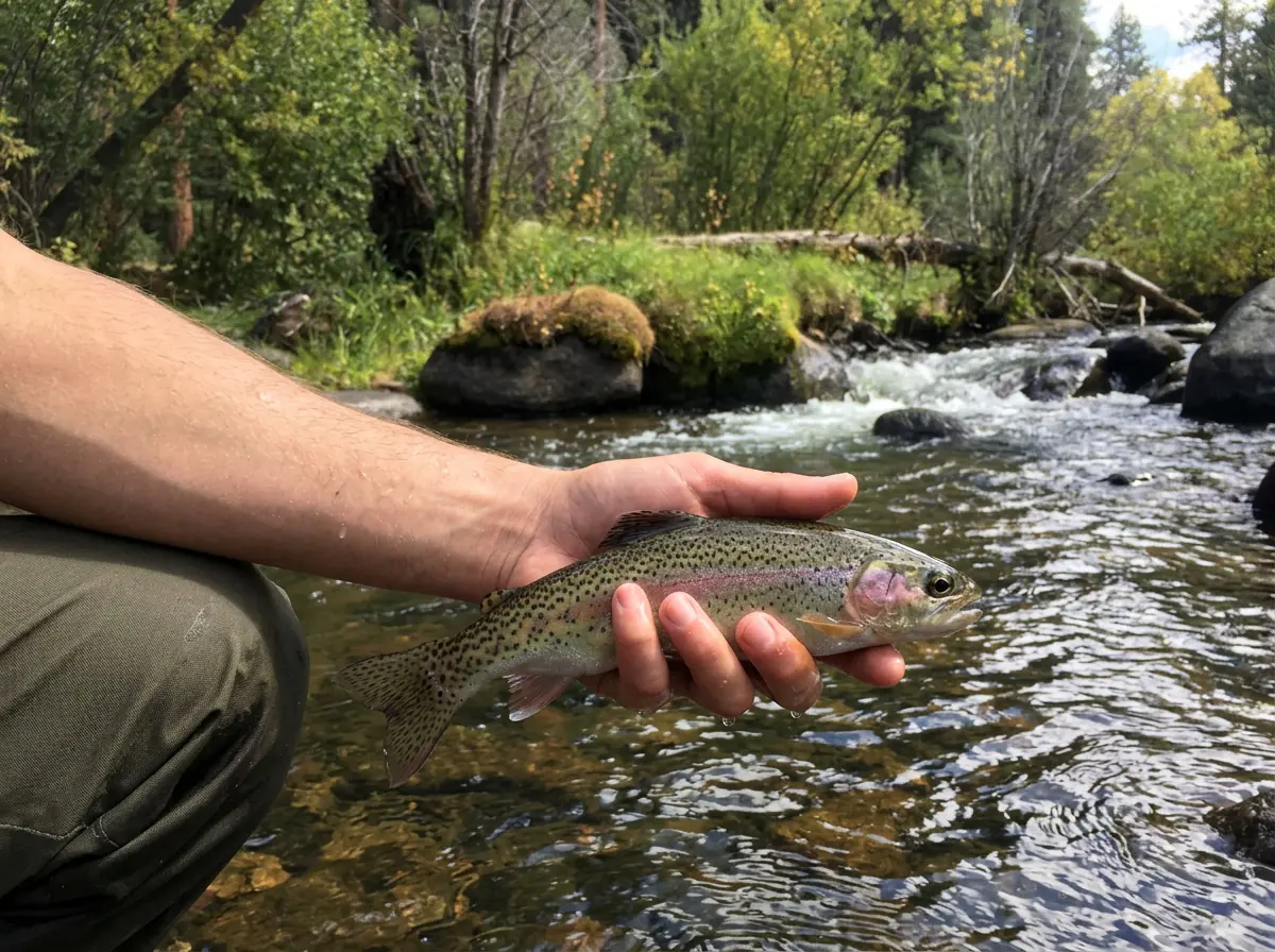
Rainbow Trout, Brown Trout, Cutthroat Trout Small. The top prize is the creek's colorful cutthroats, along with rainbows and browns, rather than big fish.
Fit
Is Lottis Creek Right for Your Trip?
Who'll enjoy the hike and the tight pocket water, and who should look at another stream
- You want a walk-in high-country stream with branch choices and tight drifts.
- You'd like to chase cutthroats in the upper reaches and don't mind hiking for them.
- You enjoy using a dry/dropper in pressured pockets and switching to dries as you move up.
- You're planning a day trip or a three-day trip in summer or fall, maybe with your dog.
Related water
Similar Small Streams Nearby
Other summer and fall freestone creeks in the same basin when you want the same kind of small-water fishing
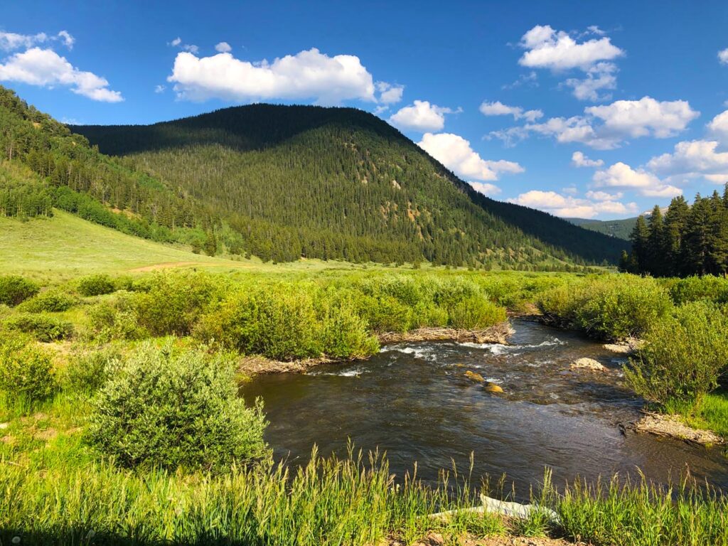 Small freestone, easier goingSpring Creek - Main SectionSpring Creek's Main Section is another small freestone creek in the same basin with the same summer and fall season, so the dry/dropper rigs and short-cast approach you'd use on Lottis carry over well.It's rated easy rather than medium, which is great for a relaxed day but offers less of the tight-water challenge you get on Lottis. Check the exact approach and access before you go.
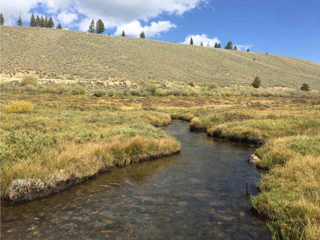 Another easy small creekWillow Creek - Main SectionWillow Creek's Main Section is a small freestone creek in the same basin, with a summer and fall season similar to Lottis. It's a good choice if you want the same kind of small-water fishing with less difficulty.It's rated easy, so you'll trade some of Lottis's tight-pocket challenge for simpler fishing. Its access and season are separate from Lottis, so check its approach before planning.
- You want a roadside outing or a winter visit to the upper forks.
- You're hoping for big trout rather than plenty of small ones.
- You'd rather make long, open casts than work tight, brushy pockets.
- You want to fish in spring, when snowmelt can make this reach a poor choice.
Alternative rivers
A Different Kind of Fishing Nearby
When the season or your plans call for a year-round technical tailwater instead of a hike

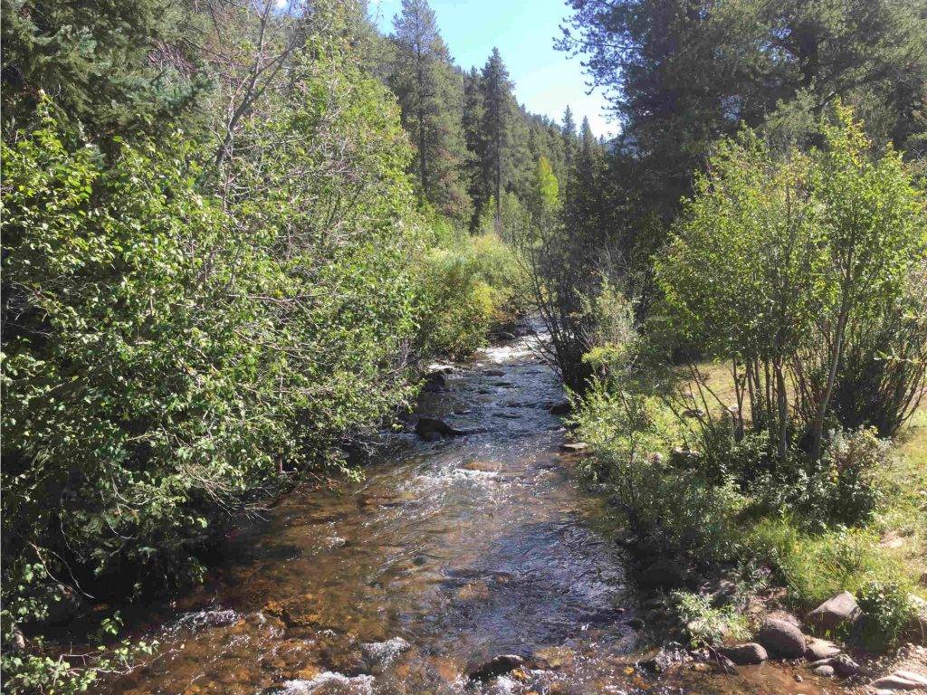
Find your next river
Pick the river before you pack the truck.
Some days call for a quiet creek. Others call for room to cast or a shot at a bigger fish. Find the water that fits the day you want.
- Compare 250+ Colorado rivers and sections by season, fish size, difficulty and access.
- See over 5,000 mapped access points and get directions.
- Save favorite waters and keep a backup plan handy.
Weather
Lottis Creek Weather
Check recent rain and the forecast before you head to the creek.
Plan around the weather
This stretch is ungauged. Use the forecast below and look for changes in water level after rain or snowmelt.
Past Weather and the 7-Day Forecast
Almont area: section point forecast
Station daily weather summary
- Precipitation
- 0 inLiquid equivalent
- Snowfall
- —
- Avg. wind
- 4 mph NNW
- Observed sky / weather
- —
- Pressure
- —
Observation sources
Temperature: TAYLOR PARK. daily_station_report Source
Precipitation: TAYLOR PARK. Reported daily precipitation (liquid equivalent) and snowfall, in inches. Source
Wind: TAYLOR PARK. Mean station observations, 8am–6pm local Source
Pressure: TAYLOR PARK. Mean observed sea-level pressure, 8am–6pm local Source
Observed sky / weather: TAYLOR PARK. Qualitative station reports across available hours of the listed local date; not measured cloud percentage. Source
Daily station values are shown where available. Other fields retain their observation sources. 21 hourly station reports.
Station daily weather summary
- Precipitation
- 0 inLiquid equivalent
- Snowfall
- —
- Avg. wind
- 3 mph N
- Observed sky / weather
- —
- Pressure
- —
Observation sources
Temperature: TAYLOR PARK. daily_station_report Source
Precipitation: TAYLOR PARK. Reported daily precipitation (liquid equivalent) and snowfall, in inches. Source
Wind: TAYLOR PARK. Mean station observations, 8am–6pm local Source
Pressure: TAYLOR PARK. Mean observed sea-level pressure, 8am–6pm local Source
Observed sky / weather: TAYLOR PARK. Qualitative station reports across available hours of the listed local date; not measured cloud percentage. Source
Daily station values are shown where available. Other fields retain their observation sources. 23 hourly station reports.
Station daily weather summary
- Precipitation
- 0 inLiquid equivalent
- Snowfall
- —
- Avg. wind
- 3 mph S
- Observed sky / weather
- —
- Pressure
- —
Observation sources
Temperature: TAYLOR PARK. daily_station_report Source
Precipitation: TAYLOR PARK. Reported daily precipitation (liquid equivalent) and snowfall, in inches. Source
Wind: TAYLOR PARK. Mean station observations, 8am–6pm local Source
Pressure: TAYLOR PARK. Mean observed sea-level pressure, 8am–6pm local Source
Observed sky / weather: TAYLOR PARK. Qualitative station reports across available hours of the listed local date; not measured cloud percentage. Source
Daily station values are shown where available. Other fields retain their observation sources. 23 hourly station reports.
Observed detail unavailable
- Precipitation
- —Liquid equivalent
- Snowfall
- —
- Avg. wind
- 2 mph SSW
- Observed sky / weather
- —
- Pressure
- —
Observation sources
Temperature: TAYLOR PARK. day_spanning_observations Source
Precipitation: TAYLOR PARK. Hourly reports overlap; a daily precipitation total is unavailable. Source
Wind: TAYLOR PARK. Mean station observations, 8am–6pm local Source
Pressure: TAYLOR PARK. Mean observed sea-level pressure, 8am–6pm local Source
Observed sky / weather: TAYLOR PARK. Qualitative station reports across available hours of the listed local date; not measured cloud percentage. Source
Nearby TAYLOR PARK station observations: . High and low summarize available temperature samples, not certified daily extremes. Station conditions can differ from the canyon. 21 hourly station reports.
Observed detail unavailable
- Precipitation
- —Liquid equivalent
- Snowfall
- —
- Avg. wind
- 3 mph SSW
- Observed sky / weather
- —
- Pressure
- —
Observation sources
Temperature: TAYLOR PARK. day_spanning_observations Source
Precipitation: TAYLOR PARK. Hourly reports overlap; a daily precipitation total is unavailable. Source
Wind: TAYLOR PARK. Mean station observations, 8am–6pm local Source
Pressure: TAYLOR PARK. Mean observed sea-level pressure, 8am–6pm local Source
Observed sky / weather: TAYLOR PARK. Qualitative station reports across available hours of the listed local date; not measured cloud percentage. Source
Nearby TAYLOR PARK station observations: . High and low summarize available temperature samples, not certified daily extremes. Station conditions can differ from the canyon. 20 hourly station reports.
Observed detail unavailable
- Precipitation
- —Liquid equivalent
- Snowfall
- —
- Avg. wind
- 3 mph SSW
- Observed sky / weather
- —
- Pressure
- —
Observation sources
Temperature: TAYLOR PARK. day_spanning_observations Source
Precipitation: TAYLOR PARK. Hourly reports overlap; a daily precipitation total is unavailable. Source
Wind: TAYLOR PARK. Mean station observations, 8am–6pm local Source
Pressure: TAYLOR PARK. Mean observed sea-level pressure, 8am–6pm local Source
Observed sky / weather: TAYLOR PARK. Qualitative station reports across available hours of the listed local date; not measured cloud percentage. Source
Nearby TAYLOR PARK station observations: . High and low summarize available temperature samples, not certified daily extremes. Station conditions can differ from the canyon. 24 hourly station reports.
Observed detail unavailable
- Precipitation
- —Liquid equivalent
- Snowfall
- —
- Avg. wind
- 6 mph S
- Observed sky / weather
- —
- Pressure
- —
Observation sources
Temperature: TAYLOR PARK. day_spanning_observations Source
Precipitation: TAYLOR PARK. Hourly reports overlap; a daily precipitation total is unavailable. Source
Wind: TAYLOR PARK. Mean station observations, 8am–6pm local Source
Pressure: TAYLOR PARK. Mean observed sea-level pressure, 8am–6pm local Source
Observed sky / weather: TAYLOR PARK. Qualitative station reports across available hours of the listed local date; not measured cloud percentage. Source
Nearby TAYLOR PARK station observations: . High and low summarize available temperature samples, not certified daily extremes. Station conditions can differ from the canyon. 21 hourly station reports.
Sunny
Precipitation chance0%Mostly Clear
Precipitation chance0%- Avg. wind
- 7 mph WSW
- Cloud cover
- 4%
- Pressure
- 30.22 inHg
Mostly Sunny
Precipitation chance12%Snow Showers Likely
Snow chance59%- Avg. wind
- 8 mph S
- Cloud cover
- 50%
- Pressure
- 30.07 inHg
Snow Showers Likely
Snow chance59%Snow Showers
Snow chance79%- Avg. wind
- 17 mph WSW
- Cloud cover
- 64%
- Pressure
- 29.81 inHg
Chance Snow Showers then Mostly Sunny
Snow chance27%Mostly Clear
Precipitation chance1%- Avg. wind
- 8 mph W
- Cloud cover
- 38%
- Pressure
- 30.08 inHg
Sunny
Precipitation chance0%Mostly Clear
Precipitation chance6%- Avg. wind
- 4 mph SW
- Cloud cover
- 19%
- Pressure
- 30.09 inHg
Chance Snow Showers
Snow chance44%Chance Snow Showers
Snow chance44%- Avg. wind
- 5 mph WSW
- Cloud cover
- 52%
- Pressure
- 30.03 inHg
Mostly Sunny
Precipitation chance9%- Avg. wind
- 4 mph W
- Cloud cover
- 43%
- Pressure
- 30.28 inHg
Weather sources
National Weather Service · TAYLOR PARK. Wind and cloud averages use 8am–6pm local time. Forecast pressure: MET Norway, averaged daytime sea-level pressure in inches of mercury (CC BY 4.0). Past station reports do not include forecast rain chances or exact cloud percentages; a dash means unavailable.
Unlock the full guide
Know where to fish and what to tie on.
Put the forecast to work. Compare streamflow history on gauged waters, then open the full fishing plan for the section you pick.
- See where to start and how to fish each season.
- Match local hatches and fill your box with the recommended flies.
- Open the access map and get directions before you leave.
Gallery
Lottis Creek Photos
A look at the small-stream water and high-country setting you'll be hiking into
River Explorer Pro
Make this your next fishing trip.
Unlock River Explorer Pro and make your next fishing trip your best adventure yet.
- Find where to get on the water with interactive access maps and directions.
- Plan around recent weather and streamflows where gauges are available.
- Pack the right flies with seasonal tactics, hatch charts and pattern recommendations.
- Compare 250+ Colorado rivers and sections and save a backup stretch.