
Overview
Fly Fishing the Lower Roaring Fork River
A big, busy freestone through Glenwood Springs that rewards anglers who fish it one lane at a time
The lower Roaring Fork runs through Glenwood Springs and down to its meeting with the Colorado, and by Colorado standards it's a pretty large river. This stretch gets more pressure than many anglers expect, but the fishing can still be good. There are many fish here: rainbow trout and brown trout in a medium size class, along with whitefish that often show up in the same runs. It's a dries-and-nymphs river. On a good day you'll spend part of your time watching for rising fish and the rest working nymph patterns through seams and riffles.
Read the complete overview
The size of the river is the first thing to solve. A broad run can look like one big piece of water, but trout use only parts of it. Break it into smaller sections and fish one reachable feeding lane at a time. Look for places where current brings food past shelter: a walking-speed inside seam, the soft edge beside a faster tongue, or a slot behind a rock or bank structure. Work the water on your side before you think about crossing. If you see a fish rise, that rise can make a shallow seam a better target than the deep run you'd planned to nymph.
This section gets hot in late summer, so check the water before you fish. Carry a thermometer and take a reading before you start and again as the day warms. If the water stays warm, rest the fish and come back another time, or choose different water that measures cooler. On any day, play trout quickly and keep them in the water when you release them. Good handling won't make warm water suitable, though. From the upper Woody Creek bridge down to the Colorado River, the special regulations require artificial flies or lures, and the trout limit is two fish with a 16-inch minimum. The mainstem within 50 yards upstream and downstream of the Fourmile Creek and Threemile Creek mouths is closed to fishing every year from March 15 through May 31 and from October 1 through November 30.
Snowmelt and storms drive flow and clarity here. Upstream tributaries and diversions influence the river, but it fishes like a freestone rather than a tailwater.
It's a large river by Colorado standards. Break it into individual lanes rather than trying to fish the whole width.
The fish are plentiful, but fishing pressure, big currents and reading broad water make it a moderate challenge.
There's public riverwalk access in Glenwood Springs, but public and private banks alternate as you move upstream.
There are many rainbow trout and brown trout, with whitefish in the same runs.
Rainbow Trout, Brown Trout, Whitefish Trout here fall in a medium size class. From the upper Woody Creek bridge to the Colorado River, the bag and possession limit is two trout, and any trout you keep must be at least 16 inches.
Fit
Is the Lower Roaring Fork Right for Your Trip?
Who'll enjoy this big water, and who'd be happier on a smaller or more open stretch
- You want room to work several lanes of a big river near Glenwood Springs.
- You enjoy switching between nymphing the edges and fishing dries when fish start rising.
- You'd like a river with plenty of fish that stays fishable through all four seasons.
- You're bringing a dog that can stay leashed.
Related water
Similar Big Freestone Water Nearby
Large rivers in the same valley that fish much like this reach
 Same river, upstreamRoaring Fork River - Middle SectionThe middle Roaring Fork is also a large, medium-difficulty freestone that fishes in all four seasons, so the lane-by-lane approach you use here carries over well.It's a different reach farther up the valley, with its own access and hatch timing. Plan with that section's guide rather than this one.
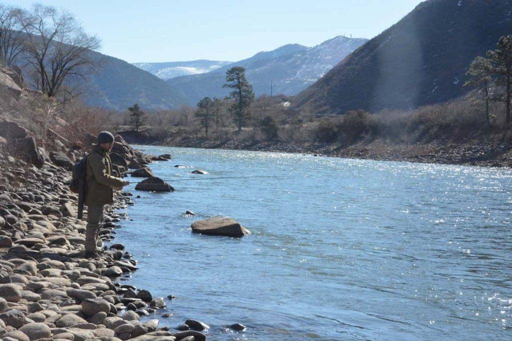 Big water at the confluenceColorado River - Lower SectionThe lower Colorado joins the Fork in Glenwood Springs and offers similar large-freestone fishing with medium difficulty year-round.It's a separate river with its own flows, access and character, so don't assume the Fork's lanes or hatch timing transfer directly.
- You're looking for a small, brushy creek.
- Your plan depends on continuous public bank access.
- You need easy crossings at any flow.
- You want quiet water to yourself on a summer weekend.
Alternative rivers
A Smaller River When the Lower Fork Doesn't Fit
A nearby choice when you'd rather fish more manageable water

Find your next river
Pick the river before you pack the truck.
Some days call for a quiet creek. Others call for room to cast or a shot at a bigger fish. Find the water that fits the day you want.
- Compare 250+ Colorado rivers and sections by season, fish size, difficulty and access.
- See over 5,000 mapped access points and get directions.
- Save favorite waters and keep a backup plan handy.
Conditions
Lower Roaring Fork Flows and Weather
Check the flow trend and the forecast before deciding whether to fish the edges, the riffles or another reach
- Fishable flow ranges
- 150–2000 cfs
- Trend
- ↓ Below the previous seven-day mean
- Source
- USGS · 09085000
- Observed
- Fri, Nov 20 · 1:45 am MST
Follow the flow trend, then adjust your fishing depth and the water you focus on.
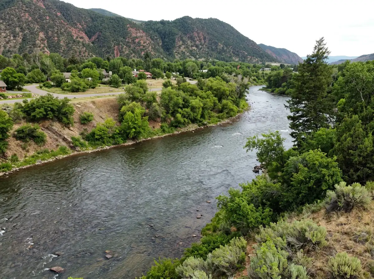
The Glenwood Springs gauge reads the lower Roaring Fork before it joins the Colorado River. Use it to plan which banks and seams are practical.
Streamflow in CFS
View all flow readings
| Date | Streamflow (CFS) |
|---|---|
| 2026-11-14 | 517 |
| 2026-11-15 | 525 |
| 2026-11-16 | 505 |
| 2026-11-17 | 495 |
| 2026-11-18 | 510 |
| 2026-11-19 | 468 |
| 2026-11-20 | 449 |
View all flow readings
| Date | Streamflow (CFS) |
|---|---|
| 2026-10-22 | 639 |
| 2026-10-23 | 885 |
| 2026-10-24 | 749 |
| 2026-10-25 | 720 |
| 2026-10-26 | 676 |
| 2026-10-27 | 632 |
| 2026-10-28 | 597 |
| 2026-10-29 | 568 |
| 2026-10-30 | 552 |
| 2026-10-31 | 544 |
| 2026-11-01 | 559 |
| 2026-11-02 | 916 |
| 2026-11-03 | 753 |
| 2026-11-04 | 675 |
| 2026-11-05 | 712 |
| 2026-11-06 | 655 |
| 2026-11-07 | 613 |
| 2026-11-08 | 579 |
| 2026-11-09 | 563 |
| 2026-11-10 | 557 |
| 2026-11-11 | 540 |
| 2026-11-12 | 529 |
| 2026-11-13 | 522 |
| 2026-11-14 | 517 |
| 2026-11-15 | 525 |
| 2026-11-16 | 505 |
| 2026-11-17 | 495 |
| 2026-11-18 | 510 |
| 2026-11-19 | 468 |
| 2026-11-20 | 449 |
Past Weather and the 7-Day Forecast
Glenwood Springs area: section point forecast
Observed detail unavailable
- Precipitation
- —Liquid equivalent
- Snowfall
- —
- Avg. wind
- 6 mph ENE
- Observed sky / weather
- —
- Pressure
- —
Observation sources
Temperature: GW7545 GLENWOOD SPRINGS. incomplete Source
Precipitation: GW7545 GLENWOOD SPRINGS. Hourly reports overlap; a daily precipitation total is unavailable. Source
Wind: GW7545 GLENWOOD SPRINGS. Mean station observations, 8am–6pm local Source
Pressure: GW7545 GLENWOOD SPRINGS. Mean observed sea-level pressure, 8am–6pm local Source
Observed sky / weather: GW7545 GLENWOOD SPRINGS. Qualitative station reports across available hours of the listed local date; not measured cloud percentage. Source
Nearby GW7545 GLENWOOD SPRINGS station observations: . High and low summarize available temperature samples, not certified daily extremes. Station conditions can differ from the canyon. 256 hourly station reports.
Observed detail unavailable
- Precipitation
- —Liquid equivalent
- Snowfall
- —
- Avg. wind
- 4 mph E
- Observed sky / weather
- —
- Pressure
- —
Observation sources
Temperature: GW7545 GLENWOOD SPRINGS. day_spanning_observations Source
Precipitation: GW7545 GLENWOOD SPRINGS. Hourly reports overlap; a daily precipitation total is unavailable. Source
Wind: GW7545 GLENWOOD SPRINGS. Mean station observations, 8am–6pm local Source
Pressure: GW7545 GLENWOOD SPRINGS. Mean observed sea-level pressure, 8am–6pm local Source
Observed sky / weather: GW7545 GLENWOOD SPRINGS. Qualitative station reports across available hours of the listed local date; not measured cloud percentage. Source
Nearby GW7545 GLENWOOD SPRINGS station observations: . High and low summarize available temperature samples, not certified daily extremes. Station conditions can differ from the canyon. 259 hourly station reports.
Observed detail unavailable
- Precipitation
- —Liquid equivalent
- Snowfall
- —
- Avg. wind
- 6 mph N
- Observed sky / weather
- —
- Pressure
- —
Observation sources
Temperature: GW7545 GLENWOOD SPRINGS. day_spanning_observations Source
Precipitation: GW7545 GLENWOOD SPRINGS. Hourly reports overlap; a daily precipitation total is unavailable. Source
Wind: GW7545 GLENWOOD SPRINGS. Mean station observations, 8am–6pm local Source
Pressure: GW7545 GLENWOOD SPRINGS. Mean observed sea-level pressure, 8am–6pm local Source
Observed sky / weather: GW7545 GLENWOOD SPRINGS. Qualitative station reports across available hours of the listed local date; not measured cloud percentage. Source
Nearby GW7545 GLENWOOD SPRINGS station observations: . High and low summarize available temperature samples, not certified daily extremes. Station conditions can differ from the canyon. 267 hourly station reports.
Observed detail unavailable
- Precipitation
- —Liquid equivalent
- Snowfall
- —
- Avg. wind
- 5 mph SE
- Observed sky / weather
- —
- Pressure
- —
Observation sources
Temperature: GW7545 GLENWOOD SPRINGS. day_spanning_observations Source
Precipitation: GW7545 GLENWOOD SPRINGS. Hourly reports overlap; a daily precipitation total is unavailable. Source
Wind: GW7545 GLENWOOD SPRINGS. Mean station observations, 8am–6pm local Source
Pressure: GW7545 GLENWOOD SPRINGS. Mean observed sea-level pressure, 8am–6pm local Source
Observed sky / weather: GW7545 GLENWOOD SPRINGS. Qualitative station reports across available hours of the listed local date; not measured cloud percentage. Source
Nearby GW7545 GLENWOOD SPRINGS station observations: . High and low summarize available temperature samples, not certified daily extremes. Station conditions can differ from the canyon. 271 hourly station reports.
Observed detail unavailable
- Precipitation
- —Liquid equivalent
- Snowfall
- —
- Avg. wind
- 6 mph SSE
- Observed sky / weather
- —
- Pressure
- —
Observation sources
Temperature: GW7545 GLENWOOD SPRINGS. day_spanning_observations Source
Precipitation: GW7545 GLENWOOD SPRINGS. Hourly reports overlap; a daily precipitation total is unavailable. Source
Wind: GW7545 GLENWOOD SPRINGS. Mean station observations, 8am–6pm local Source
Pressure: GW7545 GLENWOOD SPRINGS. Mean observed sea-level pressure, 8am–6pm local Source
Observed sky / weather: GW7545 GLENWOOD SPRINGS. Qualitative station reports across available hours of the listed local date; not measured cloud percentage. Source
Nearby GW7545 GLENWOOD SPRINGS station observations: . High and low summarize available temperature samples, not certified daily extremes. Station conditions can differ from the canyon. 252 hourly station reports.
Observed detail unavailable
- Precipitation
- —Liquid equivalent
- Snowfall
- —
- Avg. wind
- 6 mph NNW
- Observed sky / weather
- —
- Pressure
- —
Observation sources
Temperature: GW7545 GLENWOOD SPRINGS. day_spanning_observations Source
Precipitation: GW7545 GLENWOOD SPRINGS. Hourly reports overlap; a daily precipitation total is unavailable. Source
Wind: GW7545 GLENWOOD SPRINGS. Mean station observations, 8am–6pm local Source
Pressure: GW7545 GLENWOOD SPRINGS. Mean observed sea-level pressure, 8am–6pm local Source
Observed sky / weather: GW7545 GLENWOOD SPRINGS. Qualitative station reports across available hours of the listed local date; not measured cloud percentage. Source
Nearby GW7545 GLENWOOD SPRINGS station observations: . High and low summarize available temperature samples, not certified daily extremes. Station conditions can differ from the canyon. 268 hourly station reports.
Observed detail unavailable
- Precipitation
- —Liquid equivalent
- Snowfall
- —
- Avg. wind
- 5 mph SE
- Observed sky / weather
- —
- Pressure
- —
Observation sources
Temperature: GW7545 GLENWOOD SPRINGS. day_spanning_observations Source
Precipitation: GW7545 GLENWOOD SPRINGS. Hourly reports overlap; a daily precipitation total is unavailable. Source
Wind: GW7545 GLENWOOD SPRINGS. Mean station observations, 8am–6pm local Source
Pressure: GW7545 GLENWOOD SPRINGS. Mean observed sea-level pressure, 8am–6pm local Source
Observed sky / weather: GW7545 GLENWOOD SPRINGS. Qualitative station reports across available hours of the listed local date; not measured cloud percentage. Source
Nearby GW7545 GLENWOOD SPRINGS station observations: . High and low summarize available temperature samples, not certified daily extremes. Station conditions can differ from the canyon. 263 hourly station reports.
Rain And Snow Showers Likely
Rain / snow chance57%Slight Chance Snow Showers then Partly Cloudy
Snow chance15%- Avg. wind
- 14 mph W
- Cloud cover
- 74%
- Pressure
- 29.84 inHg
Sunny
Precipitation chance7%Mostly Clear
Precipitation chance0%- Avg. wind
- 6 mph W
- Cloud cover
- 12%
- Pressure
- 30.01 inHg
Mostly Sunny
Precipitation chance0%Partly Cloudy then Slight Chance Snow Showers
Snow chance23%- Avg. wind
- 4 mph WSW
- Cloud cover
- 47%
- Pressure
- 30.13 inHg
Chance Rain And Snow Showers
Rain / snow chance46%Chance Snow Showers
Snow chance37%- Avg. wind
- 6 mph WSW
- Cloud cover
- 69%
- Pressure
- 30.12 inHg
Mostly Sunny
Precipitation chance4%Partly Cloudy
Precipitation chance8%- Avg. wind
- 3 mph W
- Cloud cover
- 40%
- Pressure
- 30.38 inHg
Partly Sunny then Chance Snow Showers
Snow chance32%Chance Snow Showers
Snow chance32%- Avg. wind
- 4 mph WSW
- Cloud cover
- 55%
- Pressure
- 30.16 inHg
Chance Snow Showers
Snow chance28%- Avg. wind
- 5 mph WSW
- Cloud cover
- 55%
- Pressure
- 30.2 inHg
Weather sources
National Weather Service · GW7545 GLENWOOD SPRINGS. Wind and cloud averages use 8am–6pm local time. Forecast pressure: MET Norway, averaged daytime sea-level pressure in inches of mercury (CC BY 4.0). Past station reports do not include forecast rain chances or exact cloud percentages; a dash means unavailable.
Unlock the full guide
Know where to fish and what to tie on.
Put the forecast to work. Compare streamflow history on gauged waters, then open the full fishing plan for the section you pick.
- See where to start and how to fish each season.
- Match local hatches and fill your box with the recommended flies.
- Open the access map and get directions before you leave.
Gallery
Scenes From the Lower Roaring Fork
A look at the broad runs, banks and confluence water you'll be planning around
River Explorer Pro
Make this your next fishing trip.
Unlock River Explorer Pro and make your next fishing trip your best adventure yet.
- Find where to get on the water with interactive access maps and directions.
- Plan around recent weather and streamflows where gauges are available.
- Pack the right flies with seasonal tactics, hatch charts and pattern recommendations.
- Compare 250+ Colorado rivers and sections and save a backup stretch.