
Overview
South Fork of the South Platte Overview
A meandering South Park meadow stream with wary trout and signed State Wildlife Area access.
The South Fork of the South Platte is a meandering South Park meadow stream that's nearly identical in character to the Middle Fork, with a little more access. The best water is on the 63 Ranch and Knight-Imler State Wildlife Areas, where the river winds through open grassland in tight bends, undercut banks, short riffles and slow glides. You'll find rainbow, brown and brook trout here, and the upper headwaters of the South Fork hold some brook trout fishing and camping. Most of the trout are on the smaller side, but there are enough of them to make a fun day on a pretty stream, and the deeper bends and undercuts give you a chance at a better fish.
Read the complete overview
The thing that shapes everything on the South Fork is the lack of cover. There are no trees or structure to hide behind, so trout get wary quickly if you walk up close to the water. Approach the river carefully and you'll catch more fish. Stay back from the bank, keep a low profile and look over a bend before you step into casting range. Overall this is lightly fished water, but the SWA properties can get crowded on weekends, so a weekday trip usually gives you more room and less pressured fish.
The fish are still a bit picky up here. Once you find the right insect for the day, though, they aren't as fussy about exact patterns and sizes as tailwater trout. That makes the South Fork an easier section to fish overall, even though the fish run smaller. Dries and nymphs are the standard approach. A visible dry with a short nymph dropper covers most days, and a single dry is the better choice when fish are rising in shallow, slow water.
A meandering South Park meadow freestone, so flows follow snowmelt and weather rather than reservoir releases.
A small stream of tight bends, undercut banks, short riffles and slow glides, fished with short-to-medium casts.
Open meadow water with no cover makes trout wary, but once you find the right bug they aren't fussy about exact patterns.
Signed access on the Knight-Imler and 63 Ranch State Wildlife Areas, with designated parking and a walk in at Knight-Imler.
Plenty of small rainbow, brown and brook trout to keep things fun, though not tailwater densities.
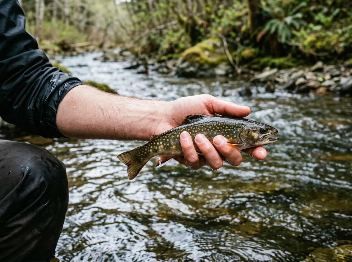
Rainbow Trout, Brown Trout, Brook Trout Most trout run small, and the deeper bends and undercuts give you a chance at a better fish.
Fit
Is the South Fork Right for You?
Reasons to make the trip, and reasons to pick another day or another water.
- You enjoy stalking wary trout in open meadow water where a careful approach pays off.
- You like fishing dries and a short dropper on small water with easy, signed access.
- You want a mix of rainbows, browns and brook trout in a scenic South Park setting.
- You can fish on a weekday, when the SWA water is quieter.
Related water
Similar Water Nearby
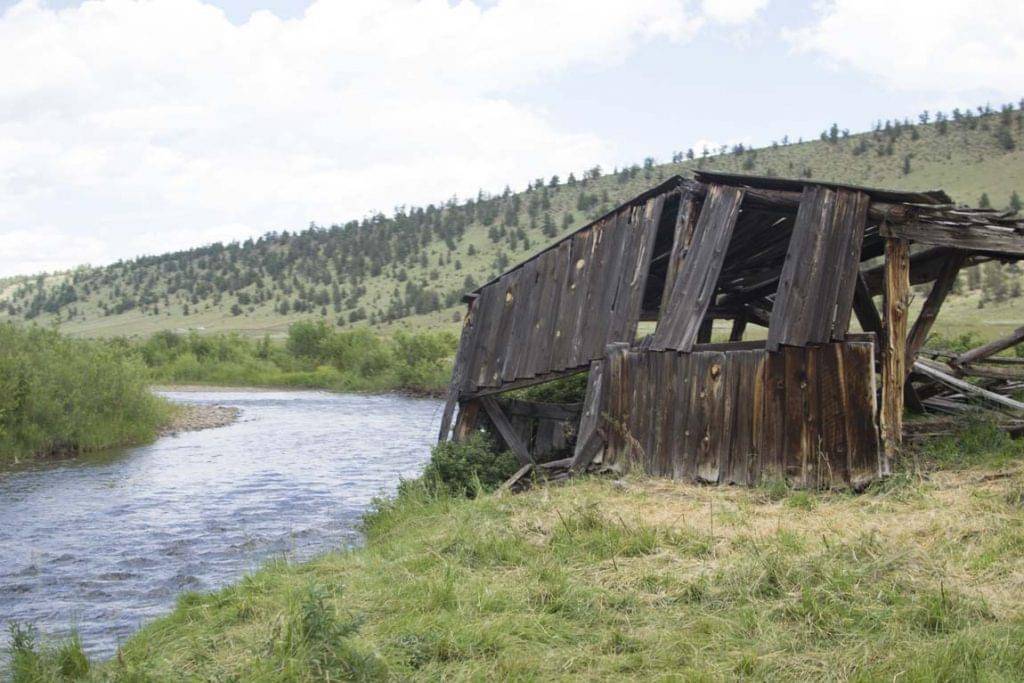
Another small South Park freestone with the same meadow character.
- You're after big tailwater trout or high fish counts.
- Your only free day is a weekend and you want the popular SWA water to yourself.
- You're planning a winter trip.
- You're bringing your dog, since pets are prohibited at both State Wildlife Areas.
Alternative rivers
A Different Option on the South Platte
When you want year-round fishing or a tougher tailwater challenge.


Find your next river
Pick the river before you pack the truck.
Some days call for a quiet creek. Others call for room to cast or a shot at a bigger fish. Find the water that fits the day you want.
- Compare 250+ Colorado rivers and sections by season, fish size, difficulty and access.
- See over 5,000 mapped access points and get directions.
- Save favorite waters and keep a backup plan handy.
Conditions
South Fork Flows and Weather
The gauge sits upstream above Antero Reservoir, so when a reliable reading is available, read it as a trend, and always check the water where you actually fish.
Current streamflow is unavailable
Check the latest reading at the gauge before you head out.
Open the official gauge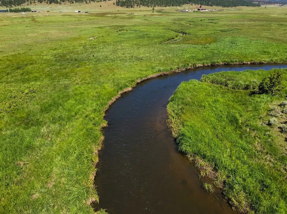
DWR measures the South Fork upstream above Antero Reservoir. Use the gauge range for planning and check the water at your downstream South Fork access.
Past Weather and the 7-Day Forecast
South Fork above Antero Reservoir: section point forecast
Cloudy; Mostly Cloudy; Clear
- Precipitation
- —Liquid equivalent
- Snowfall
- —
- Avg. wind
- 1 mph NW
- Observed sky / weather
- Cloudy; Mostly Cloudy; Clear; Partly Cloudy; Light Rain; Rain; Light Snow
- Pressure
- —
Observation sources
Temperature: Central Colorado Regional Airport. day_spanning_observations Source
Precipitation: Central Colorado Regional Airport. Hourly reports overlap; a daily precipitation total is unavailable. Source
Wind: Central Colorado Regional Airport. Mean station observations, 8am–6pm local Source
Pressure: Central Colorado Regional Airport. Mean observed sea-level pressure, 8am–6pm local Source
Observed sky / weather: Central Colorado Regional Airport. Qualitative station reports across available hours of the listed local date; not measured cloud percentage. Source
Nearby Central Colorado Regional Airport station observations: Cloudy; Mostly Cloudy; Clear; Partly Cloudy; Light Rain; Rain; Light Snow. High and low summarize available temperature samples, not certified daily extremes. Station conditions can differ from the canyon. 56 hourly station reports.
Clear; Partly Cloudy; Mostly Cloudy
- Precipitation
- —Liquid equivalent
- Snowfall
- —
- Avg. wind
- 3 mph SSE
- Observed sky / weather
- Clear; Partly Cloudy; Mostly Cloudy; Cloudy
- Pressure
- —
Observation sources
Temperature: Central Colorado Regional Airport. day_spanning_observations Source
Precipitation: Central Colorado Regional Airport. Hourly reports overlap; a daily precipitation total is unavailable. Source
Wind: Central Colorado Regional Airport. Mean station observations, 8am–6pm local Source
Pressure: Central Colorado Regional Airport. Mean observed sea-level pressure, 8am–6pm local Source
Observed sky / weather: Central Colorado Regional Airport. Qualitative station reports across available hours of the listed local date; not measured cloud percentage. Source
Nearby Central Colorado Regional Airport station observations: Clear; Partly Cloudy; Mostly Cloudy; Cloudy. High and low summarize available temperature samples, not certified daily extremes. Station conditions can differ from the canyon. 63 hourly station reports.
Clear
- Precipitation
- —Liquid equivalent
- Snowfall
- —
- Avg. wind
- 3 mph SE
- Observed sky / weather
- Clear
- Pressure
- —
Observation sources
Temperature: Central Colorado Regional Airport. day_spanning_observations Source
Precipitation: Central Colorado Regional Airport. Hourly reports overlap; a daily precipitation total is unavailable. Source
Wind: Central Colorado Regional Airport. Mean station observations, 8am–6pm local Source
Pressure: Central Colorado Regional Airport. Mean observed sea-level pressure, 8am–6pm local Source
Observed sky / weather: Central Colorado Regional Airport. Qualitative station reports across available hours of the listed local date; not measured cloud percentage. Source
Nearby Central Colorado Regional Airport station observations: Clear. High and low summarize available temperature samples, not certified daily extremes. Station conditions can differ from the canyon. 64 hourly station reports.
Cloudy; Drizzle; Mostly Cloudy
- Precipitation
- —Liquid equivalent
- Snowfall
- —
- Avg. wind
- 12 mph SE
- Observed sky / weather
- Cloudy; Drizzle; Mostly Cloudy; Partly Cloudy; Clear; Clear and Windy; Windy; Mostly Cloudy and Windy; Partly Cloudy and Windy
- Pressure
- —
Observation sources
Temperature: Central Colorado Regional Airport. day_spanning_observations Source
Precipitation: Central Colorado Regional Airport. Hourly reports overlap; a daily precipitation total is unavailable. Source
Wind: Central Colorado Regional Airport. Mean station observations, 8am–6pm local Source
Pressure: Central Colorado Regional Airport. Mean observed sea-level pressure, 8am–6pm local Source
Observed sky / weather: Central Colorado Regional Airport. Qualitative station reports across available hours of the listed local date; not measured cloud percentage. Source
Nearby Central Colorado Regional Airport station observations: Cloudy; Drizzle; Mostly Cloudy; Partly Cloudy; Clear; Clear and Windy; Windy; Mostly Cloudy and Windy; Partly Cloudy and Windy. High and low summarize available temperature samples, not certified daily extremes. Station conditions can differ from the canyon. 63 hourly station reports.
Clear; Partly Cloudy; Clear and Windy
- Precipitation
- —Liquid equivalent
- Snowfall
- —
- Avg. wind
- 8 mph W
- Observed sky / weather
- Clear; Partly Cloudy; Clear and Windy; Cloudy
- Pressure
- —
Observation sources
Temperature: Central Colorado Regional Airport. day_spanning_observations Source
Precipitation: Central Colorado Regional Airport. Hourly reports overlap; a daily precipitation total is unavailable. Source
Wind: Central Colorado Regional Airport. Mean station observations, 8am–6pm local Source
Pressure: Central Colorado Regional Airport. Mean observed sea-level pressure, 8am–6pm local Source
Observed sky / weather: Central Colorado Regional Airport. Qualitative station reports across available hours of the listed local date; not measured cloud percentage. Source
Nearby Central Colorado Regional Airport station observations: Clear; Partly Cloudy; Clear and Windy; Cloudy. High and low summarize available temperature samples, not certified daily extremes. Station conditions can differ from the canyon. 59 hourly station reports.
Cloudy; Partly Cloudy; Clear
- Precipitation
- —Liquid equivalent
- Snowfall
- —
- Avg. wind
- 6 mph SSE
- Observed sky / weather
- Cloudy; Partly Cloudy; Clear; Clear and Windy
- Pressure
- —
Observation sources
Temperature: Central Colorado Regional Airport. day_spanning_observations Source
Precipitation: Central Colorado Regional Airport. Hourly reports overlap; a daily precipitation total is unavailable. Source
Wind: Central Colorado Regional Airport. Mean station observations, 8am–6pm local Source
Pressure: Central Colorado Regional Airport. Mean observed sea-level pressure, 8am–6pm local Source
Observed sky / weather: Central Colorado Regional Airport. Qualitative station reports across available hours of the listed local date; not measured cloud percentage. Source
Nearby Central Colorado Regional Airport station observations: Cloudy; Partly Cloudy; Clear; Clear and Windy. High and low summarize available temperature samples, not certified daily extremes. Station conditions can differ from the canyon. 66 hourly station reports.
Mostly Cloudy; Cloudy; Partly Cloudy
- Precipitation
- —Liquid equivalent
- Snowfall
- —
- Avg. wind
- 12 mph WSW
- Observed sky / weather
- Mostly Cloudy; Cloudy; Partly Cloudy; Windy
- Pressure
- —
Observation sources
Temperature: Central Colorado Regional Airport. day_spanning_observations Source
Precipitation: Central Colorado Regional Airport. Hourly reports overlap; a daily precipitation total is unavailable. Source
Wind: Central Colorado Regional Airport. Mean station observations, 8am–6pm local Source
Pressure: Central Colorado Regional Airport. Mean observed sea-level pressure, 8am–6pm local Source
Observed sky / weather: Central Colorado Regional Airport. Qualitative station reports across available hours of the listed local date; not measured cloud percentage. Source
Nearby Central Colorado Regional Airport station observations: Mostly Cloudy; Cloudy; Partly Cloudy; Windy. High and low summarize available temperature samples, not certified daily extremes. Station conditions can differ from the canyon. 55 hourly station reports.
Chance Light Snow
Snow chance31%Mostly Clear
Precipitation chance0%- Avg. wind
- 8 mph WNW
- Cloud cover
- 45%
- Pressure
- 29.91 inHg
Mostly Sunny
Precipitation chance0%Partly Cloudy
Precipitation chance0%- Avg. wind
- 6 mph SSW
- Cloud cover
- 34%
- Pressure
- 30.13 inHg
Partly Sunny then Chance Light Snow
Snow chance40%Chance Light Snow then Mostly Cloudy
Snow chance40%- Avg. wind
- 5 mph SW
- Cloud cover
- 63%
- Pressure
- 30.11 inHg
Sunny
Precipitation chance1%Partly Cloudy
Precipitation chance0%- Avg. wind
- 5 mph W
- Cloud cover
- 18%
- Pressure
- 30.25 inHg
Mostly Sunny
Precipitation chance4%Partly Cloudy
Precipitation chance5%- Avg. wind
- 4 mph WSW
- Cloud cover
- 39%
- Pressure
- 30.06 inHg
Mostly Sunny then Slight Chance Snow Showers
Snow chance21%Slight Chance Snow Showers
Snow chance21%- Avg. wind
- 8 mph W
- Cloud cover
- 33%
- Pressure
- 30.06 inHg
Mostly Sunny
Precipitation chance10%- Avg. wind
- 13 mph W
- Cloud cover
- 33%
- Pressure
- 29.94 inHg
Weather sources
National Weather Service · Central Colorado Regional Airport. Wind and cloud averages use 8am–6pm local time. Forecast pressure: MET Norway, averaged daytime sea-level pressure in inches of mercury (CC BY 4.0). Past station reports do not include forecast rain chances or exact cloud percentages; a dash means unavailable.
Unlock the full guide
Know where to fish and what to tie on.
Put the forecast to work. Compare streamflow history on gauged waters, then open the full fishing plan for the section you pick.
- See where to start and how to fish each season.
- Match local hatches and fill your box with the recommended flies.
- Open the access map and get directions before you leave.
Gallery
South Fork Photos
A look at the open meadow water and bends you'll be fishing.
River Explorer Pro
Make this your next fishing trip.
Unlock River Explorer Pro and make your next fishing trip your best adventure yet.
- Find where to get on the water with interactive access maps and directions.
- Plan around recent weather and streamflows where gauges are available.
- Pack the right flies with seasonal tactics, hatch charts and pattern recommendations.
- Compare 250+ Colorado rivers and sections and save a backup stretch.