
Overview
Fishing the Lower Piedra River
Canyon water from the Southern Ute Indian Reservation up to Second Box Canyon, with plenty of trout and a few tough ways down
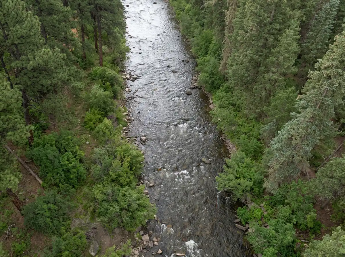
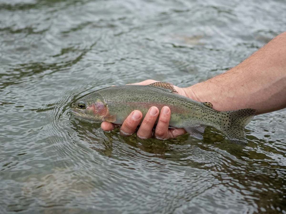
The lower Piedra River runs from the Southern Ute Indian Reservation up through the town of Piedra and on to Second Box Canyon, and there's a ton of water to fish along the way. This medium-sized freestone holds a very high number of trout. Most are rainbows and browns in the 10 to 16 inch range, and a few trophy-class browns live here too. The river doesn't see many anglers, so you can often have a good stretch of canyon to yourself and spend the day working dries and nymphs over plenty of fish.
Read the complete overview
The hard part is getting to the water. Most of the lower section sits below steep canyon walls, and in most places you can't get from the road down to the river. Hiking straight down from the road isn't advised because it can be dangerous. The campgrounds and signed trails give you much better access. Once you're at the river, stay within posted public access and on footing that feels solid. On the west side, Forest Road 621 reaches the Lower Piedra Campground. On the east side, Forest Road 622, the First Fork Road, is a separate route. It's a beautiful drive up First Box Canyon to the confluence of the First Fork and the Piedra. It takes some effort to drive all the way back there, so the water stays pristine. From the confluence, follow the signed hiking trail upstream or downstream where it's passable, and you'll find more good water than you'll know what to do with.
You can also find access well below the confluence, as far south as the Southern Ute Indian Reservation. Nonmembers fishing designated Southern Ute Tribal water need a Tribal fishing permit rather than a Colorado license, and must use the Tribe's mapped entry and exit points. Allotted and private land is separate, so get the owner's permission there. From the Forest Road 631 bridge downstream to the lower Tres Piedra Ranch boundary, 1.5 miles above US 160, the river is artificial flies and lures only, and all trout must be released immediately.
The Piedra has a bountiful array of insect life, and that keeps this fishery healthy and productive. There are many salmonflies on this river, and if you time it right you may be in for the hatch of your dreams. Come prepared with adult and nymph versions of golden stones and salmonflies so you're ready if you run into one of those hatches.
A freestone driven by snowmelt and rain, so flow, clarity and fish position change with the season and with storms.
Medium water with pools, runs, riffles and pocket water. You can break it into one reachable piece at a time from the bank.
The trout are plentiful and willing to eat dries and nymphs. The canyon's mixed currents make drag-free drifts the real test.
Steep canyon walls keep most of the road well above the river. The campgrounds and the First Fork Road are the practical ways down.
A very high number of trout, mostly rainbows and browns.
Rainbow Trout, Brown Trout Most trout run 10 to 16 inches, with a few trophy-class browns in the mix.
Fit
Is the Lower Piedra Right for Your Trip?
Who'll love this canyon and who would be happier on easier water
- A canyon freestone with a mix of pools, seams and short pocket-water drifts.
- You want lots of rainbows and browns and real solitude on lightly fished water.
- You enjoy prospecting with dries and nymphs and working on drag-free drifts in mixed currents.
- You'd like a shot at a big stonefly hatch and don't mind carrying salmonfly and golden stone patterns to be ready for it.
- You're happy to base out of a campground or drive the First Fork Road and hike the trail to reach water. Dogs are welcome.
Related water
Nearby Piedra Water
Other sections in the drainage with a similar feel, each with its own access to plan
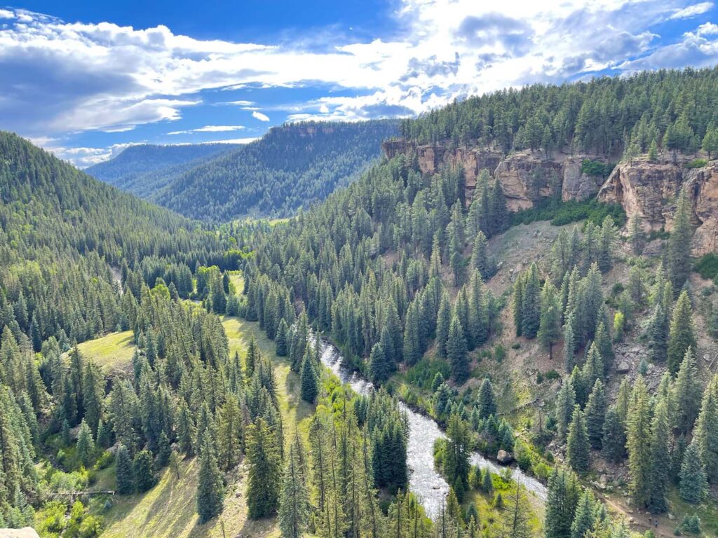 Same river, more canyon waterPiedra River Canyon - Canyon SectionIt's another medium-sized Piedra freestone with the same medium difficulty and the same spring-through-fall season, so the flies and tactics you'd use here carry over well.It has its own access and conditions, so read its guide and plan the approach before you assume it's an easier walk in.
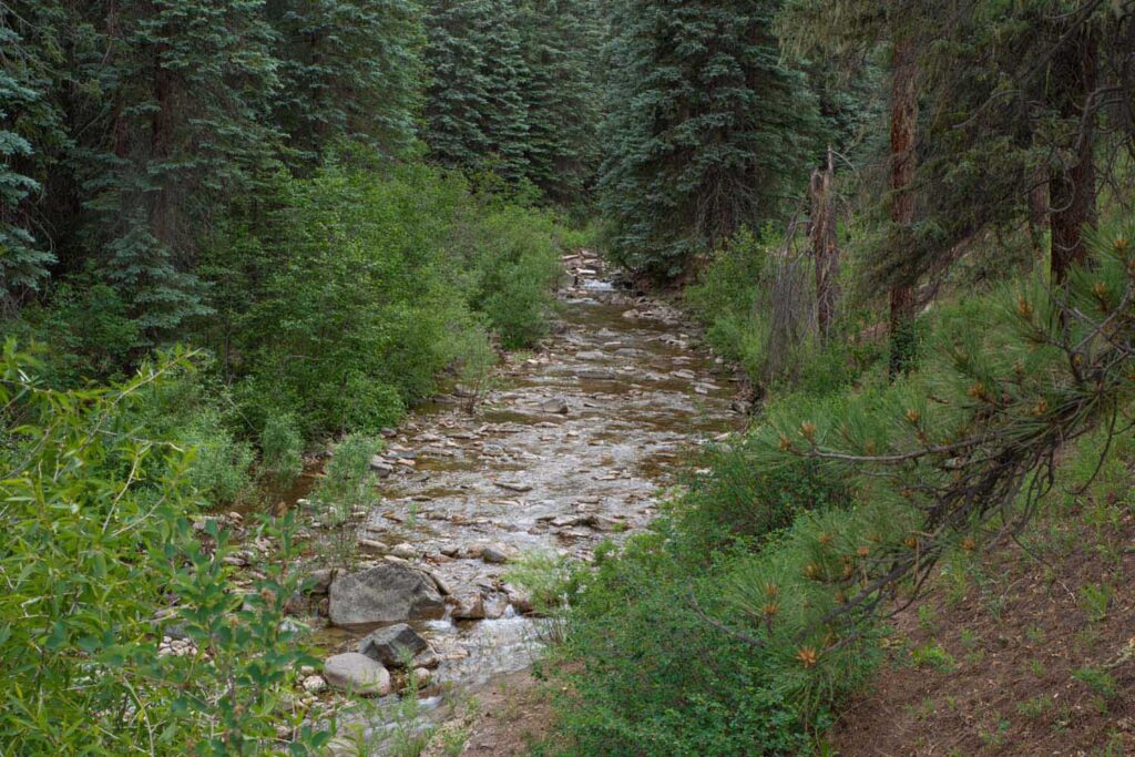 Small tributary at the confluenceFirst Fork of the Piedra River - Main SectionThe First Fork meets the Piedra at the end of Forest Road 622. If you're already making that drive, you can fish smaller water on the same trip.It's small water that fishes in summer and fall only, so it isn't a spring option, and you'll be making shorter casts in tighter spots.
- Easy banks everywhere or a quick winter stop in the lower canyon.
- You need short, gentle walks from the car to the water.
- You're mainly after big fish rather than numbers of 10 to 16 inch trout.
- You plan to fish designated Southern Ute Tribal water and haven't arranged the Tribal permit.
Alternative rivers
Another Option When the Lower Piedra Isn't in Season
A larger freestone in the same basin that fishes through the winter
Find your next river
Pick the river before you pack the truck.
Some days call for a quiet creek. Others call for room to cast or a shot at a bigger fish. Find the water that fits the day you want.
- Compare 250+ Colorado rivers and sections by season, fish size, difficulty and access.
- See over 5,000 mapped access points and get directions.
- Save favorite waters and keep a backup plan handy.
Conditions
Current Flows and Weather
The Arboles gauge sits far downstream, so use it to see how the river is trending, not as a reading at the canyon access
- Trend
- ↓ Below the previous seven-day mean
- Source
- USGS · 09349800
- Observed
- Mon, Nov 16 · 1:15 am MST
Follow the flow trend, then adjust your fishing depth and the water you focus on.
The Arboles gauge is well downstream of the canyon. Check the water at your access.
Streamflow in CFS
View all flow readings
| Date | Streamflow (CFS) |
|---|---|
| 2026-11-10 | 924 |
| 2026-11-11 | 834 |
| 2026-11-12 | 763 |
| 2026-11-14 | 835 |
| 2026-11-15 | 835 |
| 2026-11-16 | 755 |
View all flow readings
| Date | Streamflow (CFS) |
|---|---|
| 2026-10-18 | 790 |
| 2026-10-19 | 673 |
| 2026-10-20 | 605 |
| 2026-10-21 | 636 |
| 2026-10-27 | 2300 |
| 2026-10-28 | 1810 |
| 2026-10-29 | 1470 |
| 2026-10-30 | 1260 |
| 2026-10-31 | 1360 |
| 2026-11-01 | 6500 |
| 2026-11-02 | 9350 |
| 2026-11-03 | 4420 |
| 2026-11-04 | 3040 |
| 2026-11-05 | 2200 |
| 2026-11-06 | 1720 |
| 2026-11-07 | 1420 |
| 2026-11-08 | 1200 |
| 2026-11-09 | 1040 |
| 2026-11-10 | 924 |
| 2026-11-11 | 834 |
| 2026-11-12 | 763 |
| 2026-11-14 | 835 |
| 2026-11-15 | 835 |
| 2026-11-16 | 755 |
Past Weather and the 7-Day Forecast
Lower Piedra Canyon: point forecast
Clear; Fog/Mist
- Precipitation
- —Liquid equivalent
- Snowfall
- —
- Avg. wind
- 5 mph SSW
- Observed sky / weather
- Clear; Fog/Mist
- Pressure
- —
Observation sources
Temperature: Stevens Field, Pagosa Springs. day_spanning_observations Source
Precipitation: Stevens Field, Pagosa Springs. Hourly reports overlap; a daily precipitation total is unavailable. Source
Wind: Stevens Field, Pagosa Springs. Mean station observations, 8am–6pm local Source
Pressure: Stevens Field, Pagosa Springs. Mean observed sea-level pressure, 8am–6pm local Source
Observed sky / weather: Stevens Field, Pagosa Springs. Qualitative station reports across available hours of the listed local date; not measured cloud percentage. Source
Nearby Stevens Field, Pagosa Springs station observations: Clear; Fog/Mist. High and low summarize available temperature samples, not certified daily extremes. Station conditions can differ from the canyon. 50 hourly station reports.
Clear; Light Rain
- Precipitation
- —Liquid equivalent
- Snowfall
- —
- Avg. wind
- 5 mph SW
- Observed sky / weather
- Clear; Light Rain
- Pressure
- —
Observation sources
Temperature: Stevens Field, Pagosa Springs. day_spanning_observations Source
Precipitation: Stevens Field, Pagosa Springs. Hourly reports overlap; a daily precipitation total is unavailable. Source
Wind: Stevens Field, Pagosa Springs. Mean station observations, 8am–6pm local Source
Pressure: Stevens Field, Pagosa Springs. Mean observed sea-level pressure, 8am–6pm local Source
Observed sky / weather: Stevens Field, Pagosa Springs. Qualitative station reports across available hours of the listed local date; not measured cloud percentage. Source
Nearby Stevens Field, Pagosa Springs station observations: Clear; Light Rain. High and low summarize available temperature samples, not certified daily extremes. Station conditions can differ from the canyon. 59 hourly station reports.
Clear
- Precipitation
- —Liquid equivalent
- Snowfall
- —
- Avg. wind
- 4 mph SW
- Observed sky / weather
- Clear
- Pressure
- —
Observation sources
Temperature: Stevens Field, Pagosa Springs. day_spanning_observations Source
Precipitation: Stevens Field, Pagosa Springs. Hourly reports overlap; a daily precipitation total is unavailable. Source
Wind: Stevens Field, Pagosa Springs. Mean station observations, 8am–6pm local Source
Pressure: Stevens Field, Pagosa Springs. Mean observed sea-level pressure, 8am–6pm local Source
Observed sky / weather: Stevens Field, Pagosa Springs. Qualitative station reports across available hours of the listed local date; not measured cloud percentage. Source
Nearby Stevens Field, Pagosa Springs station observations: Clear. High and low summarize available temperature samples, not certified daily extremes. Station conditions can differ from the canyon. 58 hourly station reports.
Clear
- Precipitation
- —Liquid equivalent
- Snowfall
- —
- Avg. wind
- 4 mph SW
- Observed sky / weather
- Clear
- Pressure
- —
Observation sources
Temperature: Stevens Field, Pagosa Springs. day_spanning_observations Source
Precipitation: Stevens Field, Pagosa Springs. Hourly reports overlap; a daily precipitation total is unavailable. Source
Wind: Stevens Field, Pagosa Springs. Mean station observations, 8am–6pm local Source
Pressure: Stevens Field, Pagosa Springs. Mean observed sea-level pressure, 8am–6pm local Source
Observed sky / weather: Stevens Field, Pagosa Springs. Qualitative station reports across available hours of the listed local date; not measured cloud percentage. Source
Nearby Stevens Field, Pagosa Springs station observations: Clear. High and low summarize available temperature samples, not certified daily extremes. Station conditions can differ from the canyon. 53 hourly station reports.
Light Drizzle; Cloudy; Mostly Cloudy
- Precipitation
- —Liquid equivalent
- Snowfall
- —
- Avg. wind
- 3 mph SSW
- Observed sky / weather
- Light Drizzle; Cloudy; Mostly Cloudy; Clear; Mostly Clear; Partly Cloudy
- Pressure
- —
Observation sources
Temperature: Stevens Field, Pagosa Springs. day_spanning_observations Source
Precipitation: Stevens Field, Pagosa Springs. Hourly reports overlap; a daily precipitation total is unavailable. Source
Wind: Stevens Field, Pagosa Springs. Mean station observations, 8am–6pm local Source
Pressure: Stevens Field, Pagosa Springs. Mean observed sea-level pressure, 8am–6pm local Source
Observed sky / weather: Stevens Field, Pagosa Springs. Qualitative station reports across available hours of the listed local date; not measured cloud percentage. Source
Nearby Stevens Field, Pagosa Springs station observations: Light Drizzle; Cloudy; Mostly Cloudy; Clear; Mostly Clear; Partly Cloudy. High and low summarize available temperature samples, not certified daily extremes. Station conditions can differ from the canyon. 61 hourly station reports.
Partly Cloudy; Cloudy; Light Drizzle
- Precipitation
- —Liquid equivalent
- Snowfall
- —
- Avg. wind
- 4 mph WSW
- Observed sky / weather
- Partly Cloudy; Cloudy; Light Drizzle; Light Rain; Unknown Precipitation; Light Rain and Fog/Mist; Unknown Precipitation and Fog/Mist; Light Snow and Fog/Mist; Fog; Light Drizzle and Fog/Mist
- Pressure
- —
Observation sources
Temperature: Stevens Field, Pagosa Springs. day_spanning_observations Source
Precipitation: Stevens Field, Pagosa Springs. Hourly reports overlap; a daily precipitation total is unavailable. Source
Wind: Stevens Field, Pagosa Springs. Mean station observations, 8am–6pm local Source
Pressure: Stevens Field, Pagosa Springs. Mean observed sea-level pressure, 8am–6pm local Source
Observed sky / weather: Stevens Field, Pagosa Springs. Qualitative station reports across available hours of the listed local date; not measured cloud percentage. Source
Nearby Stevens Field, Pagosa Springs station observations: Partly Cloudy; Cloudy; Light Drizzle; Light Rain; Unknown Precipitation; Light Rain and Fog/Mist; Unknown Precipitation and Fog/Mist; Light Snow and Fog/Mist; Fog; Light Drizzle and Fog/Mist. High and low summarize available temperature samples, not certified daily extremes. Station conditions can differ from the canyon. 49 hourly station reports.
Clear; Mostly Cloudy; Cloudy
- Precipitation
- —Liquid equivalent
- Snowfall
- —
- Avg. wind
- 3 mph SSW
- Observed sky / weather
- Clear; Mostly Cloudy; Cloudy; Partly Cloudy; Mostly Clear
- Pressure
- —
Observation sources
Temperature: Stevens Field, Pagosa Springs. day_spanning_observations Source
Precipitation: Stevens Field, Pagosa Springs. Hourly reports overlap; a daily precipitation total is unavailable. Source
Wind: Stevens Field, Pagosa Springs. Mean station observations, 8am–6pm local Source
Pressure: Stevens Field, Pagosa Springs. Mean observed sea-level pressure, 8am–6pm local Source
Observed sky / weather: Stevens Field, Pagosa Springs. Qualitative station reports across available hours of the listed local date; not measured cloud percentage. Source
Nearby Stevens Field, Pagosa Springs station observations: Clear; Mostly Cloudy; Cloudy; Partly Cloudy; Mostly Clear. High and low summarize available temperature samples, not certified daily extremes. Station conditions can differ from the canyon. 63 hourly station reports.
Mostly Sunny
Precipitation chance0%Partly Cloudy
Precipitation chance13%- Avg. wind
- 1 mph SSW
- Cloud cover
- 37%
- Pressure
- 30.16 inHg
Showers And Thunderstorms
Rain chance94%Snow Showers Likely
Snow chance94%- Avg. wind
- 6 mph S
- Cloud cover
- 81%
- Pressure
- 30 inHg
Sunny
Precipitation chance6%Partly Cloudy
Precipitation chance1%- Avg. wind
- 2 mph SW
- Cloud cover
- 18%
- Pressure
- 30.17 inHg
Mostly Sunny then Slight Chance T-storms
Snow chance72%Slight Chance T-storms
Snow chance91%- Avg. wind
- 3 mph SE
- Cloud cover
- 50%
- Pressure
- 30.09 inHg
Rain And Snow Showers
Rain / snow chance91%Chance Snow Showers then Partly Cloudy
Snow chance35%- Avg. wind
- 14 mph SW
- Cloud cover
- 87%
- Pressure
- 29.96 inHg
Sunny
Precipitation chance2%Mostly Clear
Precipitation chance1%- Avg. wind
- 1 mph S
- Cloud cover
- 18%
- Pressure
- 30.08 inHg
Mostly Sunny
Precipitation chance13%- Avg. wind
- 1 mph S
- Cloud cover
- 32%
- Pressure
- 30.13 inHg
Weather sources
National Weather Service · Stevens Field, Pagosa Springs. Wind and cloud averages use 8am–6pm local time. Forecast pressure: MET Norway, averaged daytime sea-level pressure in inches of mercury (CC BY 4.0). Past station reports do not include forecast rain chances or exact cloud percentages; a dash means unavailable.
Unlock the full guide
Know where to fish and what to tie on.
Put the forecast to work. Compare streamflow history on gauged waters, then open the full fishing plan for the section you pick.
- See where to start and how to fish each season.
- Match local hatches and fill your box with the recommended flies.
- Open the access map and get directions before you leave.
Gallery
Lower Piedra Photo Gallery
A look at the canyon water and the kind of banks you'll be fishing from
River Explorer Pro
Make this your next fishing trip.
Unlock River Explorer Pro and make your next fishing trip your best adventure yet.
- Find where to get on the water with interactive access maps and directions.
- Plan around recent weather and streamflows where gauges are available.
- Pack the right flies with seasonal tactics, hatch charts and pattern recommendations.
- Compare 250+ Colorado rivers and sections and save a backup stretch.