
Overview
Fishing the Piedra River Canyon
A hike-in brown trout reach with cliffs, pools and trout that make you work for them
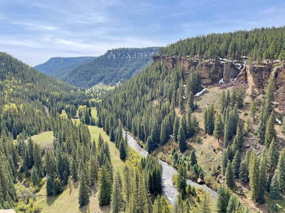
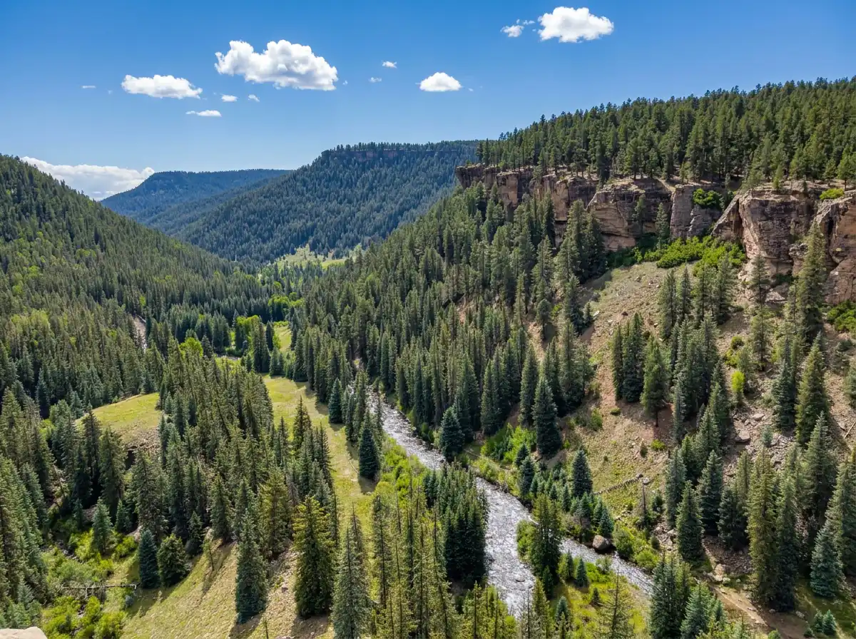
The canyon section of the Piedra River is a hike-in reach. You can fish it as a day hike or stretch it into a multi-day trip, and that walk is a big part of its appeal. It feels different from the upper forks and from the road-access water farther downstream. Once you're in, you're working with the water in front of you and the trail behind you. It isn't a true canyon the whole way, but you'll fish near some sheer rock cliffs at the start of this section, and the scenery alone makes the effort worthwhile. This is medium-sized freestone water with medium difficulty. It's mostly a brown trout fishery with a few rainbows here and there, and it holds good numbers of medium-sized fish.
Read the complete overview
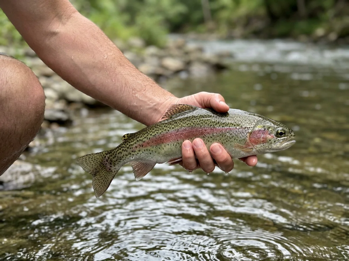
Trout here eat a variety of nymphs, streamers and dry flies, depending on the hatch and the time of year you're fishing the canyon. I found the fish more challenging than I expected. There were also more anglers than I thought there'd be for this area, though it was still easy to find our own water and explore. On the day we fished it, the two of us caught about 30 fish, so the canyon can be generous. Still, you'll usually earn your fish by covering promising pools and making short, careful drifts, so don't come in counting on a big number.
I probably shouldn't share this, but since we didn't catch it, I will. When we fished this section, we spooked a behemoth of a brown trout. We only saw it briefly, so I can't tell you its size with any certainty. My guess was somewhere around 25 inches, and it may have been even bigger. A fish like that would be very unusual for a river this size, but every now and then you cross paths with a fish of a lifetime. Despite our many streamer casts into the murky water, it eluded us. Just seeing that fish blew my mind and made our day. I'd have traded all the others to land that one. What a day, and great scenery too.
For your own trip, carry dries, nymphs and a streamer or two, and let rising fish or the water in front of you decide which one comes out. Footing varies, and you have limited ways to retreat once you're down in the canyon. Pace the walk and leave yourself energy for the hike out. From the Forest Service Road 631 (Piedra Road) bridge downstream to the lower boundary of Tres Piedra Ranch, about 1.5 miles upstream of US 160, CPW lists artificial flies or lures only and immediate release of all trout, so come rigged with flies and plan to handle every fish quickly. The access section has the details.
Freestone river shaped by snowmelt and rain, so clarity and flow change through spring and after storms.
Medium river with pools, riffles, runs and pocket water. There's usually room to cast, but crossings take judgment.
Medium. The browns can be more challenging than you'd expect, so a careful approach and clean drifts matter.
Hard. It's a hike-in reach via the Piedra River Trail, with variable footing and limited ways out once you're in the canyon.
Many. Good numbers of trout, mostly browns with a few rainbows, though you'll usually earn them by covering water.
Rainbow Trout, Brown Trout Medium for most fish, with a rare chance at a much larger brown.
Fit
Is the Piedra Canyon Right for Your Trip?
The walk, the footing and the fishing style decide whether this reach suits your day
- A walk-in river trip with canyon scenery and time to work different water types.
- Fishing reachable pools and runs with a flexible rig.
- Hunting brown trout through pools, riffles and pocket water when you don't mind earning your fish.
- A day hike or multi-day trip where finding your own stretch of water is part of the fun.
Related water
Similar Water on the Piedra
The same river and spring-through-fall season on a smaller scale
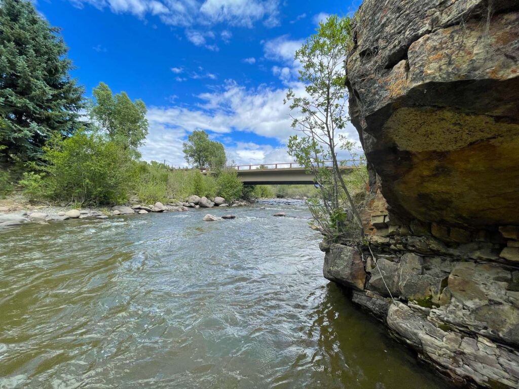
- A casual wade across strong water or a quick drive-up trip.
- A day when you want easy numbers, since these trout can be more challenging than you'd expect.
- A winter outing, because this reach is fished spring through fall.
- Fishing bait or keeping trout from the Forest Service Road 631 (Piedra Road) bridge downstream to the lower Tres Piedra Ranch boundary, where CPW lists artificial flies or lures only and immediate release of all trout.
Alternative rivers
Other Sections to Consider Nearby
Basin options for comparable water, bigger rivers or a winter day out
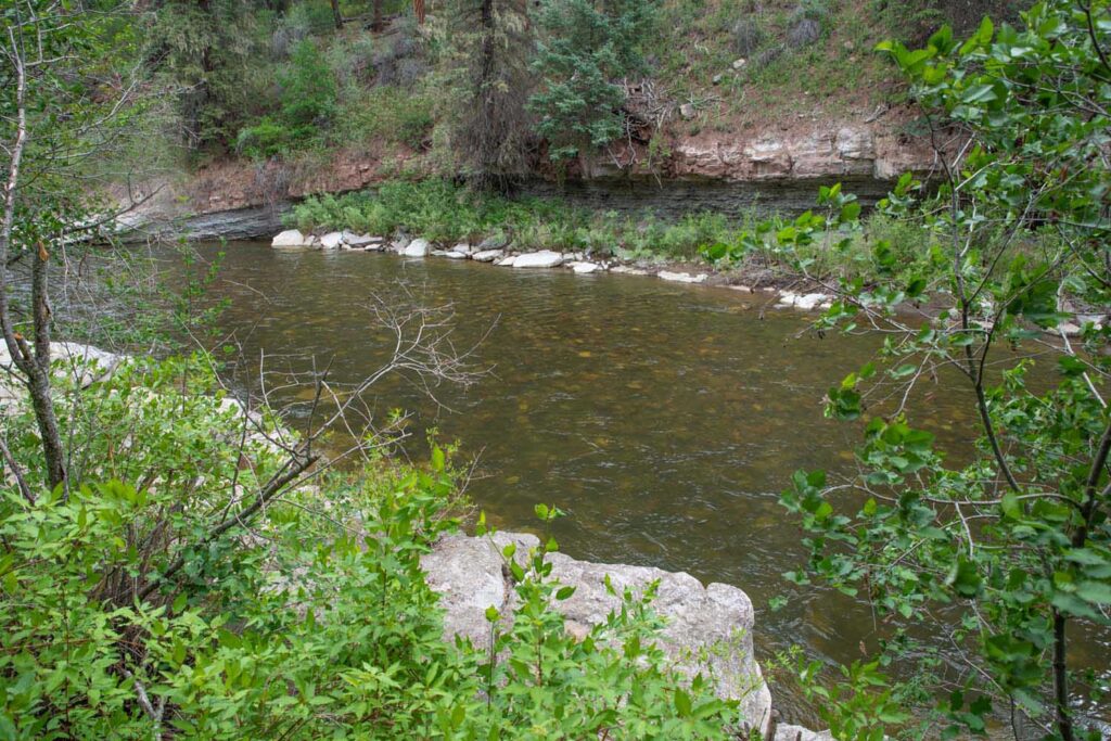 Same river, comparable waterLower Piedra River - Lower SectionMedium freestone water on the Piedra with the same medium difficulty and spring-through-fall window. It's a good choice when you want fishing similar to the canyon's.You give up the canyon's hike-in setting and cliff scenery, and it has its own approaches, so check its access before you go.
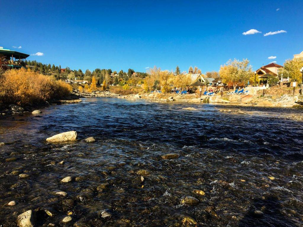 Larger water with a winter optionSan Juan River - Middle SectionLarge freestone water in the same basin, listed as fishable in all four seasons, including winter when the canyon is outside its usual window.Bigger water gives you more to read and makes crossings harder, and winter fishing there still depends on access, flow and weather.
Find your next river
Pick the river before you pack the truck.
Some days call for a quiet creek. Others call for room to cast or a shot at a bigger fish. Find the water that fits the day you want.
- Compare 250+ Colorado rivers and sections by season, fish size, difficulty and access.
- See over 5,000 mapped access points and get directions.
- Save favorite waters and keep a backup plan handy.
Conditions
Current Flows and Weather for the Piedra Canyon
Check the local forecast, and treat the same-river gauge far downstream near Arboles as broad trend context, not a read on canyon clarity, depth or crossings
- Fishable flow ranges
- 75–450 cfs
- Trend
- ↓ Below the previous seven-day mean
- Source
- USGS · 09349800
- Observed
- Mon, Nov 16 · 1:15 am MST
Follow the flow trend, then adjust your fishing depth and the water you focus on.
The Piedra River station near Arboles is downstream of the canyon. Treat it as same-river context and make local wading decisions at your access.
Streamflow in CFS
View all flow readings
| Date | Streamflow (CFS) |
|---|---|
| 2026-11-10 | 924 |
| 2026-11-11 | 834 |
| 2026-11-12 | 763 |
| 2026-11-14 | 835 |
| 2026-11-15 | 835 |
| 2026-11-16 | 755 |
View all flow readings
| Date | Streamflow (CFS) |
|---|---|
| 2026-10-18 | 790 |
| 2026-10-19 | 673 |
| 2026-10-20 | 605 |
| 2026-10-21 | 636 |
| 2026-10-27 | 2300 |
| 2026-10-28 | 1810 |
| 2026-10-29 | 1470 |
| 2026-10-30 | 1260 |
| 2026-10-31 | 1360 |
| 2026-11-01 | 6500 |
| 2026-11-02 | 9350 |
| 2026-11-03 | 4420 |
| 2026-11-04 | 3040 |
| 2026-11-05 | 2200 |
| 2026-11-06 | 1720 |
| 2026-11-07 | 1420 |
| 2026-11-08 | 1200 |
| 2026-11-09 | 1040 |
| 2026-11-10 | 924 |
| 2026-11-11 | 834 |
| 2026-11-12 | 763 |
| 2026-11-14 | 835 |
| 2026-11-15 | 835 |
| 2026-11-16 | 755 |
Past Weather and the 7-Day Forecast
Pagosa Springs area: section point forecast
Observed detail unavailable
- Precipitation
- —Liquid equivalent
- Snowfall
- —
- Avg. wind
- 2 mph SSE
- Observed sky / weather
- —
- Pressure
- —
Observation sources
Temperature: 160W14250RWS1RHS - 0.1 mi E of Great W Ave Pagosa Springs. day_spanning_observations Source
Precipitation: 160W14250RWS1RHS - 0.1 mi E of Great W Ave Pagosa Springs. Hourly reports overlap; a daily precipitation total is unavailable. Source
Wind: 160W14250RWS1RHS - 0.1 mi E of Great W Ave Pagosa Springs. Mean station observations, 8am–6pm local Source
Pressure: 160W14250RWS1RHS - 0.1 mi E of Great W Ave Pagosa Springs. Mean observed sea-level pressure, 8am–6pm local Source
Observed sky / weather: 160W14250RWS1RHS - 0.1 mi E of Great W Ave Pagosa Springs. Qualitative station reports across available hours of the listed local date; not measured cloud percentage. Source
Nearby 160W14250RWS1RHS - 0.1 mi E of Great W Ave Pagosa Springs station observations: . High and low summarize available temperature samples, not certified daily extremes. Station conditions can differ from the canyon. 109 hourly station reports.
Observed detail unavailable
- Precipitation
- —Liquid equivalent
- Snowfall
- —
- Avg. wind
- 3 mph WSW
- Observed sky / weather
- —
- Pressure
- —
Observation sources
Temperature: 160W14250RWS1RHS - 0.1 mi E of Great W Ave Pagosa Springs. day_spanning_observations Source
Precipitation: 160W14250RWS1RHS - 0.1 mi E of Great W Ave Pagosa Springs. Hourly reports overlap; a daily precipitation total is unavailable. Source
Wind: 160W14250RWS1RHS - 0.1 mi E of Great W Ave Pagosa Springs. Mean station observations, 8am–6pm local Source
Pressure: 160W14250RWS1RHS - 0.1 mi E of Great W Ave Pagosa Springs. Mean observed sea-level pressure, 8am–6pm local Source
Observed sky / weather: 160W14250RWS1RHS - 0.1 mi E of Great W Ave Pagosa Springs. Qualitative station reports across available hours of the listed local date; not measured cloud percentage. Source
Nearby 160W14250RWS1RHS - 0.1 mi E of Great W Ave Pagosa Springs station observations: . High and low summarize available temperature samples, not certified daily extremes. Station conditions can differ from the canyon. 114 hourly station reports.
Observed detail unavailable
- Precipitation
- —Liquid equivalent
- Snowfall
- —
- Avg. wind
- 3 mph S
- Observed sky / weather
- —
- Pressure
- —
Observation sources
Temperature: 160W14250RWS1RHS - 0.1 mi E of Great W Ave Pagosa Springs. day_spanning_observations Source
Precipitation: 160W14250RWS1RHS - 0.1 mi E of Great W Ave Pagosa Springs. Hourly reports overlap; a daily precipitation total is unavailable. Source
Wind: 160W14250RWS1RHS - 0.1 mi E of Great W Ave Pagosa Springs. Mean station observations, 8am–6pm local Source
Pressure: 160W14250RWS1RHS - 0.1 mi E of Great W Ave Pagosa Springs. Mean observed sea-level pressure, 8am–6pm local Source
Observed sky / weather: 160W14250RWS1RHS - 0.1 mi E of Great W Ave Pagosa Springs. Qualitative station reports across available hours of the listed local date; not measured cloud percentage. Source
Nearby 160W14250RWS1RHS - 0.1 mi E of Great W Ave Pagosa Springs station observations: . High and low summarize available temperature samples, not certified daily extremes. Station conditions can differ from the canyon. 126 hourly station reports.
Observed detail unavailable
- Precipitation
- —Liquid equivalent
- Snowfall
- —
- Avg. wind
- 3 mph S
- Observed sky / weather
- —
- Pressure
- —
Observation sources
Temperature: 160W14250RWS1RHS - 0.1 mi E of Great W Ave Pagosa Springs. day_spanning_observations Source
Precipitation: 160W14250RWS1RHS - 0.1 mi E of Great W Ave Pagosa Springs. Hourly reports overlap; a daily precipitation total is unavailable. Source
Wind: 160W14250RWS1RHS - 0.1 mi E of Great W Ave Pagosa Springs. Mean station observations, 8am–6pm local Source
Pressure: 160W14250RWS1RHS - 0.1 mi E of Great W Ave Pagosa Springs. Mean observed sea-level pressure, 8am–6pm local Source
Observed sky / weather: 160W14250RWS1RHS - 0.1 mi E of Great W Ave Pagosa Springs. Qualitative station reports across available hours of the listed local date; not measured cloud percentage. Source
Nearby 160W14250RWS1RHS - 0.1 mi E of Great W Ave Pagosa Springs station observations: . High and low summarize available temperature samples, not certified daily extremes. Station conditions can differ from the canyon. 104 hourly station reports.
Observed detail unavailable
- Precipitation
- —Liquid equivalent
- Snowfall
- —
- Avg. wind
- 2 mph SW
- Observed sky / weather
- —
- Pressure
- —
Observation sources
Temperature: 160W14250RWS1RHS - 0.1 mi E of Great W Ave Pagosa Springs. day_spanning_observations Source
Precipitation: 160W14250RWS1RHS - 0.1 mi E of Great W Ave Pagosa Springs. Hourly reports overlap; a daily precipitation total is unavailable. Source
Wind: 160W14250RWS1RHS - 0.1 mi E of Great W Ave Pagosa Springs. Mean station observations, 8am–6pm local Source
Pressure: 160W14250RWS1RHS - 0.1 mi E of Great W Ave Pagosa Springs. Mean observed sea-level pressure, 8am–6pm local Source
Observed sky / weather: 160W14250RWS1RHS - 0.1 mi E of Great W Ave Pagosa Springs. Qualitative station reports across available hours of the listed local date; not measured cloud percentage. Source
Nearby 160W14250RWS1RHS - 0.1 mi E of Great W Ave Pagosa Springs station observations: . High and low summarize available temperature samples, not certified daily extremes. Station conditions can differ from the canyon. 131 hourly station reports.
Observed detail unavailable
- Precipitation
- —Liquid equivalent
- Snowfall
- —
- Avg. wind
- 3 mph SW
- Observed sky / weather
- —
- Pressure
- —
Observation sources
Temperature: 160W14250RWS1RHS - 0.1 mi E of Great W Ave Pagosa Springs. day_spanning_observations Source
Precipitation: 160W14250RWS1RHS - 0.1 mi E of Great W Ave Pagosa Springs. Hourly reports overlap; a daily precipitation total is unavailable. Source
Wind: 160W14250RWS1RHS - 0.1 mi E of Great W Ave Pagosa Springs. Mean station observations, 8am–6pm local Source
Pressure: 160W14250RWS1RHS - 0.1 mi E of Great W Ave Pagosa Springs. Mean observed sea-level pressure, 8am–6pm local Source
Observed sky / weather: 160W14250RWS1RHS - 0.1 mi E of Great W Ave Pagosa Springs. Qualitative station reports across available hours of the listed local date; not measured cloud percentage. Source
Nearby 160W14250RWS1RHS - 0.1 mi E of Great W Ave Pagosa Springs station observations: . High and low summarize available temperature samples, not certified daily extremes. Station conditions can differ from the canyon. 104 hourly station reports.
Observed detail unavailable
- Precipitation
- —Liquid equivalent
- Snowfall
- —
- Avg. wind
- 2 mph S
- Observed sky / weather
- —
- Pressure
- —
Observation sources
Temperature: 160W14250RWS1RHS - 0.1 mi E of Great W Ave Pagosa Springs. day_spanning_observations Source
Precipitation: 160W14250RWS1RHS - 0.1 mi E of Great W Ave Pagosa Springs. Hourly reports overlap; a daily precipitation total is unavailable. Source
Wind: 160W14250RWS1RHS - 0.1 mi E of Great W Ave Pagosa Springs. Mean station observations, 8am–6pm local Source
Pressure: 160W14250RWS1RHS - 0.1 mi E of Great W Ave Pagosa Springs. Mean observed sea-level pressure, 8am–6pm local Source
Observed sky / weather: 160W14250RWS1RHS - 0.1 mi E of Great W Ave Pagosa Springs. Qualitative station reports across available hours of the listed local date; not measured cloud percentage. Source
Nearby 160W14250RWS1RHS - 0.1 mi E of Great W Ave Pagosa Springs station observations: . High and low summarize available temperature samples, not certified daily extremes. Station conditions can differ from the canyon. 119 hourly station reports.
Mostly Sunny
Precipitation chance0%Partly Cloudy
Precipitation chance14%- Avg. wind
- 2 mph SSE
- Cloud cover
- 35%
- Pressure
- 30.17 inHg
Showers And Thunderstorms
Rain chance97%Snow Showers Likely
Snow chance97%- Avg. wind
- 9 mph S
- Cloud cover
- 84%
- Pressure
- 30 inHg
Mostly Sunny
Precipitation chance8%Partly Cloudy
Precipitation chance1%- Avg. wind
- 3 mph SSW
- Cloud cover
- 21%
- Pressure
- 30.17 inHg
Mostly Sunny then Slight Chance T-storms
Snow chance72%Slight Chance T-storms
Snow chance93%- Avg. wind
- 5 mph S
- Cloud cover
- 47%
- Pressure
- 30.08 inHg
Snow Showers
Snow chance93%Chance Snow Showers then Partly Cloudy
Snow chance39%- Avg. wind
- 15 mph SW
- Cloud cover
- 90%
- Pressure
- 29.96 inHg
Sunny
Precipitation chance4%Partly Cloudy
Precipitation chance2%- Avg. wind
- 2 mph SSW
- Cloud cover
- 20%
- Pressure
- 30.08 inHg
Mostly Sunny
Precipitation chance14%- Avg. wind
- 1 mph SSW
- Cloud cover
- 31%
- Pressure
- 30.12 inHg
Weather sources
National Weather Service · 160W14250RWS1RHS - 0.1 mi E of Great W Ave Pagosa Springs. Wind and cloud averages use 8am–6pm local time. Forecast pressure: MET Norway, averaged daytime sea-level pressure in inches of mercury (CC BY 4.0). Past station reports do not include forecast rain chances or exact cloud percentages; a dash means unavailable.
Unlock the full guide
Know where to fish and what to tie on.
Put the forecast to work. Compare streamflow history on gauged waters, then open the full fishing plan for the section you pick.
- See where to start and how to fish each season.
- Match local hatches and fill your box with the recommended flies.
- Open the access map and get directions before you leave.
Gallery
Piedra Canyon Photos
A feel for the canyon's cliffs, pools and runs, and how the scenery shifts through the seasons
River Explorer Pro
Make this your next fishing trip.
Unlock River Explorer Pro and make your next fishing trip your best adventure yet.
- Find where to get on the water with interactive access maps and directions.
- Plan around recent weather and streamflows where gauges are available.
- Pack the right flies with seasonal tactics, hatch charts and pattern recommendations.
- Compare 250+ Colorado rivers and sections and save a backup stretch.