
Overview
Fishing the Upper Crystal River
Smaller rainbows and browns, clear boulder pockets and a summer-to-fall season above Redstone
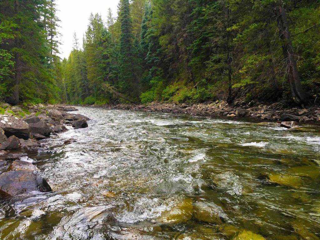
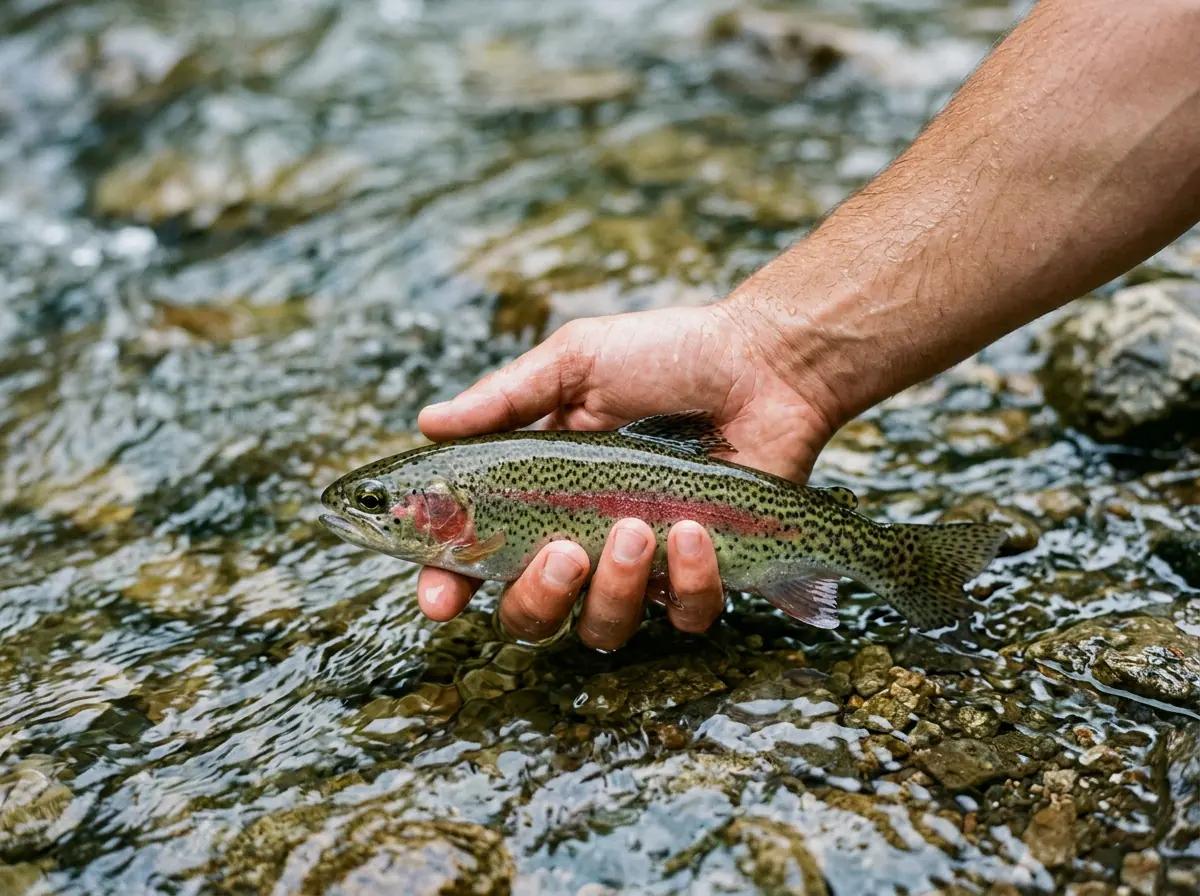
The upper Crystal River is a medium-sized freestone that runs from its high headwaters down past Marble toward Redstone. On a good summer or fall day it lives up to its name, with clear water tumbling over rock and rainbow and brown trout holding behind the boulders. Most of the trout are on the smaller side, and you'll find a fair number of them rather than a fish in every slot. Think of this as a pocket-water trip for willing trout and quiet mountain surroundings. It isn't the place to hunt a big fish, and it's better for it.
Read the complete overview
The section gets much easier to read once you stop trying to take in the whole river. Most of the good water comes in small pieces: the soft cushion in front of a boulder, the slot behind it, and the seam where fast water slides past a slower edge along the bank. Each of those spots gives a trout food carried by the current and a place to rest out of the push. You'll do most of your fishing with a single buoyant dry or a light dry-dropper, using short, accurate casts and keeping your line off the faster current between you and the fish. That's a big part of why we rate it easy. The trout usually aren't fussy, and the skill that matters most is controlling a drift over a few feet of water, not making a long, technical presentation.
The Crystal runs clear more often than not, but it's still a freestone. Snowmelt and summer storms can color it up and push it hard, which is one reason this upper section is really a summer and fall river. Spring runoff and snow, along with winter ice and limited high-country access, make it a poor plan in the other two seasons.
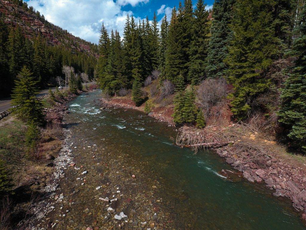
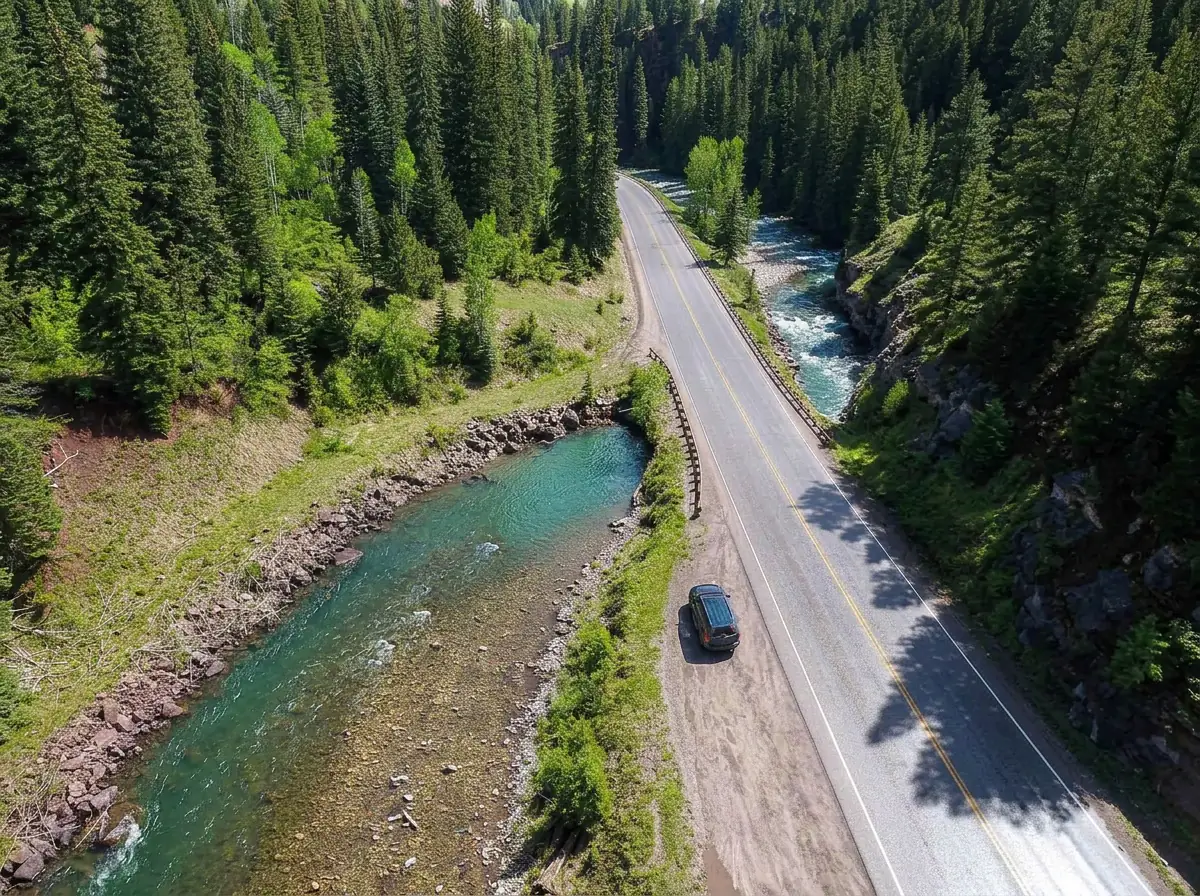
Access is straightforward if you use the designated public spots along Highway 133 and around Marble, including the town's Mill Site Park. Above Marble, the road and terrain turn this into a rougher high-country outing. Public water is mixed with private land throughout the valley, so treat the upper Crystal as a set of places you can fish, not one continuous roadside river. Check current Colorado fishing regulations and posted signs for the water you're on. We recommend releasing the trout you catch so these small mountain fish stay in the river.
A freestone driven by snowmelt and rain, so clarity and current follow runoff and summer storms rather than dam releases.
Big enough for real pockets and short runs, small enough that most good water is a short cast from where you're standing.
Trout are usually willing. The skill that matters is a short, drag-free drift behind boulders, not fine hatch matching.
Easy at designated public spots along Highway 133 and around Marble. Above Marble, the road and terrain get much rougher.
A fair scattering of trout in the good pockets rather than fish stacked in every slot.
Rainbow Trout, Brown Trout Mostly smaller rainbows and browns. Come for the setting and the eager fish, not a trophy.
Fit
Is the Upper Crystal Right for Your Trip?
Who will enjoy these small-trout pockets, and when another river makes more sense
- You enjoy catching smaller brown and rainbow trout in rocky pockets with short, accurate dry-fly and dry-dropper drifts.
- You want a summer or fall mountain-river trip with quieter water than the busiest valley fisheries.
- You'd like to practice drift control and reading pocket water on fish that are usually willing to eat.
Related water
More Crystal River Water
A same-river section farther down the valley that also fishes in spring
- You're looking for a winter destination, a shot at large trout or easy driving above Marble.
- You need continuous public banks, or you're counting on a river named Crystal to always run clear.
- Your trip falls in spring runoff, when snow and high water make this section an unreliable choice.
Alternative rivers
When the Upper Crystal Is Out of Season
A bigger river in the same basin that stays fishable through spring and winter

Find your next river
Pick the river before you pack the truck.
Some days call for a quiet creek. Others call for room to cast or a shot at a bigger fish. Find the water that fits the day you want.
- Compare 250+ Colorado rivers and sections by season, fish size, difficulty and access.
- See over 5,000 mapped access points and get directions.
- Save favorite waters and keep a backup plan handy.
Conditions
Current Flows and Weather on the Crystal
Check the flow trend and the forecast before you drive up valley, because rising, off-color water changes where trout hold
- Fishable flow ranges
- 40–500 cfs
- Trend
- ↓ Below the previous seven-day mean
- Source
- USGS · 09081600
- Observed
- Fri, Nov 20 · 2:00 am MST
Follow the flow trend, then adjust your fishing depth and the water you focus on.
This is a same-river gauge reading. Use it for flow context and confirm the water where you fish.
Streamflow in CFS
View all flow readings
| Date | Streamflow (CFS) |
|---|---|
| 2026-11-14 | 111 |
| 2026-11-15 | 107 |
| 2026-11-16 | 99.8 |
| 2026-11-17 | 101 |
| 2026-11-18 | 100 |
| 2026-11-19 | 89.3 |
| 2026-11-20 | 99 |
View all flow readings
| Date | Streamflow (CFS) |
|---|---|
| 2026-10-22 | 297 |
| 2026-10-23 | 342 |
| 2026-10-24 | 242 |
| 2026-10-25 | 218 |
| 2026-10-26 | 192 |
| 2026-10-27 | 164 |
| 2026-10-28 | 147 |
| 2026-10-29 | 132 |
| 2026-10-30 | 122 |
| 2026-10-31 | 116 |
| 2026-11-01 | 220 |
| 2026-11-02 | 355 |
| 2026-11-03 | 223 |
| 2026-11-04 | 199 |
| 2026-11-05 | 194 |
| 2026-11-06 | 175 |
| 2026-11-07 | 155 |
| 2026-11-08 | 145 |
| 2026-11-09 | 138 |
| 2026-11-10 | 133 |
| 2026-11-11 | 121 |
| 2026-11-12 | 117 |
| 2026-11-13 | 113 |
| 2026-11-14 | 111 |
| 2026-11-15 | 107 |
| 2026-11-16 | 99.8 |
| 2026-11-17 | 101 |
| 2026-11-18 | 100 |
| 2026-11-19 | 89.3 |
| 2026-11-20 | 99 |
Past Weather and the 7-Day Forecast
Upper Crystal / Marble area: section point forecast
Clear
- Precipitation
- —Liquid equivalent
- Snowfall
- —
- Avg. wind
- 5 mph NW
- Observed sky / weather
- Clear
- Pressure
- 29.86 inHg
Observation sources
Temperature: Aspen-Pitkin County Airport. day_spanning_observations Source
Precipitation: Aspen-Pitkin County Airport. Hourly reports overlap; a daily precipitation total is unavailable. Source
Wind: Aspen-Pitkin County Airport. Mean station observations, 8am–6pm local Source
Pressure: Aspen-Pitkin County Airport. Mean observed sea-level pressure, 8am–6pm local Source
Observed sky / weather: Aspen-Pitkin County Airport. Qualitative station reports across available hours of the listed local date; not measured cloud percentage. Source
Nearby Aspen-Pitkin County Airport station observations: Clear. High and low summarize available temperature samples, not certified daily extremes. Station conditions can differ from the canyon. 110 hourly station reports.
Cloudy; Light Rain; Mostly Cloudy
- Precipitation
- —Liquid equivalent
- Snowfall
- —
- Avg. wind
- 4 mph NNW
- Observed sky / weather
- Cloudy; Light Rain; Mostly Cloudy; Partly Cloudy; Clear; Mostly Clear; Haze; Fog/Mist; Light Snow and Fog/Mist; Light Snow
- Pressure
- 29.74 inHg
Observation sources
Temperature: Aspen-Pitkin County Airport. day_spanning_observations Source
Precipitation: Aspen-Pitkin County Airport. Hourly reports overlap; a daily precipitation total is unavailable. Source
Wind: Aspen-Pitkin County Airport. Mean station observations, 8am–6pm local Source
Pressure: Aspen-Pitkin County Airport. Mean observed sea-level pressure, 8am–6pm local Source
Observed sky / weather: Aspen-Pitkin County Airport. Qualitative station reports across available hours of the listed local date; not measured cloud percentage. Source
Nearby Aspen-Pitkin County Airport station observations: Cloudy; Light Rain; Mostly Cloudy; Partly Cloudy; Clear; Mostly Clear; Haze; Fog/Mist; Light Snow and Fog/Mist; Light Snow. High and low summarize available temperature samples, not certified daily extremes. Station conditions can differ from the canyon. 135 hourly station reports.
Clear; Mostly Clear; Cloudy
- Precipitation
- —Liquid equivalent
- Snowfall
- —
- Avg. wind
- 5 mph NNW
- Observed sky / weather
- Clear; Mostly Clear; Cloudy; Fog/Mist; Light Rain
- Pressure
- 30.1 inHg
Observation sources
Temperature: Aspen-Pitkin County Airport. day_spanning_observations Source
Precipitation: Aspen-Pitkin County Airport. Hourly reports overlap; a daily precipitation total is unavailable. Source
Wind: Aspen-Pitkin County Airport. Mean station observations, 8am–6pm local Source
Pressure: Aspen-Pitkin County Airport. Mean observed sea-level pressure, 8am–6pm local Source
Observed sky / weather: Aspen-Pitkin County Airport. Qualitative station reports across available hours of the listed local date; not measured cloud percentage. Source
Nearby Aspen-Pitkin County Airport station observations: Clear; Mostly Clear; Cloudy; Fog/Mist; Light Rain. High and low summarize available temperature samples, not certified daily extremes. Station conditions can differ from the canyon. 109 hourly station reports.
Clear
- Precipitation
- —Liquid equivalent
- Snowfall
- —
- Avg. wind
- 5 mph NNW
- Observed sky / weather
- Clear
- Pressure
- 30.12 inHg
Observation sources
Temperature: Aspen-Pitkin County Airport. day_spanning_observations Source
Precipitation: Aspen-Pitkin County Airport. Hourly reports overlap; a daily precipitation total is unavailable. Source
Wind: Aspen-Pitkin County Airport. Mean station observations, 8am–6pm local Source
Pressure: Aspen-Pitkin County Airport. Mean observed sea-level pressure, 8am–6pm local Source
Observed sky / weather: Aspen-Pitkin County Airport. Qualitative station reports across available hours of the listed local date; not measured cloud percentage. Source
Nearby Aspen-Pitkin County Airport station observations: Clear. High and low summarize available temperature samples, not certified daily extremes. Station conditions can differ from the canyon. 126 hourly station reports.
Partly Cloudy; Mostly Cloudy; Cloudy
- Precipitation
- —Liquid equivalent
- Snowfall
- —
- Avg. wind
- 10 mph S
- Observed sky / weather
- Partly Cloudy; Mostly Cloudy; Cloudy; Light Rain; Rain and Fog/Mist; Light Rain and Fog/Mist; Rain; Mostly Clear; Clear
- Pressure
- 29.75 inHg
Observation sources
Temperature: Aspen-Pitkin County Airport. day_spanning_observations Source
Precipitation: Aspen-Pitkin County Airport. Hourly reports overlap; a daily precipitation total is unavailable. Source
Wind: Aspen-Pitkin County Airport. Mean station observations, 8am–6pm local Source
Pressure: Aspen-Pitkin County Airport. Mean observed sea-level pressure, 8am–6pm local Source
Observed sky / weather: Aspen-Pitkin County Airport. Qualitative station reports across available hours of the listed local date; not measured cloud percentage. Source
Nearby Aspen-Pitkin County Airport station observations: Partly Cloudy; Mostly Cloudy; Cloudy; Light Rain; Rain and Fog/Mist; Light Rain and Fog/Mist; Rain; Mostly Clear; Clear. High and low summarize available temperature samples, not certified daily extremes. Station conditions can differ from the canyon. 140 hourly station reports.
Clear; Mostly Clear; Mostly Cloudy
- Precipitation
- —Liquid equivalent
- Snowfall
- —
- Avg. wind
- 5 mph NW
- Observed sky / weather
- Clear; Mostly Clear; Mostly Cloudy; Cloudy; Partly Cloudy
- Pressure
- 30.12 inHg
Observation sources
Temperature: Aspen-Pitkin County Airport. day_spanning_observations Source
Precipitation: Aspen-Pitkin County Airport. Hourly reports overlap; a daily precipitation total is unavailable. Source
Wind: Aspen-Pitkin County Airport. Mean station observations, 8am–6pm local Source
Pressure: Aspen-Pitkin County Airport. Mean observed sea-level pressure, 8am–6pm local Source
Observed sky / weather: Aspen-Pitkin County Airport. Qualitative station reports across available hours of the listed local date; not measured cloud percentage. Source
Nearby Aspen-Pitkin County Airport station observations: Clear; Mostly Clear; Mostly Cloudy; Cloudy; Partly Cloudy. High and low summarize available temperature samples, not certified daily extremes. Station conditions can differ from the canyon. 121 hourly station reports.
Cloudy; Mostly Cloudy; Clear
- Precipitation
- —Liquid equivalent
- Snowfall
- —
- Avg. wind
- 7 mph NNW
- Observed sky / weather
- Cloudy; Mostly Cloudy; Clear; Mostly Clear; Partly Cloudy
- Pressure
- 30.11 inHg
Observation sources
Temperature: Aspen-Pitkin County Airport. day_spanning_observations Source
Precipitation: Aspen-Pitkin County Airport. Hourly reports overlap; a daily precipitation total is unavailable. Source
Wind: Aspen-Pitkin County Airport. Mean station observations, 8am–6pm local Source
Pressure: Aspen-Pitkin County Airport. Mean observed sea-level pressure, 8am–6pm local Source
Observed sky / weather: Aspen-Pitkin County Airport. Qualitative station reports across available hours of the listed local date; not measured cloud percentage. Source
Nearby Aspen-Pitkin County Airport station observations: Cloudy; Mostly Cloudy; Clear; Mostly Clear; Partly Cloudy. High and low summarize available temperature samples, not certified daily extremes. Station conditions can differ from the canyon. 110 hourly station reports.
Snow Showers Likely And Patchy Blowing Snow
Snow chance58%Chance Snow Showers
Snow chance33%- Avg. wind
- 17 mph SW
- Cloud cover
- 78%
- Pressure
- 29.89 inHg
Slight Chance Snow Showers then Mostly Sunny
Snow chance15%Mostly Clear
Precipitation chance0%- Avg. wind
- 5 mph W
- Cloud cover
- 16%
- Pressure
- 29.99 inHg
Mostly Sunny
Precipitation chance0%Partly Cloudy then Chance Snow Showers
Snow chance27%- Avg. wind
- 6 mph SSW
- Cloud cover
- 37%
- Pressure
- 30.12 inHg
Snow Showers Likely
Snow chance55%Chance Snow Showers
Snow chance47%- Avg. wind
- 7 mph SW
- Cloud cover
- 69%
- Pressure
- 30.16 inHg
Mostly Sunny
Precipitation chance11%Partly Cloudy
Precipitation chance8%- Avg. wind
- 3 mph NNW
- Cloud cover
- 41%
- Pressure
- 30.33 inHg
Partly Sunny then Chance Snow Showers
Snow chance32%Chance Snow Showers
Snow chance33%- Avg. wind
- 5 mph SSW
- Cloud cover
- 54%
- Pressure
- 30.16 inHg
Chance Snow Showers
Snow chance34%- Avg. wind
- 5 mph NNW
- Cloud cover
- 57%
- Pressure
- 30.2 inHg
Weather sources
National Weather Service · Aspen-Pitkin County Airport. Wind and cloud averages use 8am–6pm local time. Forecast pressure: MET Norway, averaged daytime sea-level pressure in inches of mercury (CC BY 4.0). Past station reports do not include forecast rain chances or exact cloud percentages; a dash means unavailable.
Unlock the full guide
Know where to fish and what to tie on.
Put the forecast to work. Compare streamflow history on gauged waters, then open the full fishing plan for the section you pick.
- See where to start and how to fish each season.
- Match local hatches and fill your box with the recommended flies.
- Open the access map and get directions before you leave.
Gallery
Photos of the Upper Crystal Valley
A look at the rocky pocket water and mountain scenery you'll be fishing
River Explorer Pro
Make this your next fishing trip.
Unlock River Explorer Pro and make your next fishing trip your best adventure yet.
- Find where to get on the water with interactive access maps and directions.
- Plan around recent weather and streamflows where gauges are available.
- Pack the right flies with seasonal tactics, hatch charts and pattern recommendations.
- Compare 250+ Colorado rivers and sections and save a backup stretch.