
Overview
Fishing the West Fork of the San Juan
A hike-in freestone where careful, unhurried fishing turns up small browns and rainbows
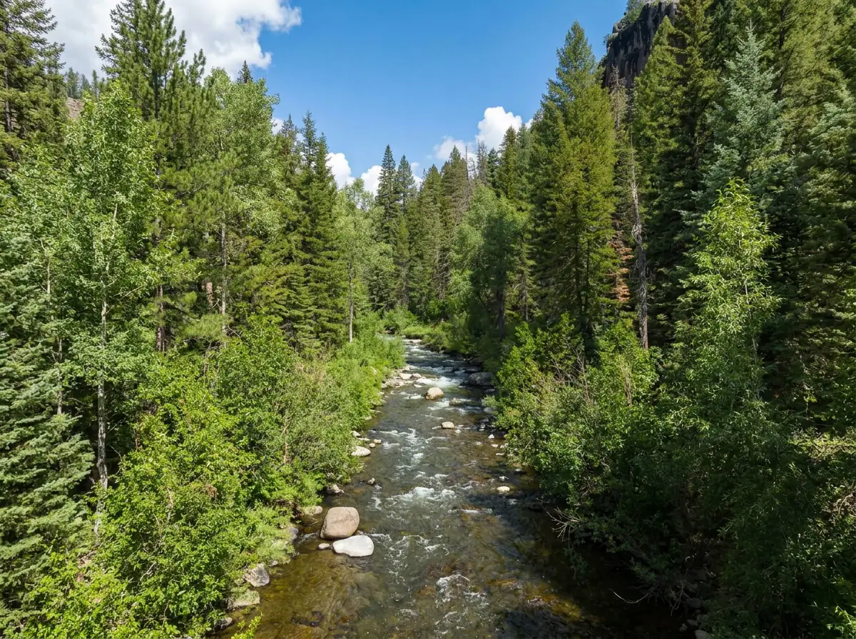
The West Fork of the San Juan fishes a lot like its neighbor, the East Fork, but you have to walk for it. The trail leaves from beyond the campground on West Fork Road and heads up into the Weminuche, and the river beside it is a medium-sized freestone of riffles, runs and pocket water surrounded by beautiful mountain scenery. The lower water near the trailhead sees the most anglers. The farther up you go, the more adventurous the trip becomes, and the more the day turns into fishing quiet water at your own pace. You're fishing for Brown Trout and Rainbow Trout that run on the small side. There are enough fish to make covering water worthwhile, though you won't find every run full, and the fishing sits in the middle for difficulty.
Read the complete overview
The approach that works here is simple: walk, fish and don't skip water. As you hike up, give a few honest casts to everything that looks like it should hold a trout. That includes the little pockets behind rocks and the soft edges most people walk right past. Most of the time the trout will eat a variety of standard dries and nymphs if you work the water with a method and a little stealth. They aren't overly difficult to catch, but they reward extra respect. Treat them more carefully than you would fish on a typical unpressured freestone: keep low, make your first cast count and don't wade through the spot you're about to fish.
Fly selection rarely gets complicated. If you're covering good water and still can't find the trout, stop and look at what's living in the river. Watch what's coming down in the drift, or make a quick pass with a bug seine from a stable bank or shallow margin where you're permitted to fish. There's no need to turn rocks or push into a riffle to see what the West Fork holds. Match the size and color of what you find and you can turn a nice day of hiking into a memorable day of fishing. If your plans take you up toward the headwaters, Cimarron Creek joins the West Fork in the same upper valley and fishes similarly. It's worth exploring if it fits the hike you've already planned and you're confident the access is lawful and the route is safe.
A snowmelt and rain-fed freestone, so water level and clarity change through the season. Early summer can still carry runoff, and fall usually fishes lower and clearer.
A medium river of riffles, runs and pockets. Break it into one reachable feeding lane at a time and fish your own side before you consider a crossing.
The trout aren't overly selective, but a stealthy approach and drag-free drifts make a real difference in how many fish you move and how good they are.
A signed road to the trailhead, then a hike. The trail starts across private property, so stay on it until you reach water you can lawfully fish.
You'll find fish by covering water and checking every likely pocket, not by parking in one run.
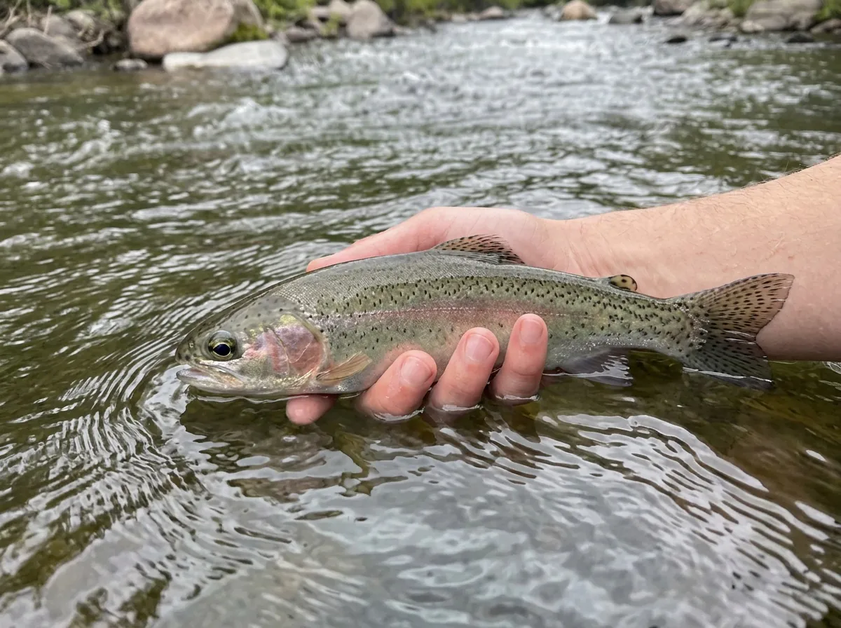
Rainbow Trout, Brown Trout Mostly small Brown Trout and Rainbow Trout. A careful approach gives you your best shot at the better fish in the section.
Fit
Is the West Fork Right for Your Trip?
Who will enjoy the walk-and-fish style, and when another water makes more sense
- A summer or fall hike with time to stop and fish pockets on the way up.
- You enjoy covering water with standard dries and nymphs on a dry-dropper.
- You want a scenic hike-in river where the day is as much about the walk as the fish.
- You're happy to watch the drift or run a bug seine from a stable, lawful bank or shallow margin to match what the trout are eating.
Related water
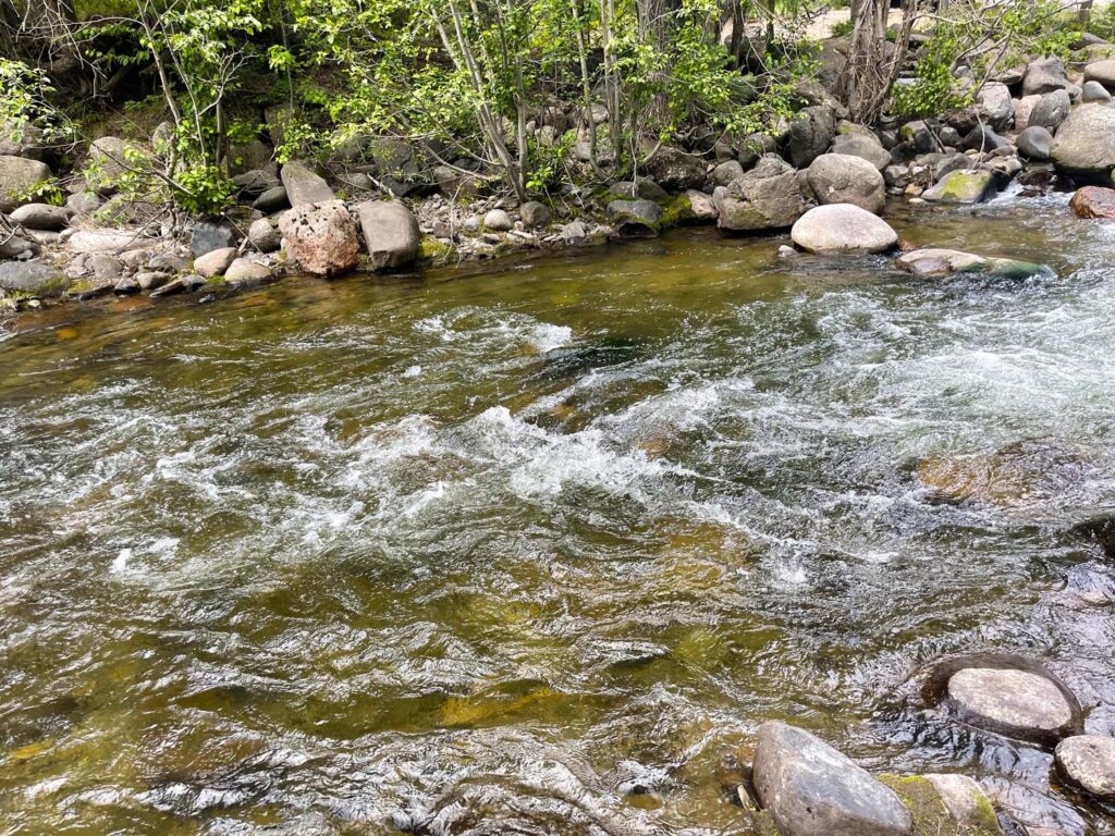
Similar Freestones Near Pagosa Springs
Nearby forks and creeks with the same summer and fall season and a similar approach
 Similar fishing on the next fork overEast Fork of San Juan River - East Fork SectionThe East Fork is a summer and fall freestone with medium difficulty, and the West Fork fishes much like it. If you like the walk-and-fish style here, the same dries, nymphs and careful approach carry over.The East Fork is smaller water and easier to get to, so you give up some of the West Fork's hike-in feel and its room to spread out.
 Smaller freestone in the same corridorWolf Creek of San Juan River - Main SectionWolf Creek is another summer and fall freestone off the US 160 corridor near Pagosa Springs, with medium difficulty and the same pocket-picking approach.It's smaller water, with tighter casting and shorter drifts than the medium-sized West Fork.
- A quick roadside trip or a spring or winter fishing plan.
- You're mainly after big trout rather than small browns and rainbows.
- You'd rather not hike or keep track of private and public access along a trail.
Alternative rivers
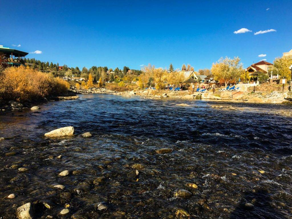
A Bigger River with a Longer Season
The San Juan's Middle Section when you want to fish spring or winter
Find your next river
Pick the river before you pack the truck.
Some days call for a quiet creek. Others call for room to cast or a shot at a bigger fish. Find the water that fits the day you want.
- Compare 250+ Colorado rivers and sections by season, fish size, difficulty and access.
- See over 5,000 mapped access points and get directions.
- Save favorite waters and keep a backup plan handy.
Weather
West Fork of the San Juan River Weather
Check recent rain and the forecast before you head to the creek.
Plan around the weather
This stretch is ungauged. Use the forecast below and look for changes in water level after rain or snowmelt.
Past Weather and the 7-Day Forecast
West Fork trail corridor: section point forecast
Observed detail unavailable
- Precipitation
- —Liquid equivalent
- Snowfall
- —
- Avg. wind
- 5 mph SSE
- Observed sky / weather
- —
- Pressure
- —
Observation sources
Temperature: Pagosa Springs. day_spanning_observations Source
Precipitation: Pagosa Springs. Hourly reports overlap; a daily precipitation total is unavailable. Source
Wind: Pagosa Springs. Mean station observations, 8am–6pm local Source
Pressure: Pagosa Springs. Mean observed sea-level pressure, 8am–6pm local Source
Observed sky / weather: Pagosa Springs. Qualitative station reports across available hours of the listed local date; not measured cloud percentage. Source
Nearby Pagosa Springs station observations: . High and low summarize available temperature samples, not certified daily extremes. Station conditions can differ from the canyon. 235 hourly station reports.
Observed detail unavailable
- Precipitation
- —Liquid equivalent
- Snowfall
- —
- Avg. wind
- 5 mph S
- Observed sky / weather
- —
- Pressure
- —
Observation sources
Temperature: Pagosa Springs. day_spanning_observations Source
Precipitation: Pagosa Springs. Hourly reports overlap; a daily precipitation total is unavailable. Source
Wind: Pagosa Springs. Mean station observations, 8am–6pm local Source
Pressure: Pagosa Springs. Mean observed sea-level pressure, 8am–6pm local Source
Observed sky / weather: Pagosa Springs. Qualitative station reports across available hours of the listed local date; not measured cloud percentage. Source
Nearby Pagosa Springs station observations: . High and low summarize available temperature samples, not certified daily extremes. Station conditions can differ from the canyon. 236 hourly station reports.
Observed detail unavailable
- Precipitation
- —Liquid equivalent
- Snowfall
- —
- Avg. wind
- 5 mph SSE
- Observed sky / weather
- —
- Pressure
- —
Observation sources
Temperature: Pagosa Springs. day_spanning_observations Source
Precipitation: Pagosa Springs. Hourly reports overlap; a daily precipitation total is unavailable. Source
Wind: Pagosa Springs. Mean station observations, 8am–6pm local Source
Pressure: Pagosa Springs. Mean observed sea-level pressure, 8am–6pm local Source
Observed sky / weather: Pagosa Springs. Qualitative station reports across available hours of the listed local date; not measured cloud percentage. Source
Nearby Pagosa Springs station observations: . High and low summarize available temperature samples, not certified daily extremes. Station conditions can differ from the canyon. 239 hourly station reports.
Observed detail unavailable
- Precipitation
- —Liquid equivalent
- Snowfall
- —
- Avg. wind
- 4 mph SSE
- Observed sky / weather
- —
- Pressure
- —
Observation sources
Temperature: Pagosa Springs. day_spanning_observations Source
Precipitation: Pagosa Springs. Hourly reports overlap; a daily precipitation total is unavailable. Source
Wind: Pagosa Springs. Mean station observations, 8am–6pm local Source
Pressure: Pagosa Springs. Mean observed sea-level pressure, 8am–6pm local Source
Observed sky / weather: Pagosa Springs. Qualitative station reports across available hours of the listed local date; not measured cloud percentage. Source
Nearby Pagosa Springs station observations: . High and low summarize available temperature samples, not certified daily extremes. Station conditions can differ from the canyon. 257 hourly station reports.
Observed detail unavailable
- Precipitation
- —Liquid equivalent
- Snowfall
- —
- Avg. wind
- 3 mph WSW
- Observed sky / weather
- —
- Pressure
- —
Observation sources
Temperature: Pagosa Springs. day_spanning_observations Source
Precipitation: Pagosa Springs. Hourly reports overlap; a daily precipitation total is unavailable. Source
Wind: Pagosa Springs. Mean station observations, 8am–6pm local Source
Pressure: Pagosa Springs. Mean observed sea-level pressure, 8am–6pm local Source
Observed sky / weather: Pagosa Springs. Qualitative station reports across available hours of the listed local date; not measured cloud percentage. Source
Nearby Pagosa Springs station observations: . High and low summarize available temperature samples, not certified daily extremes. Station conditions can differ from the canyon. 264 hourly station reports.
Observed detail unavailable
- Precipitation
- —Liquid equivalent
- Snowfall
- —
- Avg. wind
- 3 mph ESE
- Observed sky / weather
- —
- Pressure
- —
Observation sources
Temperature: Pagosa Springs. day_spanning_observations Source
Precipitation: Pagosa Springs. Hourly reports overlap; a daily precipitation total is unavailable. Source
Wind: Pagosa Springs. Mean station observations, 8am–6pm local Source
Pressure: Pagosa Springs. Mean observed sea-level pressure, 8am–6pm local Source
Observed sky / weather: Pagosa Springs. Qualitative station reports across available hours of the listed local date; not measured cloud percentage. Source
Nearby Pagosa Springs station observations: . High and low summarize available temperature samples, not certified daily extremes. Station conditions can differ from the canyon. 237 hourly station reports.
Observed detail unavailable
- Precipitation
- —Liquid equivalent
- Snowfall
- —
- Avg. wind
- 4 mph SE
- Observed sky / weather
- —
- Pressure
- —
Observation sources
Temperature: Pagosa Springs. day_spanning_observations Source
Precipitation: Pagosa Springs. Hourly reports overlap; a daily precipitation total is unavailable. Source
Wind: Pagosa Springs. Mean station observations, 8am–6pm local Source
Pressure: Pagosa Springs. Mean observed sea-level pressure, 8am–6pm local Source
Observed sky / weather: Pagosa Springs. Qualitative station reports across available hours of the listed local date; not measured cloud percentage. Source
Nearby Pagosa Springs station observations: . High and low summarize available temperature samples, not certified daily extremes. Station conditions can differ from the canyon. 249 hourly station reports.
Mostly Sunny
Precipitation chance0%Partly Cloudy
Precipitation chance6%- Avg. wind
- 4 mph S
- Cloud cover
- 26%
- Pressure
- 30.18 inHg
Mostly Cloudy then Slight Chance T-storms
Snow chance100%Slight Chance T-storms
Snow chance100%- Avg. wind
- 12 mph SSW
- Cloud cover
- 85%
- Pressure
- 30.03 inHg
Slight Chance Snow Showers then Mostly Sunny
Snow chance16%Partly Cloudy
Precipitation chance1%- Avg. wind
- 7 mph SW
- Cloud cover
- 25%
- Pressure
- 30.2 inHg
Mostly Sunny then Snow Showers Likely
Snow chance64%Snow Showers
Snow chance94%- Avg. wind
- 9 mph SW
- Cloud cover
- 36%
- Pressure
- 30.13 inHg
Snow Showers
Snow chance94%Chance Snow Showers
Snow chance54%- Avg. wind
- 18 mph SW
- Cloud cover
- 83%
- Pressure
- 29.98 inHg
Mostly Sunny
Precipitation chance5%Partly Cloudy
Precipitation chance2%- Avg. wind
- 4 mph SW
- Cloud cover
- 24%
- Pressure
- 30.06 inHg
Mostly Sunny
Precipitation chance14%- Avg. wind
- 5 mph SW
- Cloud cover
- 30%
- Pressure
- 30.16 inHg
Weather sources
National Weather Service · Pagosa Springs. Wind and cloud averages use 8am–6pm local time. Forecast pressure: MET Norway, averaged daytime sea-level pressure in inches of mercury (CC BY 4.0). Past station reports do not include forecast rain chances or exact cloud percentages; a dash means unavailable.
Unlock the full guide
Know where to fish and what to tie on.
Put the forecast to work. Compare streamflow history on gauged waters, then open the full fishing plan for the section you pick.
- See where to start and how to fish each season.
- Match local hatches and fill your box with the recommended flies.
- Open the access map and get directions before you leave.
Gallery
Scenery Along the West Fork
Mountain valley scenery and wooded pocket water along the West Fork
River Explorer Pro
Make this your next fishing trip.
Unlock River Explorer Pro and make your next fishing trip your best adventure yet.
- Find where to get on the water with interactive access maps and directions.
- Plan around recent weather and streamflows where gauges are available.
- Pack the right flies with seasonal tactics, hatch charts and pattern recommendations.
- Compare 250+ Colorado rivers and sections and save a backup stretch.