
Overview
Fishing the San Juan River Through Pagosa Springs
Walk-in town water from signed approaches, where a clean drift makes the difference
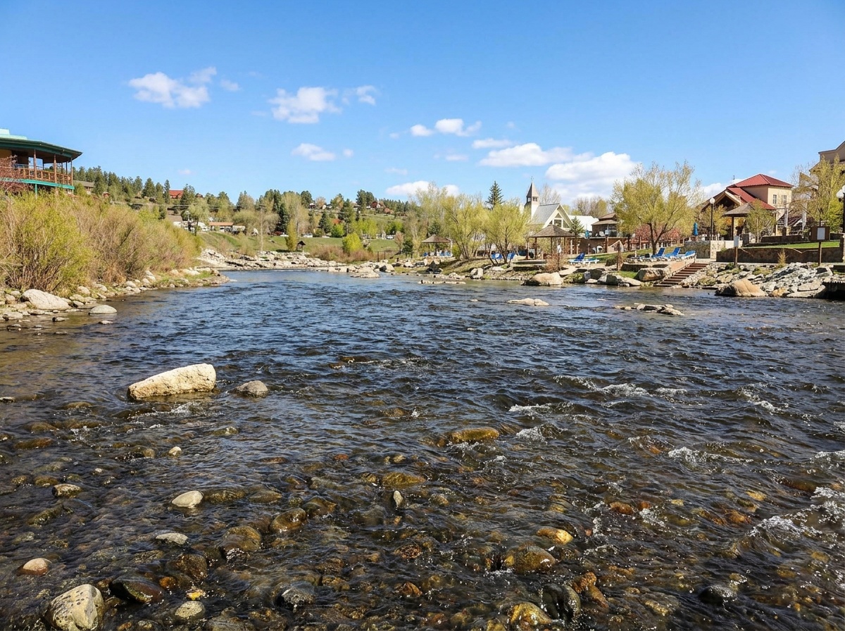
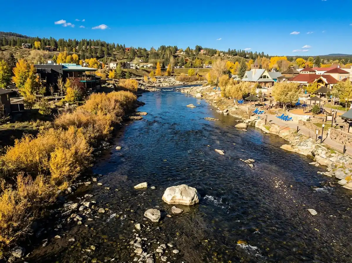
The middle section of the San Juan River runs right through the town of Pagosa Springs, Colorado, and it's one of the handiest pieces of trout water in the area. You can walk in from a signed public access point, fish a run, then move on to another signed access without spending half the day on logistics. The riverwalk isn't public river access at every point, and the special trout regulation through town sets a limit without creating any access. Start from the signed public approaches and you'll spend your time fishing instead of sorting out boundaries. If you like, finish the day with a soak at the hot springs.
Read the complete overview
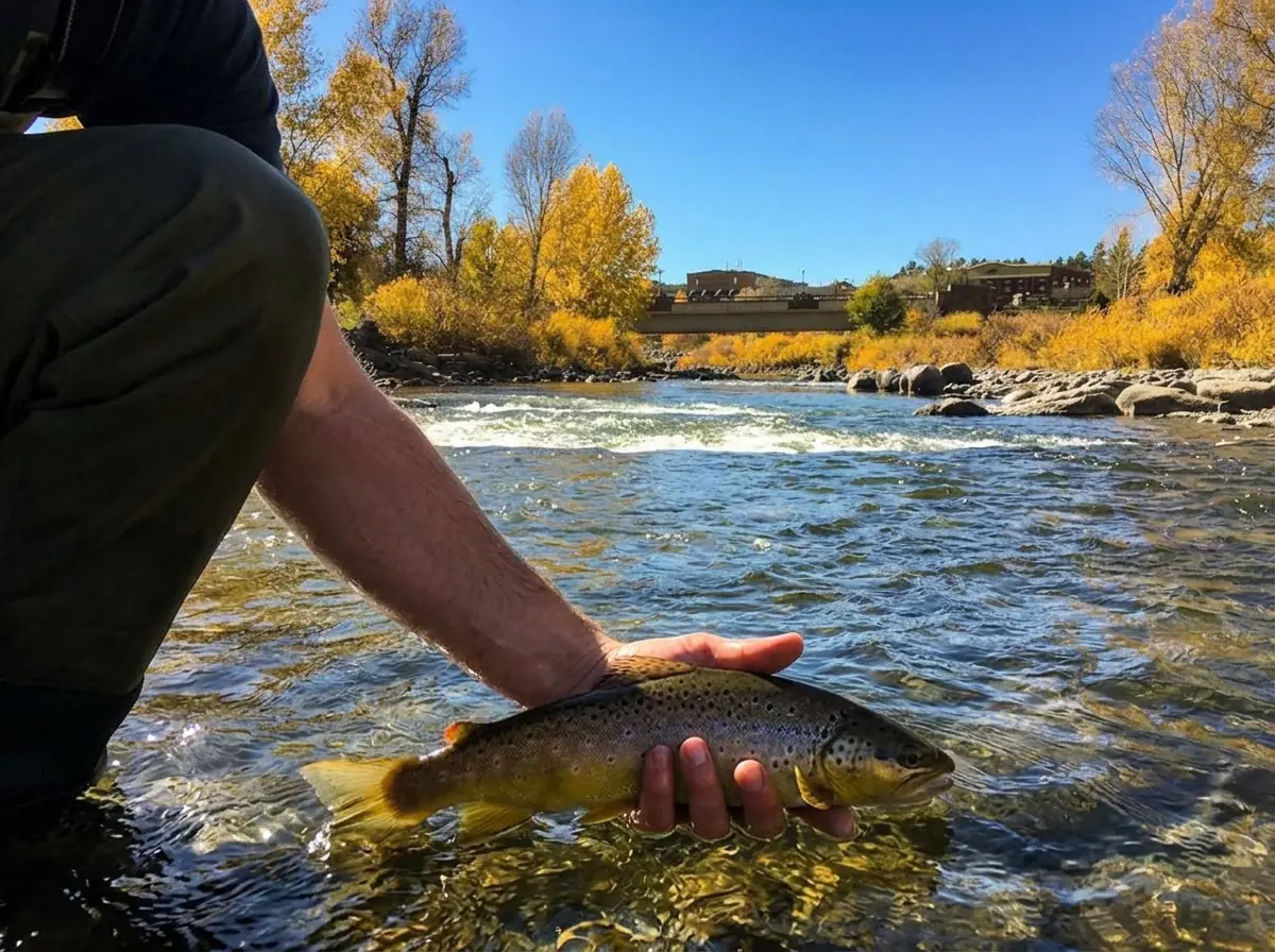
Through town the San Juan fishes like a freestone. It's a big river with riffles, runs and seams that hold mostly brown and rainbow trout, and cutthroat are also on the list. Trout numbers are moderate and most fish run medium-sized. They can be picky, so bring your A game. A clean drag-free drift and a fly that matches what's actually on the water will do more for you here than a box full of guesses.
Timing is the biggest decision you'll make. Spring through fall is usually the preferred window, but actual water temperature, flow and footing decide any given day. Summer can warm this stretch and brings out lots of tubers, which makes fishing tougher. An earlier start may help you work around some of the traffic, but it doesn't guarantee an empty river or water that's cool enough to fish, so check the water temperature and conditions before you start. Winter fishing is possible on milder days, as long as flow, bank ice and footing cooperate.
The town water fishes like a freestone, so snowmelt and storms shape its flow, clarity and where the trout hold.
This is a big river. You'll get more out of it by breaking it into near-side seams and runs you can reach without a difficult crossing.
The trout can be picky, so a clean drift and the right fly matter. Bring your A game and plan to put some time in.
Easy walk-in from signed public approaches. The riverwalk is a path, not river access, so use it only to move between separately signed public accesses. Not every bank in town is public.
Expect some trout rather than steady action. Covering several runs from signed accesses tends to pay off more than parking in one spot.
Rainbow Trout, Brown Trout, Cutthroat Trout Mostly medium-sized brown and rainbow trout, with cutthroat also on the section list. A bigger fish can turn up, but don't count on one.
Fit
Is the Town Section Right for Your Trip?
Who will enjoy this reach and when another water makes more sense
- A walk-and-fish day through Pagosa Springs, moving between runs from public approaches.
- A larger freestone that can work in every season when flow and weather allow, with spring and fall the strongest windows.
- Summer anglers willing to try an earlier start to work around tubing traffic, when water temperature and access allow.
- Anglers who enjoy matching PMDs, caddis and olives for picky trout.
- Ending a day of fishing with a soak at the hot springs.
Related water
Similar Water Nearby
Another freestone in the basin with a comparable feel
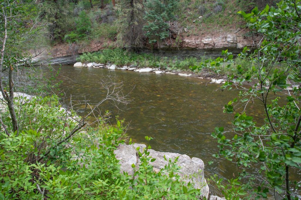
- The technical New Mexico tailwater. This town reach is a separate freestone fishery.
- Expecting public access along every town bank.
- Midday summer sessions when warm water and tubing traffic make fishing tough.
- High, opaque runoff water.
- Big numbers of eager fish. This water rewards persistence more than volume.
Alternative rivers
Other San Juan Basin Options
Smaller upstream water for days when town flows, heat or crowds don't line up
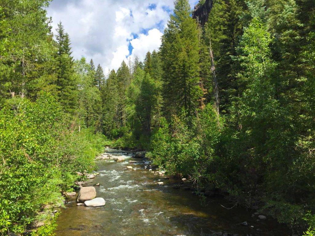 Upstream San Juan freestone for summer and fallSan Juan River - West Fork - Main SectionThe West Fork is a separately named fork upstream in the San Juan drainage, not this mainstem town reach. It's medium-sized freestone water and a reasonable summer or fall alternative when its own water temperature, flows and access check out. Expect smaller, often quieter water than the town section, though not guaranteed eager trout.It's listed for summer and fall only, and access is mostly hike-in from a trailhead rather than a short walk from town.
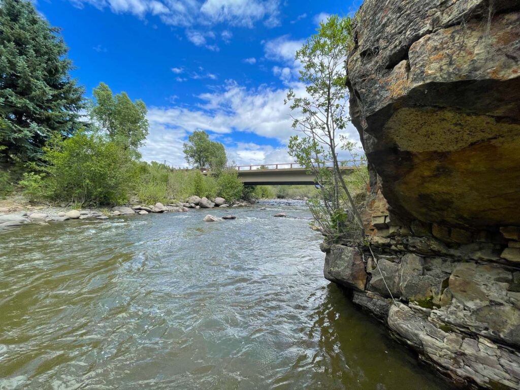 Small freestone for a quieter dayPiedra River - Upper SectionThe upper Piedra is small freestone water of medium difficulty that fishes from spring through fall. Tighter water is easier to read one pocket at a time.It's a much smaller river with a different feel from the big town water, and it isn't listed for winter fishing.
Find your next river
Pick the river before you pack the truck.
Some days call for a quiet creek. Others call for room to cast or a shot at a bigger fish. Find the water that fits the day you want.
- Compare 250+ Colorado rivers and sections by season, fish size, difficulty and access.
- See over 5,000 mapped access points and get directions.
- Save favorite waters and keep a backup plan handy.
Conditions
Flows and Weather in Pagosa Springs
Check the Pagosa Springs gauge trend and the forecast before choosing your runs
- Fishable flow ranges
- 150–1000 cfs
- Trend
- ↓ Below the previous seven-day mean
- Source
- USGS · 09342500
- Observed
- Mon, Nov 16 · 1:00 am MST
Follow the flow trend, then adjust your fishing depth and the water you focus on.
This is a same-river gauge reading. Use it for flow context and confirm the water where you fish.
Streamflow in CFS
View all flow readings
| Date | Streamflow (CFS) |
|---|---|
| 2026-11-10 | 468 |
| 2026-11-11 | 413 |
| 2026-11-12 | 374 |
| 2026-11-13 | 341 |
| 2026-11-14 | 383 |
| 2026-11-15 | 339 |
| 2026-11-16 | 334 |
View all flow readings
| Date | Streamflow (CFS) |
|---|---|
| 2026-10-18 | 602 |
| 2026-10-19 | 538 |
| 2026-10-20 | 508 |
| 2026-10-21 | 537 |
| 2026-10-24 | 4200 |
| 2026-10-25 | 3430 |
| 2026-10-26 | 2480 |
| 2026-10-27 | 1800 |
| 2026-10-28 | 1370 |
| 2026-10-29 | 1060 |
| 2026-10-30 | 838 |
| 2026-10-31 | 1070 |
| 2026-11-01 | 4930 |
| 2026-11-02 | 7070 |
| 2026-11-03 | 3610 |
| 2026-11-04 | 2330 |
| 2026-11-05 | 1560 |
| 2026-11-06 | 1110 |
| 2026-11-07 | 778 |
| 2026-11-08 | 627 |
| 2026-11-09 | 535 |
| 2026-11-10 | 468 |
| 2026-11-11 | 413 |
| 2026-11-12 | 374 |
| 2026-11-13 | 341 |
| 2026-11-14 | 383 |
| 2026-11-15 | 339 |
| 2026-11-16 | 334 |
Past Weather and the 7-Day Forecast
Pagosa Springs area: section point forecast
Observed detail unavailable
- Precipitation
- —Liquid equivalent
- Snowfall
- —
- Avg. wind
- 5 mph SSE
- Observed sky / weather
- —
- Pressure
- —
Observation sources
Temperature: Pagosa Springs. day_spanning_observations Source
Precipitation: Pagosa Springs. Hourly reports overlap; a daily precipitation total is unavailable. Source
Wind: Pagosa Springs. Mean station observations, 8am–6pm local Source
Pressure: Pagosa Springs. Mean observed sea-level pressure, 8am–6pm local Source
Observed sky / weather: Pagosa Springs. Qualitative station reports across available hours of the listed local date; not measured cloud percentage. Source
Nearby Pagosa Springs station observations: . High and low summarize available temperature samples, not certified daily extremes. Station conditions can differ from the canyon. 235 hourly station reports.
Observed detail unavailable
- Precipitation
- —Liquid equivalent
- Snowfall
- —
- Avg. wind
- 5 mph S
- Observed sky / weather
- —
- Pressure
- —
Observation sources
Temperature: Pagosa Springs. day_spanning_observations Source
Precipitation: Pagosa Springs. Hourly reports overlap; a daily precipitation total is unavailable. Source
Wind: Pagosa Springs. Mean station observations, 8am–6pm local Source
Pressure: Pagosa Springs. Mean observed sea-level pressure, 8am–6pm local Source
Observed sky / weather: Pagosa Springs. Qualitative station reports across available hours of the listed local date; not measured cloud percentage. Source
Nearby Pagosa Springs station observations: . High and low summarize available temperature samples, not certified daily extremes. Station conditions can differ from the canyon. 236 hourly station reports.
Observed detail unavailable
- Precipitation
- —Liquid equivalent
- Snowfall
- —
- Avg. wind
- 5 mph SSE
- Observed sky / weather
- —
- Pressure
- —
Observation sources
Temperature: Pagosa Springs. day_spanning_observations Source
Precipitation: Pagosa Springs. Hourly reports overlap; a daily precipitation total is unavailable. Source
Wind: Pagosa Springs. Mean station observations, 8am–6pm local Source
Pressure: Pagosa Springs. Mean observed sea-level pressure, 8am–6pm local Source
Observed sky / weather: Pagosa Springs. Qualitative station reports across available hours of the listed local date; not measured cloud percentage. Source
Nearby Pagosa Springs station observations: . High and low summarize available temperature samples, not certified daily extremes. Station conditions can differ from the canyon. 239 hourly station reports.
Observed detail unavailable
- Precipitation
- —Liquid equivalent
- Snowfall
- —
- Avg. wind
- 4 mph SSE
- Observed sky / weather
- —
- Pressure
- —
Observation sources
Temperature: Pagosa Springs. day_spanning_observations Source
Precipitation: Pagosa Springs. Hourly reports overlap; a daily precipitation total is unavailable. Source
Wind: Pagosa Springs. Mean station observations, 8am–6pm local Source
Pressure: Pagosa Springs. Mean observed sea-level pressure, 8am–6pm local Source
Observed sky / weather: Pagosa Springs. Qualitative station reports across available hours of the listed local date; not measured cloud percentage. Source
Nearby Pagosa Springs station observations: . High and low summarize available temperature samples, not certified daily extremes. Station conditions can differ from the canyon. 257 hourly station reports.
Observed detail unavailable
- Precipitation
- —Liquid equivalent
- Snowfall
- —
- Avg. wind
- 3 mph WSW
- Observed sky / weather
- —
- Pressure
- —
Observation sources
Temperature: Pagosa Springs. day_spanning_observations Source
Precipitation: Pagosa Springs. Hourly reports overlap; a daily precipitation total is unavailable. Source
Wind: Pagosa Springs. Mean station observations, 8am–6pm local Source
Pressure: Pagosa Springs. Mean observed sea-level pressure, 8am–6pm local Source
Observed sky / weather: Pagosa Springs. Qualitative station reports across available hours of the listed local date; not measured cloud percentage. Source
Nearby Pagosa Springs station observations: . High and low summarize available temperature samples, not certified daily extremes. Station conditions can differ from the canyon. 264 hourly station reports.
Observed detail unavailable
- Precipitation
- —Liquid equivalent
- Snowfall
- —
- Avg. wind
- 3 mph ESE
- Observed sky / weather
- —
- Pressure
- —
Observation sources
Temperature: Pagosa Springs. day_spanning_observations Source
Precipitation: Pagosa Springs. Hourly reports overlap; a daily precipitation total is unavailable. Source
Wind: Pagosa Springs. Mean station observations, 8am–6pm local Source
Pressure: Pagosa Springs. Mean observed sea-level pressure, 8am–6pm local Source
Observed sky / weather: Pagosa Springs. Qualitative station reports across available hours of the listed local date; not measured cloud percentage. Source
Nearby Pagosa Springs station observations: . High and low summarize available temperature samples, not certified daily extremes. Station conditions can differ from the canyon. 237 hourly station reports.
Observed detail unavailable
- Precipitation
- —Liquid equivalent
- Snowfall
- —
- Avg. wind
- 4 mph SE
- Observed sky / weather
- —
- Pressure
- —
Observation sources
Temperature: Pagosa Springs. day_spanning_observations Source
Precipitation: Pagosa Springs. Hourly reports overlap; a daily precipitation total is unavailable. Source
Wind: Pagosa Springs. Mean station observations, 8am–6pm local Source
Pressure: Pagosa Springs. Mean observed sea-level pressure, 8am–6pm local Source
Observed sky / weather: Pagosa Springs. Qualitative station reports across available hours of the listed local date; not measured cloud percentage. Source
Nearby Pagosa Springs station observations: . High and low summarize available temperature samples, not certified daily extremes. Station conditions can differ from the canyon. 249 hourly station reports.
Mostly Sunny
Precipitation chance0%Partly Cloudy
Precipitation chance7%- Avg. wind
- 3 mph SSW
- Cloud cover
- 32%
- Pressure
- 30.15 inHg
Showers And Thunderstorms
Rain chance93%Snow Showers
Snow chance93%- Avg. wind
- 11 mph SSW
- Cloud cover
- 79%
- Pressure
- 29.98 inHg
Slight Chance Snow Showers then Mostly Sunny
Snow chance20%Mostly Clear
Precipitation chance1%- Avg. wind
- 6 mph SW
- Cloud cover
- 24%
- Pressure
- 30.16 inHg
Mostly Sunny then Slight Chance T-storms
Snow chance62%Slight Chance T-storms
Snow chance91%- Avg. wind
- 7 mph S
- Cloud cover
- 39%
- Pressure
- 30.06 inHg
Slight Chance T-storms
Snow chance92%Chance Snow Showers
Snow chance52%- Avg. wind
- 18 mph SW
- Cloud cover
- 90%
- Pressure
- 29.96 inHg
Sunny
Precipitation chance5%Mostly Clear
Precipitation chance2%- Avg. wind
- 3 mph SSW
- Cloud cover
- 22%
- Pressure
- 30.09 inHg
Mostly Sunny
Precipitation chance14%- Avg. wind
- 2 mph SSW
- Cloud cover
- 28%
- Pressure
- 30.11 inHg
Weather sources
National Weather Service · Pagosa Springs. Wind and cloud averages use 8am–6pm local time. Forecast pressure: MET Norway, averaged daytime sea-level pressure in inches of mercury (CC BY 4.0). Past station reports do not include forecast rain chances or exact cloud percentages; a dash means unavailable.
Unlock the full guide
Know where to fish and what to tie on.
Put the forecast to work. Compare streamflow history on gauged waters, then open the full fishing plan for the section you pick.
- See where to start and how to fish each season.
- Match local hatches and fill your box with the recommended flies.
- Open the access map and get directions before you leave.
Gallery
Scenes from the San Juan in Pagosa Springs
A look at the water and riverwalk setting before you go
River Explorer Pro
Make this your next fishing trip.
Unlock River Explorer Pro and make your next fishing trip your best adventure yet.
- Find where to get on the water with interactive access maps and directions.
- Plan around recent weather and streamflows where gauges are available.
- Pack the right flies with seasonal tactics, hatch charts and pattern recommendations.
- Compare 250+ Colorado rivers and sections and save a backup stretch.