
Overview
Fly Fishing the Lower Colorado River Near Glenwood Springs
Big freestone water with rainbows and browns, strong dry-fly windows and dependable nymphing above and below the Roaring Fork.
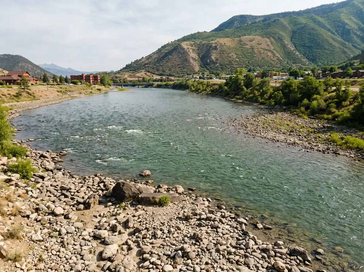
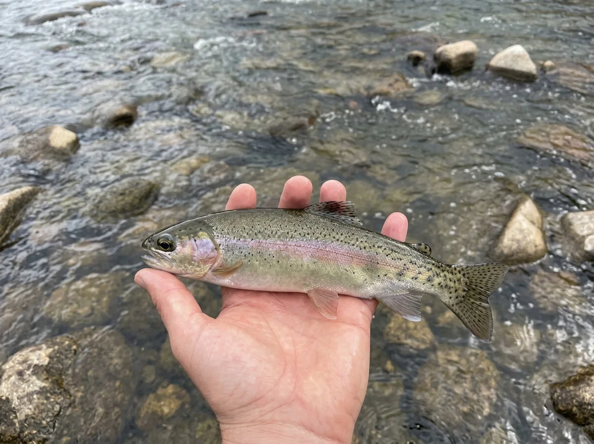
The lower Colorado around Glenwood Springs isn't as pretty as the middle and upper sections, and nobody will mistake the stretch along I-70 for a quiet canyon. What it does have is fish. This is big freestone water, and the river above and below the Roaring Fork confluence fishes well. You'll catch a good mix of rainbows and browns, most of them running from about 10 to 18 inches. You can float it year round and fish it year round, so it's a useful option when you're out by Glenwood and want to work some runs for healthy trout. A whitefish may turn up from time to time, but they move around a lot.
Read the complete overview
We rate the difficulty as medium, mostly because of the river's size. A river this big can look like one wide sheet of current until you break it into pieces you can reach: a seam along a gravel bar, the soft edge below a riffle or a slot along the bank where the current carries food past cover. When the flows are right and a hatch is coming off, the dry-fly fishing can be lights out, and rising trout may lead you away from a deep run and onto a shallower seam. When nothing is showing on top, nymphs will be your best friend. Most of your wading will happen on near-side edges. This isn't a river for casual crossings, and fishing the middle is a job for an experienced float.
Finding access takes a little exploration. Public parks, signed accesses and the whitewater-park area around Glenwood give you places to start. Private and industrial ground interrupts the banks along the highway, though, so a convenient exit or pullout doesn't mean the river beside it is open to you. Trout numbers are respectable rather than staggering. Year-round fishing also doesn't mean every day fishes equally well. Hot summer afternoons, runoff color and winter cold all change where trout hold and how readily they feed, and the seasonal notes below cover those changes.
This freestone is shaped by snowmelt and rain, and the Roaring Fork adds its own water and color at Glenwood. Flows and clarity rise with runoff and storms, then settle through the rest of the year.
This is big water. Wade the edges and near-side seams, and leave the middle of the river to experienced float anglers.
The main challenge is reading and reaching water on a large river, then matching the hatch when insects come off. Nymphing reachable runs keeps the fishing manageable.
Public parks, signed accesses and the whitewater-park area help. Private and industrial banks interrupt the I-70 corridor, though, so expect to do some exploring.
This section holds a healthy population of rainbows and browns. Expect solid fishing rather than a fish on every cast.
Rainbow Trout, Brown Trout Most trout run from about 10 to 18 inches.
Fit
Is the Lower Colorado a Good Fit for Your Trip?
See who will enjoy this big water around Glenwood and who may prefer a smaller river.
- You want big-water rainbow and brown fishing within easy reach of Glenwood Springs.
- You enjoy dry-fly windows when a hatch develops and don't mind nymphing reachable runs when it doesn't.
- You want a river you can fish, or float with experienced help, in every season.
- You'd like to bring your dog along for a day on the water.
Related water
Nearby Water: The Middle Colorado and Lower Roaring Fork
These large freestone sections in the same drainage have a similar feel.
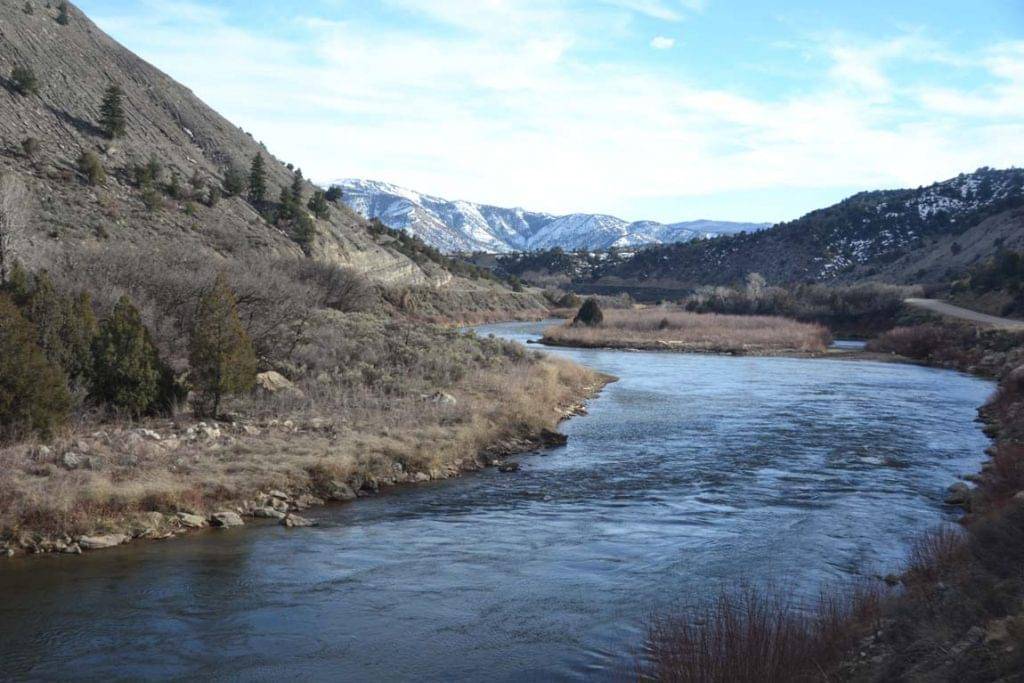 Same river, more sceneryColorado River - Middle SectionIf you like the lower river's big freestone character, the middle section offers the same river size, medium difficulty and four-season fishing, with more of the scenery the lower stretch lacks.You give up the convenience of fishing around Glenwood and the added options near the Roaring Fork confluence. Check its own access and hatch notes instead of carrying over timing from this section.
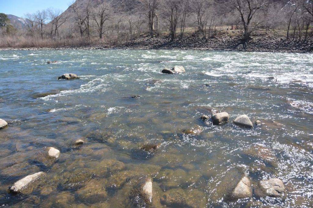
 Joins the Colorado at GlenwoodRoaring Fork River - Lower SectionThe lower Roaring Fork meets the Colorado at Glenwood and shares this section's large freestone character, medium difficulty and year-round fishing. That makes it a natural switch without leaving the area.It's a different river with its own flows and clarity during runoff and after storms. Conditions on one river won't tell you exactly what the other one is doing.
- You want an isolated small-creek setting. The highway and town are part of the scenery here.
- Your plan depends on wading across the main river. Crossings here aren't casual.
- You care most about scenery. The middle and upper sections are prettier.
Alternative rivers
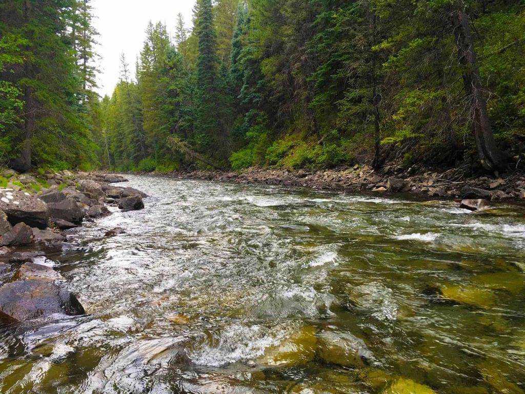
The Crystal River: A Smaller Alternative in the Basin
Consider this river when you'd rather fish water that's easier to read and wade than the big rivers.
Find your next river
Pick the river before you pack the truck.
Some days call for a quiet creek. Others call for room to cast or a shot at a bigger fish. Find the water that fits the day you want.
- Compare 250+ Colorado rivers and sections by season, fish size, difficulty and access.
- See over 5,000 mapped access points and get directions.
- Save favorite waters and keep a backup plan handy.
Conditions
Current Flows and Weather Near Glenwood
Check the live flow, recent trend and forecast before you decide where to wade or whether to float.
- Fishable flow ranges
- 1250–5500 cfs
- Trend
- ↓ Below the previous seven-day mean
- Source
- USGS · 09085100
- Observed
- Fri, Nov 20 · 1:15 am MST
Follow the flow trend, then adjust your fishing depth and the water you focus on.
This is a same-river gauge reading. Use it for flow context and confirm the water where you fish.
Streamflow in CFS
View all flow readings
| Date | Streamflow (CFS) |
|---|---|
| 2026-11-14 | 1070 |
| 2026-11-15 | 1080 |
| 2026-11-16 | 1060 |
| 2026-11-17 | 1040 |
| 2026-11-18 | 1060 |
| 2026-11-19 | 1000 |
| 2026-11-20 | 970 |
View all flow readings
| Date | Streamflow (CFS) |
|---|---|
| 2026-10-22 | 1370 |
| 2026-10-23 | 1640 |
| 2026-10-24 | 1520 |
| 2026-10-25 | 1510 |
| 2026-10-26 | 1460 |
| 2026-10-27 | 1450 |
| 2026-10-28 | 1340 |
| 2026-10-29 | 1330 |
| 2026-10-30 | 1360 |
| 2026-10-31 | 1300 |
| 2026-11-01 | 1380 |
| 2026-11-02 | 1800 |
| 2026-11-03 | 1580 |
| 2026-11-04 | 1390 |
| 2026-11-05 | 1360 |
| 2026-11-06 | 1280 |
| 2026-11-07 | 1220 |
| 2026-11-08 | 1180 |
| 2026-11-09 | 1150 |
| 2026-11-10 | 1140 |
| 2026-11-11 | 1120 |
| 2026-11-12 | 1090 |
| 2026-11-13 | 1070 |
| 2026-11-14 | 1070 |
| 2026-11-15 | 1080 |
| 2026-11-16 | 1060 |
| 2026-11-17 | 1040 |
| 2026-11-18 | 1060 |
| 2026-11-19 | 1000 |
| 2026-11-20 | 970 |
Past Weather and the 7-Day Forecast
Glenwood Springs area: section point forecast
Observed detail unavailable
- Precipitation
- —Liquid equivalent
- Snowfall
- —
- Avg. wind
- 4 mph S
- Observed sky / weather
- —
- Pressure
- —
Observation sources
Temperature: 070W11765RWS1RHS at W No Name Tunnel. day_spanning_observations Source
Precipitation: 070W11765RWS1RHS at W No Name Tunnel. Hourly reports overlap; a daily precipitation total is unavailable. Source
Wind: 070W11765RWS1RHS at W No Name Tunnel. Mean station observations, 8am–6pm local Source
Pressure: 070W11765RWS1RHS at W No Name Tunnel. Mean observed sea-level pressure, 8am–6pm local Source
Observed sky / weather: 070W11765RWS1RHS at W No Name Tunnel. Qualitative station reports across available hours of the listed local date; not measured cloud percentage. Source
Nearby 070W11765RWS1RHS at W No Name Tunnel station observations: . High and low summarize available temperature samples, not certified daily extremes. Station conditions can differ from the canyon. 123 hourly station reports.
Observed detail unavailable
- Precipitation
- —Liquid equivalent
- Snowfall
- —
- Avg. wind
- 4 mph SW
- Observed sky / weather
- —
- Pressure
- —
Observation sources
Temperature: 070W11765RWS1RHS at W No Name Tunnel. day_spanning_observations Source
Precipitation: 070W11765RWS1RHS at W No Name Tunnel. Hourly reports overlap; a daily precipitation total is unavailable. Source
Wind: 070W11765RWS1RHS at W No Name Tunnel. Mean station observations, 8am–6pm local Source
Pressure: 070W11765RWS1RHS at W No Name Tunnel. Mean observed sea-level pressure, 8am–6pm local Source
Observed sky / weather: 070W11765RWS1RHS at W No Name Tunnel. Qualitative station reports across available hours of the listed local date; not measured cloud percentage. Source
Nearby 070W11765RWS1RHS at W No Name Tunnel station observations: . High and low summarize available temperature samples, not certified daily extremes. Station conditions can differ from the canyon. 103 hourly station reports.
Observed detail unavailable
- Precipitation
- —Liquid equivalent
- Snowfall
- —
- Avg. wind
- 5 mph SW
- Observed sky / weather
- —
- Pressure
- —
Observation sources
Temperature: 070W11765RWS1RHS at W No Name Tunnel. day_spanning_observations Source
Precipitation: 070W11765RWS1RHS at W No Name Tunnel. Hourly reports overlap; a daily precipitation total is unavailable. Source
Wind: 070W11765RWS1RHS at W No Name Tunnel. Mean station observations, 8am–6pm local Source
Pressure: 070W11765RWS1RHS at W No Name Tunnel. Mean observed sea-level pressure, 8am–6pm local Source
Observed sky / weather: 070W11765RWS1RHS at W No Name Tunnel. Qualitative station reports across available hours of the listed local date; not measured cloud percentage. Source
Nearby 070W11765RWS1RHS at W No Name Tunnel station observations: . High and low summarize available temperature samples, not certified daily extremes. Station conditions can differ from the canyon. 120 hourly station reports.
Observed detail unavailable
- Precipitation
- —Liquid equivalent
- Snowfall
- —
- Avg. wind
- 4 mph S
- Observed sky / weather
- —
- Pressure
- —
Observation sources
Temperature: 070W11765RWS1RHS at W No Name Tunnel. day_spanning_observations Source
Precipitation: 070W11765RWS1RHS at W No Name Tunnel. Hourly reports overlap; a daily precipitation total is unavailable. Source
Wind: 070W11765RWS1RHS at W No Name Tunnel. Mean station observations, 8am–6pm local Source
Pressure: 070W11765RWS1RHS at W No Name Tunnel. Mean observed sea-level pressure, 8am–6pm local Source
Observed sky / weather: 070W11765RWS1RHS at W No Name Tunnel. Qualitative station reports across available hours of the listed local date; not measured cloud percentage. Source
Nearby 070W11765RWS1RHS at W No Name Tunnel station observations: . High and low summarize available temperature samples, not certified daily extremes. Station conditions can differ from the canyon. 134 hourly station reports.
Observed detail unavailable
- Precipitation
- —Liquid equivalent
- Snowfall
- —
- Avg. wind
- 3 mph S
- Observed sky / weather
- —
- Pressure
- —
Observation sources
Temperature: 070W11765RWS1RHS at W No Name Tunnel. day_spanning_observations Source
Precipitation: 070W11765RWS1RHS at W No Name Tunnel. Hourly reports overlap; a daily precipitation total is unavailable. Source
Wind: 070W11765RWS1RHS at W No Name Tunnel. Mean station observations, 8am–6pm local Source
Pressure: 070W11765RWS1RHS at W No Name Tunnel. Mean observed sea-level pressure, 8am–6pm local Source
Observed sky / weather: 070W11765RWS1RHS at W No Name Tunnel. Qualitative station reports across available hours of the listed local date; not measured cloud percentage. Source
Nearby 070W11765RWS1RHS at W No Name Tunnel station observations: . High and low summarize available temperature samples, not certified daily extremes. Station conditions can differ from the canyon. 119 hourly station reports.
Observed detail unavailable
- Precipitation
- —Liquid equivalent
- Snowfall
- —
- Avg. wind
- 7 mph WSW
- Observed sky / weather
- —
- Pressure
- —
Observation sources
Temperature: 070W11765RWS1RHS at W No Name Tunnel. day_spanning_observations Source
Precipitation: 070W11765RWS1RHS at W No Name Tunnel. Hourly reports overlap; a daily precipitation total is unavailable. Source
Wind: 070W11765RWS1RHS at W No Name Tunnel. Mean station observations, 8am–6pm local Source
Pressure: 070W11765RWS1RHS at W No Name Tunnel. Mean observed sea-level pressure, 8am–6pm local Source
Observed sky / weather: 070W11765RWS1RHS at W No Name Tunnel. Qualitative station reports across available hours of the listed local date; not measured cloud percentage. Source
Nearby 070W11765RWS1RHS at W No Name Tunnel station observations: . High and low summarize available temperature samples, not certified daily extremes. Station conditions can differ from the canyon. 128 hourly station reports.
Observed detail unavailable
- Precipitation
- —Liquid equivalent
- Snowfall
- —
- Avg. wind
- 3 mph ESE
- Observed sky / weather
- —
- Pressure
- —
Observation sources
Temperature: 070W11765RWS1RHS at W No Name Tunnel. day_spanning_observations Source
Precipitation: 070W11765RWS1RHS at W No Name Tunnel. Hourly reports overlap; a daily precipitation total is unavailable. Source
Wind: 070W11765RWS1RHS at W No Name Tunnel. Mean station observations, 8am–6pm local Source
Pressure: 070W11765RWS1RHS at W No Name Tunnel. Mean observed sea-level pressure, 8am–6pm local Source
Observed sky / weather: 070W11765RWS1RHS at W No Name Tunnel. Qualitative station reports across available hours of the listed local date; not measured cloud percentage. Source
Nearby 070W11765RWS1RHS at W No Name Tunnel station observations: . High and low summarize available temperature samples, not certified daily extremes. Station conditions can differ from the canyon. 125 hourly station reports.
Rain And Snow Showers Likely
Rain / snow chance60%Partly Cloudy
Precipitation chance14%- Avg. wind
- 14 mph W
- Cloud cover
- 75%
- Pressure
- 29.84 inHg
Sunny
Precipitation chance7%Mostly Clear
Precipitation chance0%- Avg. wind
- 6 mph W
- Cloud cover
- 12%
- Pressure
- 30.01 inHg
Mostly Sunny
Precipitation chance0%Mostly Cloudy then Slight Chance Snow Showers
Snow chance23%- Avg. wind
- 4 mph W
- Cloud cover
- 47%
- Pressure
- 30.13 inHg
Chance Rain And Snow Showers
Rain / snow chance45%Chance Snow Showers
Snow chance37%- Avg. wind
- 6 mph WSW
- Cloud cover
- 69%
- Pressure
- 30.12 inHg
Mostly Sunny
Precipitation chance4%Partly Cloudy
Precipitation chance8%- Avg. wind
- 3 mph W
- Cloud cover
- 40%
- Pressure
- 30.38 inHg
Partly Sunny then Chance Rain And Snow Showers
Rain / snow chance33%Chance Rain And Snow Showers
Rain / snow chance33%- Avg. wind
- 4 mph W
- Cloud cover
- 55%
- Pressure
- 30.16 inHg
Chance Snow Showers
Snow chance28%- Avg. wind
- 6 mph W
- Cloud cover
- 55%
- Pressure
- 30.2 inHg
Weather sources
National Weather Service · 070W11765RWS1RHS at W No Name Tunnel. Wind and cloud averages use 8am–6pm local time. Forecast pressure: MET Norway, averaged daytime sea-level pressure in inches of mercury (CC BY 4.0). Past station reports do not include forecast rain chances or exact cloud percentages; a dash means unavailable.
Unlock the full guide
Know where to fish and what to tie on.
Put the forecast to work. Compare streamflow history on gauged waters, then open the full fishing plan for the section you pick.
- See where to start and how to fish each season.
- Match local hatches and fill your box with the recommended flies.
- Open the access map and get directions before you leave.
Gallery
Photos of the Lower Colorado
Get a look at the big runs and banks you'll fish around Glenwood.
River Explorer Pro
Make this your next fishing trip.
Unlock River Explorer Pro and make your next fishing trip your best adventure yet.
- Find where to get on the water with interactive access maps and directions.
- Plan around recent weather and streamflows where gauges are available.
- Pack the right flies with seasonal tactics, hatch charts and pattern recommendations.
- Compare 250+ Colorado rivers and sections and save a backup stretch.