
Overview
Fishing the Crystal River Main Section
Rocky runs between Redstone and Carbondale offer variety, mixed access and an outside chance at a bigger trout
The main section of the Crystal River runs from below Redstone down toward Carbondale, with Highway 133 following it most of the way. It's a medium-sized freestone with broad rocky runs, boulder pockets and riffle edges, and it holds rainbow trout, brown trout and whitefish. Most of the trout run on the small side, and you'll find some fish rather than a river stacked with them. A good day here usually comes from covering water and reading each run well, not from parking on one hole. Dries and nymphs are the core approach. A caddis dry-dropper is a good way to start whenever the current lets you fish one cleanly, and a deeper nymph rig takes over when the fish stay down.
Read the complete overview
Sort out access before anything else. Public and private ground alternate along this reach, and a convenient pullout beside the highway doesn't mean the bank below it is open to fishing. If you're a Pro member, our map below helps you get oriented along the reach and find likely approaches. Posted signs and the exact boundaries on the ground decide where you can fish. Because this stretch sits close to Carbondale and the main valley highway, it also sees more anglers than the upper Crystal, so the easiest-to-reach public water is the most likely to have someone on it. Dogs are welcome on this section, so it's an easy place to bring your dog along, as long as you follow the local land rules wherever you stop.
The appeal of the main Crystal is variety. In a single stretch you can work pocket water behind boulders, riffle seams and broad rocky runs, and plenty of it can be fished from the bank or with a short wade. Give each run a few good drifts, then keep moving. If you enjoy covering water and picking apart the seams you can reach, it's a great place to spend a day.
A freestone shaped by snowmelt and rain, with broad rocky runs, boulder pockets and riffles. Clarity and current can change with the season and after storms on the tributaries.
Medium-sized water. You can fish a lot of it from one bank by working near-side seams and pockets, but crossings depend on how high the river is running.
Medium. The trout aren't usually ultra-selective, but mixed currents make drag-free drifts harder, and the patchwork of public and private ground takes some planning.
Easy to reach, with Highway 133 following the river from Redstone to Carbondale. Public and private stretches alternate, so confirm the bank you're on before you fish.
Some fish. Expect a fair population rather than a stacked river, so moving and covering water usually pays off more than staying in one spot.
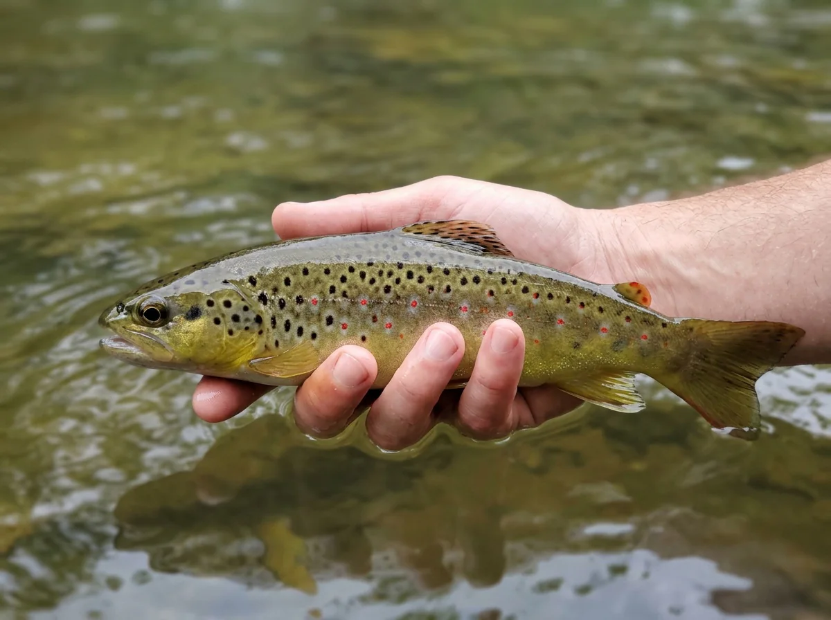
Rainbow Trout, Brown Trout, Whitefish Mostly small rainbows and browns, with whitefish in the deeper runs.
Fit
Is the Main Crystal Right for Your Day?
Who will enjoy this stretch and who is better off planning somewhere else
- Medium freestone runs in a valley with several different fisheries to try.
- A chance to cover pocket water and quieter riffle edges with a compact fly box.
- A spring-through-fall day mixing dries and nymphs, with dry-dropper water close to Carbondale.
- A relaxed day with your dog along on a dog-friendly section.
Related water
More of the Crystal River
The upper section offers the same valley at a gentler scale for summer and fall

- Continuous public banks or a plan that depends on recent stocking.
- A winter day based around the main Crystal.
- Solitude on the most convenient public water near town, especially on summer weekends.
- A trip built mainly around trophy-sized trout.
Alternative rivers
Nearby Waters Worth a Look
Options for winter, for bigger water or for a smaller creek when the main Crystal doesn't fit your plan
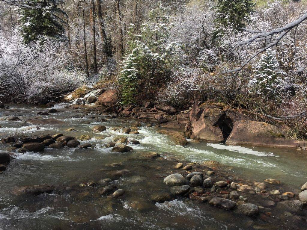
 Bigger water, open all four seasonsRoaring Fork River - Middle SectionThe middle Roaring Fork is a large freestone of similar difficulty that can be fished in every season, so it's the natural place to turn in winter or when you want more water to explore.It's a larger river, so expect more water to read and harder decisions about where and whether to cross. It calls for its own approach rather than the main Crystal's playbook.
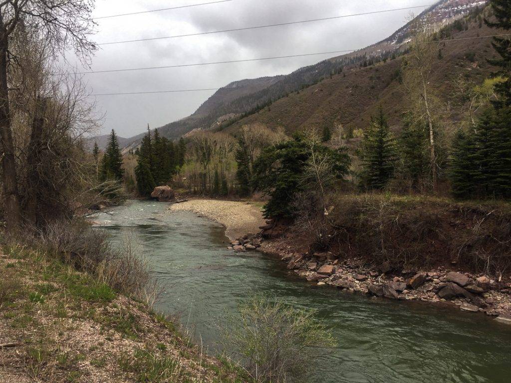
 Smaller creek for summer and fallSnowmass Creek - Main SectionSnowmass Creek is a small freestone of medium difficulty, a good change of pace in summer and fall if you like tighter, more intimate water.It's only fishable in summer and fall, and the smaller scale means shorter casts and less room to move than on the main Crystal.
Find your next river
Pick the river before you pack the truck.
Some days call for a quiet creek. Others call for room to cast or a shot at a bigger fish. Find the water that fits the day you want.
- Compare 250+ Colorado rivers and sections by season, fish size, difficulty and access.
- See over 5,000 mapped access points and get directions.
- Save favorite waters and keep a backup plan handy.
Conditions
Crystal River Flows and Weather
Treat the Avalanche Creek gauge as upstream context, especially after rain on the tributaries
- Fishable flow ranges
- 75–800 cfs
- Trend
- ↓ Below the previous seven-day mean
- Source
- USGS · 09081600
- Observed
- Fri, Nov 20 · 2:00 am MST
Follow the flow trend, then adjust your fishing depth and the water you focus on.
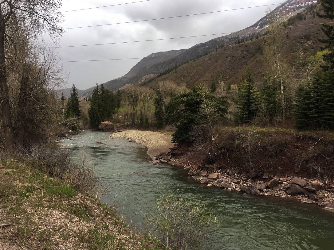
The gauge above Avalanche Creek gives upstream context near Redstone. Tributaries can change the flow and clarity farther down toward Carbondale.
Streamflow in CFS
View all flow readings
| Date | Streamflow (CFS) |
|---|---|
| 2026-11-14 | 111 |
| 2026-11-15 | 107 |
| 2026-11-16 | 99.8 |
| 2026-11-17 | 101 |
| 2026-11-18 | 100 |
| 2026-11-19 | 89.3 |
| 2026-11-20 | 99 |
View all flow readings
| Date | Streamflow (CFS) |
|---|---|
| 2026-10-22 | 297 |
| 2026-10-23 | 342 |
| 2026-10-24 | 242 |
| 2026-10-25 | 218 |
| 2026-10-26 | 192 |
| 2026-10-27 | 164 |
| 2026-10-28 | 147 |
| 2026-10-29 | 132 |
| 2026-10-30 | 122 |
| 2026-10-31 | 116 |
| 2026-11-01 | 220 |
| 2026-11-02 | 355 |
| 2026-11-03 | 223 |
| 2026-11-04 | 199 |
| 2026-11-05 | 194 |
| 2026-11-06 | 175 |
| 2026-11-07 | 155 |
| 2026-11-08 | 145 |
| 2026-11-09 | 138 |
| 2026-11-10 | 133 |
| 2026-11-11 | 121 |
| 2026-11-12 | 117 |
| 2026-11-13 | 113 |
| 2026-11-14 | 111 |
| 2026-11-15 | 107 |
| 2026-11-16 | 99.8 |
| 2026-11-17 | 101 |
| 2026-11-18 | 100 |
| 2026-11-19 | 89.3 |
| 2026-11-20 | 99 |
Past Weather and the 7-Day Forecast
Glenwood Springs area: section point forecast
Observed detail unavailable
- Precipitation
- —Liquid equivalent
- Snowfall
- —
- Avg. wind
- 2 mph NE
- Observed sky / weather
- —
- Pressure
- —
Observation sources
Temperature: Carbondale. day_spanning_observations Source
Precipitation: Carbondale. Hourly reports overlap; a daily precipitation total is unavailable. Source
Wind: Carbondale. Mean station observations, 8am–6pm local Source
Pressure: Carbondale. Mean observed sea-level pressure, 8am–6pm local Source
Observed sky / weather: Carbondale. Qualitative station reports across available hours of the listed local date; not measured cloud percentage. Source
Nearby Carbondale station observations: . High and low summarize available temperature samples, not certified daily extremes. Station conditions can differ from the canyon. 97 hourly station reports.
Observed detail unavailable
- Precipitation
- —Liquid equivalent
- Snowfall
- —
- Avg. wind
- 2 mph NW
- Observed sky / weather
- —
- Pressure
- —
Observation sources
Temperature: Carbondale. day_spanning_observations Source
Precipitation: Carbondale. Hourly reports overlap; a daily precipitation total is unavailable. Source
Wind: Carbondale. Mean station observations, 8am–6pm local Source
Pressure: Carbondale. Mean observed sea-level pressure, 8am–6pm local Source
Observed sky / weather: Carbondale. Qualitative station reports across available hours of the listed local date; not measured cloud percentage. Source
Nearby Carbondale station observations: . High and low summarize available temperature samples, not certified daily extremes. Station conditions can differ from the canyon. 82 hourly station reports.
Observed detail unavailable
- Precipitation
- —Liquid equivalent
- Snowfall
- —
- Avg. wind
- 4 mph NNW
- Observed sky / weather
- —
- Pressure
- —
Observation sources
Temperature: Carbondale. day_spanning_observations Source
Precipitation: Carbondale. Hourly reports overlap; a daily precipitation total is unavailable. Source
Wind: Carbondale. Mean station observations, 8am–6pm local Source
Pressure: Carbondale. Mean observed sea-level pressure, 8am–6pm local Source
Observed sky / weather: Carbondale. Qualitative station reports across available hours of the listed local date; not measured cloud percentage. Source
Nearby Carbondale station observations: . High and low summarize available temperature samples, not certified daily extremes. Station conditions can differ from the canyon. 82 hourly station reports.
Observed detail unavailable
- Precipitation
- —Liquid equivalent
- Snowfall
- —
- Avg. wind
- 2 mph N
- Observed sky / weather
- —
- Pressure
- —
Observation sources
Temperature: Carbondale. day_spanning_observations Source
Precipitation: Carbondale. Hourly reports overlap; a daily precipitation total is unavailable. Source
Wind: Carbondale. Mean station observations, 8am–6pm local Source
Pressure: Carbondale. Mean observed sea-level pressure, 8am–6pm local Source
Observed sky / weather: Carbondale. Qualitative station reports across available hours of the listed local date; not measured cloud percentage. Source
Nearby Carbondale station observations: . High and low summarize available temperature samples, not certified daily extremes. Station conditions can differ from the canyon. 105 hourly station reports.
Observed detail unavailable
- Precipitation
- —Liquid equivalent
- Snowfall
- —
- Avg. wind
- 4 mph S
- Observed sky / weather
- —
- Pressure
- —
Observation sources
Temperature: Carbondale. day_spanning_observations Source
Precipitation: Carbondale. Hourly reports overlap; a daily precipitation total is unavailable. Source
Wind: Carbondale. Mean station observations, 8am–6pm local Source
Pressure: Carbondale. Mean observed sea-level pressure, 8am–6pm local Source
Observed sky / weather: Carbondale. Qualitative station reports across available hours of the listed local date; not measured cloud percentage. Source
Nearby Carbondale station observations: . High and low summarize available temperature samples, not certified daily extremes. Station conditions can differ from the canyon. 92 hourly station reports.
Observed detail unavailable
- Precipitation
- —Liquid equivalent
- Snowfall
- —
- Avg. wind
- 5 mph SW
- Observed sky / weather
- —
- Pressure
- —
Observation sources
Temperature: Carbondale. day_spanning_observations Source
Precipitation: Carbondale. Hourly reports overlap; a daily precipitation total is unavailable. Source
Wind: Carbondale. Mean station observations, 8am–6pm local Source
Pressure: Carbondale. Mean observed sea-level pressure, 8am–6pm local Source
Observed sky / weather: Carbondale. Qualitative station reports across available hours of the listed local date; not measured cloud percentage. Source
Nearby Carbondale station observations: . High and low summarize available temperature samples, not certified daily extremes. Station conditions can differ from the canyon. 85 hourly station reports.
Observed detail unavailable
- Precipitation
- —Liquid equivalent
- Snowfall
- —
- Avg. wind
- 2 mph NNW
- Observed sky / weather
- —
- Pressure
- —
Observation sources
Temperature: Carbondale. day_spanning_observations Source
Precipitation: Carbondale. Hourly reports overlap; a daily precipitation total is unavailable. Source
Wind: Carbondale. Mean station observations, 8am–6pm local Source
Pressure: Carbondale. Mean observed sea-level pressure, 8am–6pm local Source
Observed sky / weather: Carbondale. Qualitative station reports across available hours of the listed local date; not measured cloud percentage. Source
Nearby Carbondale station observations: . High and low summarize available temperature samples, not certified daily extremes. Station conditions can differ from the canyon. 92 hourly station reports.
Chance Rain And Snow Showers
Rain / snow chance50%Slight Chance Snow Showers
Snow chance21%- Avg. wind
- 18 mph SW
- Cloud cover
- 60%
- Pressure
- 29.81 inHg
Sunny
Precipitation chance12%Mostly Clear
Precipitation chance0%- Avg. wind
- 6 mph WNW
- Cloud cover
- 12%
- Pressure
- 29.99 inHg
Mostly Sunny
Precipitation chance0%Partly Cloudy then Chance Snow Showers
Snow chance25%- Avg. wind
- 6 mph SSW
- Cloud cover
- 40%
- Pressure
- 30.09 inHg
Chance Snow Showers
Snow chance52%Chance Snow Showers
Snow chance44%- Avg. wind
- 8 mph SW
- Cloud cover
- 69%
- Pressure
- 30.07 inHg
Mostly Sunny
Precipitation chance6%Partly Cloudy
Precipitation chance7%- Avg. wind
- 3 mph W
- Cloud cover
- 43%
- Pressure
- 30.33 inHg
Partly Sunny then Chance Snow Showers
Snow chance32%Chance Snow Showers
Snow chance32%- Avg. wind
- 5 mph SSW
- Cloud cover
- 55%
- Pressure
- 30.13 inHg
Chance Snow Showers
Snow chance30%- Avg. wind
- 5 mph W
- Cloud cover
- 55%
- Pressure
- 30.17 inHg
Weather sources
National Weather Service · Carbondale. Wind and cloud averages use 8am–6pm local time. Forecast pressure: MET Norway, averaged daytime sea-level pressure in inches of mercury (CC BY 4.0). Past station reports do not include forecast rain chances or exact cloud percentages; a dash means unavailable.
Unlock the full guide
Know where to fish and what to tie on.
Put the forecast to work. Compare streamflow history on gauged waters, then open the full fishing plan for the section you pick.
- See where to start and how to fish each season.
- Match local hatches and fill your box with the recommended flies.
- Open the access map and get directions before you leave.
Gallery
Crystal River Main Section Photos
A look at the rocky runs, pocket water and riffle edges you'll be fishing
River Explorer Pro
Make this your next fishing trip.
Unlock River Explorer Pro and make your next fishing trip your best adventure yet.
- Find where to get on the water with interactive access maps and directions.
- Plan around recent weather and streamflows where gauges are available.
- Pack the right flies with seasonal tactics, hatch charts and pattern recommendations.
- Compare 250+ Colorado rivers and sections and save a backup stretch.