
Overview
South Platte River in Waterton Canyon
A hike-or-bike freestone section near Denver where scuds and sowbugs share the fly box with the usual insects
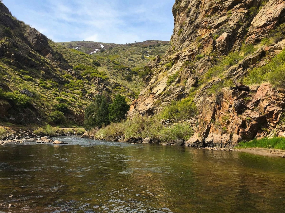
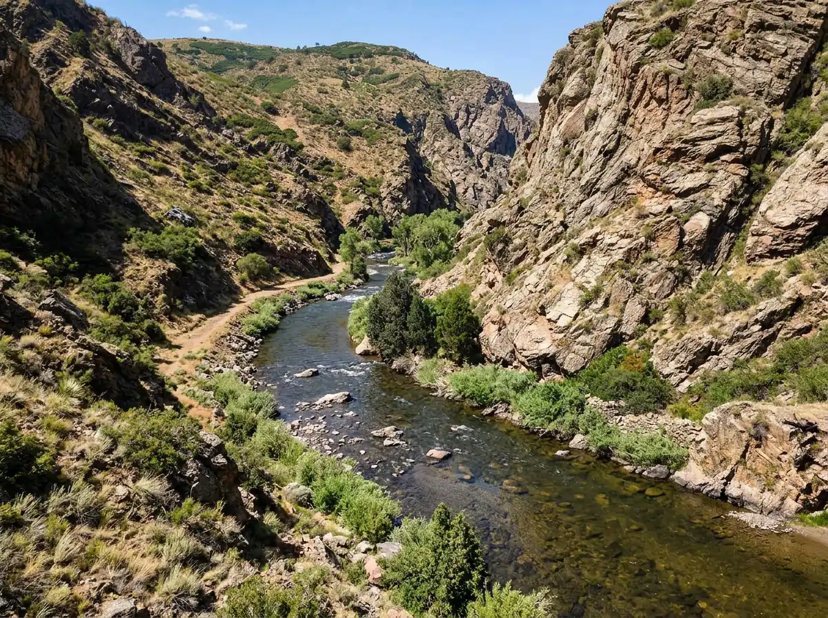
Waterton Canyon puts the South Platte less than 30 minutes from Denver, but you still earn the water. You park, then hike or bike up the canyon trail. The trail itself is easy, and a bike makes the upper reaches a realistic trip. That farther water tends to see less pressure than the runs closest to the parking area, though on a busy day you'll still share the canyon. Waterton is close and well known, so it gets crowded and the trout see a lot of flies. That pressure is a big reason we rate it hard. It also makes a great day trip, or a few hours in the evening after work when you'd rather stop at the first good water than ride deep into the canyon.
Read the complete overview
You'll hear Waterton called a tailwater. Upstream storage does shape its flows, but we treat it as a medium-sized freestone section. In practice the water can fish steadier and more technically than a pure snowmelt stream, without asking you to treat every run like a trophy tailwater. Brown and rainbow trout live here. Most run 12 to 18 inches and some grow past 20, but numbers are moderate rather than heavy, so reading water carefully pays off more than covering it fast. The fishing resembles Deckers, with one big difference in the fly box: scuds and sowbugs matter here alongside the usual caddis, midges, mayflies and stoneflies. Nymphing is the most dependable approach through the year, and the hatches open dry-fly windows when the timing lines up.
Fly selection is important here, and small, accurate flies do most of the work. Carry midge patterns in black, white and olive from #18 to #26, and mayfly patterns in olive, grey, yellow and black from #18 to #24. Those two groups cover much of the year. Caddis in olive and brown from #14 to #18 fill the warmer months. Add scuds in grey, pink, orange and olive from #14 to #18, and San Juan Worms in pink, red and brown from #10 to #16. For summer, bring hoppers in yellow, tan and olive from #10 to #16, plus black or red ants from #14 to #18. The hatch chart below shows when each group belongs near the front of your box.
A freestone section with flows shaped by upstream storage, so it can fish steadier and more technically than a typical snowmelt stream.
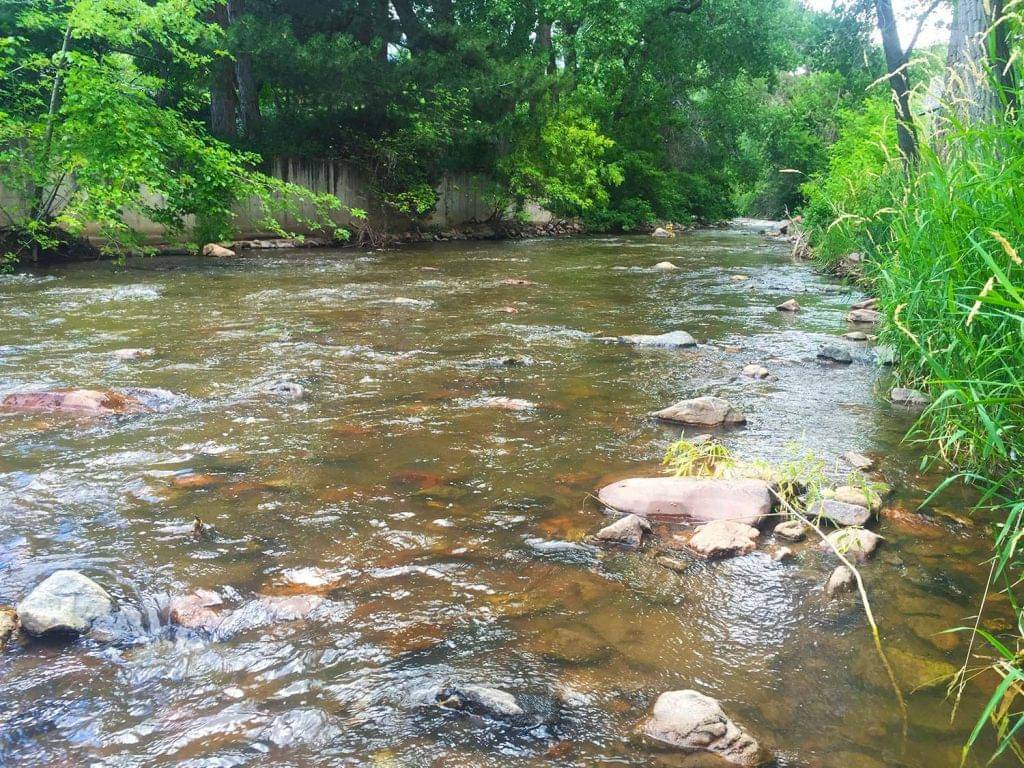
Medium-sized water with riffles, runs and pockets you can break down into one lane at a time. Wading isn't allowed, so plan on bank fishing and focus on the lanes you can reach from shore.
Hard. The trout are pressured and see a lot of flies, so small flies, careful fly choice and clean drifts make the difference.
You park at the trailhead and hike or bike in. The trail is easy, and a bike makes the upper reaches realistic.
A moderate population of brown and rainbow trout. Read the water carefully rather than expecting fish in every run.
Rainbow Trout, Brown Trout Most trout run 12 to 18 inches, and some grow past 20.
Fit
Is Waterton Canyon a Good Fit for Your Trip?
What the trail, the crowds and pressured trout mean for the kind of day you want
- You want a hike- or bike-in South Platte trip for brown and rainbow trout.
- You enjoy a mix of pocket-water nymphing and dry-fly windows close to the Front Range.
- You're looking for a few hours of fishing after work or a full day trip near Denver.
- You want to sharpen small-fly nymphing and clean drifts on pressured trout.
Related water
Similar Sections to Fish
Nearby South Platte water with comparable character, and how each one differs
 Same river, similar fishingSouth Platte River - DeckersDeckers fishes a lot like Waterton. It's medium-sized, rated hard and fishable in every season, so the same careful nymphing and small-fly skills carry over.Deckers is classified as a tailwater, and the fly selection differs from Waterton's, where scuds and sowbugs play a bigger role. Rethink your box rather than bringing the same rig.
 Freestone with a medium ratingNorth Fork of the South Platte - Lower SectionThe lower North Fork is a medium-sized freestone in the same basin, fishable in all four seasons and rated a step easier than Waterton's hard.It's different water with its own food and hatch timing, so check its own chart instead of carrying over Waterton's dates or flies.
- You want drive-up fishing beside every run.
- You expect solitude just because you walk or ride farther up the trail.
- You're hoping for high numbers of easy fish on big flies all day.
Alternative rivers
Lower Bear Creek - Lower Section
A smaller, easier option when Waterton's demands don't fit the day
Find your next river
Pick the river before you pack the truck.
Some days call for a quiet creek. Others call for room to cast or a shot at a bigger fish. Find the water that fits the day you want.
- Compare 250+ Colorado rivers and sections by season, fish size, difficulty and access.
- See over 5,000 mapped access points and get directions.
- Save favorite waters and keep a backup plan handy.
Conditions
Current Flows and Weather in Waterton Canyon
Check the latest flow, its recent trend and the forecast before you decide how far up the trail to go
- Fishable flow ranges
- 75–600 cfs
- Trend
- → Near the previous seven-day mean
- Source
- Colorado DWR · PLASTRCO
- Observed
- Sat, Nov 21 · 1:15 am MST
Follow the flow trend, then adjust your fishing depth and the water you focus on.
This is a same-river gauge reading. Use it for flow context and confirm the water where you fish.
Streamflow in CFS
View all flow readings
| Date | Streamflow (CFS) |
|---|---|
| 2026-11-15 | 33.2 |
| 2026-11-16 | 33.2 |
| 2026-11-17 | 33.2 |
| 2026-11-18 | 33.2 |
| 2026-11-19 | 33.2 |
| 2026-11-20 | 33.2 |
| 2026-11-21 | 33.2 |
View all flow readings
| Date | Streamflow (CFS) |
|---|---|
| 2026-10-23 | 35.9 |
| 2026-10-24 | 35.6 |
| 2026-10-25 | 35.1 |
| 2026-10-26 | 34.9 |
| 2026-10-27 | 34.8 |
| 2026-10-28 | 34.8 |
| 2026-10-29 | 34.8 |
| 2026-10-30 | 34.8 |
| 2026-10-31 | 34.8 |
| 2026-11-01 | 34.8 |
| 2026-11-02 | 34.9 |
| 2026-11-03 | 34.8 |
| 2026-11-04 | 36 |
| 2026-11-05 | 38.5 |
| 2026-11-06 | 38.2 |
| 2026-11-07 | 35.7 |
| 2026-11-08 | 33.5 |
| 2026-11-09 | 33.2 |
| 2026-11-10 | 33.2 |
| 2026-11-11 | 33.2 |
| 2026-11-12 | 33.2 |
| 2026-11-13 | 33.2 |
| 2026-11-14 | 33.2 |
| 2026-11-15 | 33.2 |
| 2026-11-16 | 33.2 |
| 2026-11-17 | 33.2 |
| 2026-11-18 | 33.2 |
| 2026-11-19 | 33.2 |
| 2026-11-20 | 33.2 |
| 2026-11-21 | 33.2 |
Past Weather and the 7-Day Forecast
Denver area: section point forecast
Observed detail unavailable
- Precipitation
- —Liquid equivalent
- Snowfall
- —
- Avg. wind
- 0 mph NNW
- Observed sky / weather
- —
- Pressure
- —
Observation sources
Temperature: DW1336 Columbine Hills. day_spanning_observations Source
Precipitation: DW1336 Columbine Hills. Hourly reports overlap; a daily precipitation total is unavailable. Source
Wind: DW1336 Columbine Hills. Mean station observations, 8am–6pm local Source
Pressure: DW1336 Columbine Hills. Mean observed sea-level pressure, 8am–6pm local Source
Observed sky / weather: DW1336 Columbine Hills. Qualitative station reports across available hours of the listed local date; not measured cloud percentage. Source
Nearby DW1336 Columbine Hills station observations: . High and low summarize available temperature samples, not certified daily extremes. Station conditions can differ from the canyon. 200 hourly station reports.
Observed detail unavailable
- Precipitation
- —Liquid equivalent
- Snowfall
- —
- Avg. wind
- 1 mph N
- Observed sky / weather
- —
- Pressure
- —
Observation sources
Temperature: DW1336 Columbine Hills. day_spanning_observations Source
Precipitation: DW1336 Columbine Hills. Hourly reports overlap; a daily precipitation total is unavailable. Source
Wind: DW1336 Columbine Hills. Mean station observations, 8am–6pm local Source
Pressure: DW1336 Columbine Hills. Mean observed sea-level pressure, 8am–6pm local Source
Observed sky / weather: DW1336 Columbine Hills. Qualitative station reports across available hours of the listed local date; not measured cloud percentage. Source
Nearby DW1336 Columbine Hills station observations: . High and low summarize available temperature samples, not certified daily extremes. Station conditions can differ from the canyon. 215 hourly station reports.
Observed detail unavailable
- Precipitation
- —Liquid equivalent
- Snowfall
- —
- Avg. wind
- 0 mph NE
- Observed sky / weather
- —
- Pressure
- —
Observation sources
Temperature: DW1336 Columbine Hills. day_spanning_observations Source
Precipitation: DW1336 Columbine Hills. Hourly reports overlap; a daily precipitation total is unavailable. Source
Wind: DW1336 Columbine Hills. Mean station observations, 8am–6pm local Source
Pressure: DW1336 Columbine Hills. Mean observed sea-level pressure, 8am–6pm local Source
Observed sky / weather: DW1336 Columbine Hills. Qualitative station reports across available hours of the listed local date; not measured cloud percentage. Source
Nearby DW1336 Columbine Hills station observations: . High and low summarize available temperature samples, not certified daily extremes. Station conditions can differ from the canyon. 230 hourly station reports.
Observed detail unavailable
- Precipitation
- —Liquid equivalent
- Snowfall
- —
- Avg. wind
- 3 mph S
- Observed sky / weather
- —
- Pressure
- —
Observation sources
Temperature: DW1336 Columbine Hills. day_spanning_observations Source
Precipitation: DW1336 Columbine Hills. Hourly reports overlap; a daily precipitation total is unavailable. Source
Wind: DW1336 Columbine Hills. Mean station observations, 8am–6pm local Source
Pressure: DW1336 Columbine Hills. Mean observed sea-level pressure, 8am–6pm local Source
Observed sky / weather: DW1336 Columbine Hills. Qualitative station reports across available hours of the listed local date; not measured cloud percentage. Source
Nearby DW1336 Columbine Hills station observations: . High and low summarize available temperature samples, not certified daily extremes. Station conditions can differ from the canyon. 202 hourly station reports.
Observed detail unavailable
- Precipitation
- —Liquid equivalent
- Snowfall
- —
- Avg. wind
- 2 mph WSW
- Observed sky / weather
- —
- Pressure
- —
Observation sources
Temperature: DW1336 Columbine Hills. day_spanning_observations Source
Precipitation: DW1336 Columbine Hills. Hourly reports overlap; a daily precipitation total is unavailable. Source
Wind: DW1336 Columbine Hills. Mean station observations, 8am–6pm local Source
Pressure: DW1336 Columbine Hills. Mean observed sea-level pressure, 8am–6pm local Source
Observed sky / weather: DW1336 Columbine Hills. Qualitative station reports across available hours of the listed local date; not measured cloud percentage. Source
Nearby DW1336 Columbine Hills station observations: . High and low summarize available temperature samples, not certified daily extremes. Station conditions can differ from the canyon. 190 hourly station reports.
Observed detail unavailable
- Precipitation
- —Liquid equivalent
- Snowfall
- —
- Avg. wind
- 0 mph NNW
- Observed sky / weather
- —
- Pressure
- —
Observation sources
Temperature: DW1336 Columbine Hills. day_spanning_observations Source
Precipitation: DW1336 Columbine Hills. Hourly reports overlap; a daily precipitation total is unavailable. Source
Wind: DW1336 Columbine Hills. Mean station observations, 8am–6pm local Source
Pressure: DW1336 Columbine Hills. Mean observed sea-level pressure, 8am–6pm local Source
Observed sky / weather: DW1336 Columbine Hills. Qualitative station reports across available hours of the listed local date; not measured cloud percentage. Source
Nearby DW1336 Columbine Hills station observations: . High and low summarize available temperature samples, not certified daily extremes. Station conditions can differ from the canyon. 221 hourly station reports.
Observed detail unavailable
- Precipitation
- —Liquid equivalent
- Snowfall
- —
- Avg. wind
- 5 mph SW
- Observed sky / weather
- —
- Pressure
- —
Observation sources
Temperature: DW1336 Columbine Hills. day_spanning_observations Source
Precipitation: DW1336 Columbine Hills. Hourly reports overlap; a daily precipitation total is unavailable. Source
Wind: DW1336 Columbine Hills. Mean station observations, 8am–6pm local Source
Pressure: DW1336 Columbine Hills. Mean observed sea-level pressure, 8am–6pm local Source
Observed sky / weather: DW1336 Columbine Hills. Qualitative station reports across available hours of the listed local date; not measured cloud percentage. Source
Nearby DW1336 Columbine Hills station observations: . High and low summarize available temperature samples, not certified daily extremes. Station conditions can differ from the canyon. 199 hourly station reports.
Chance Light Snow
Snow chance25%Mostly Clear
Precipitation chance0%- Avg. wind
- 4 mph NNE
- Cloud cover
- 57%
- Pressure
- 29.92 inHg
Sunny
Precipitation chance0%Partly Cloudy
Precipitation chance0%- Avg. wind
- 3 mph NNE
- Cloud cover
- 25%
- Pressure
- 30.17 inHg
Partly Sunny then Slight Chance Light Snow
Snow chance19%Slight Chance Light Snow then Mostly Cloudy
Snow chance19%- Avg. wind
- 4 mph NNE
- Cloud cover
- 61%
- Pressure
- 30.13 inHg
Sunny
Precipitation chance3%Partly Cloudy
Precipitation chance0%- Avg. wind
- 4 mph SE
- Cloud cover
- 18%
- Pressure
- 30.18 inHg
Mostly Sunny
Precipitation chance2%Partly Cloudy
Precipitation chance2%- Avg. wind
- 4 mph NE
- Cloud cover
- 35%
- Pressure
- 30.01 inHg
Mostly Sunny
Precipitation chance7%Partly Cloudy
Precipitation chance7%- Avg. wind
- 5 mph NW
- Cloud cover
- 36%
- Pressure
- 29.97 inHg
Mostly Sunny
Precipitation chance1%- Avg. wind
- 7 mph NNW
- Cloud cover
- 30%
- Pressure
- 29.83 inHg
Weather sources
National Weather Service · DW1336 Columbine Hills. Wind and cloud averages use 8am–6pm local time. Forecast pressure: MET Norway, averaged daytime sea-level pressure in inches of mercury (CC BY 4.0). Past station reports do not include forecast rain chances or exact cloud percentages; a dash means unavailable.
Unlock the full guide
Know where to fish and what to tie on.
Put the forecast to work. Compare streamflow history on gauged waters, then open the full fishing plan for the section you pick.
- See where to start and how to fish each season.
- Match local hatches and fill your box with the recommended flies.
- Open the access map and get directions before you leave.
Gallery
Waterton Canyon Photos
A look at the canyon water you'll be reading on the trail
River Explorer Pro
Make this your next fishing trip.
Unlock River Explorer Pro and make your next fishing trip your best adventure yet.
- Find where to get on the water with interactive access maps and directions.
- Plan around recent weather and streamflows where gauges are available.
- Pack the right flies with seasonal tactics, hatch charts and pattern recommendations.
- Compare 250+ Colorado rivers and sections and save a backup stretch.