
Overview
Fishing the Lower North Fork of the South Platte
Small brown trout, easy access and quiet water from Foxton Road toward the confluence
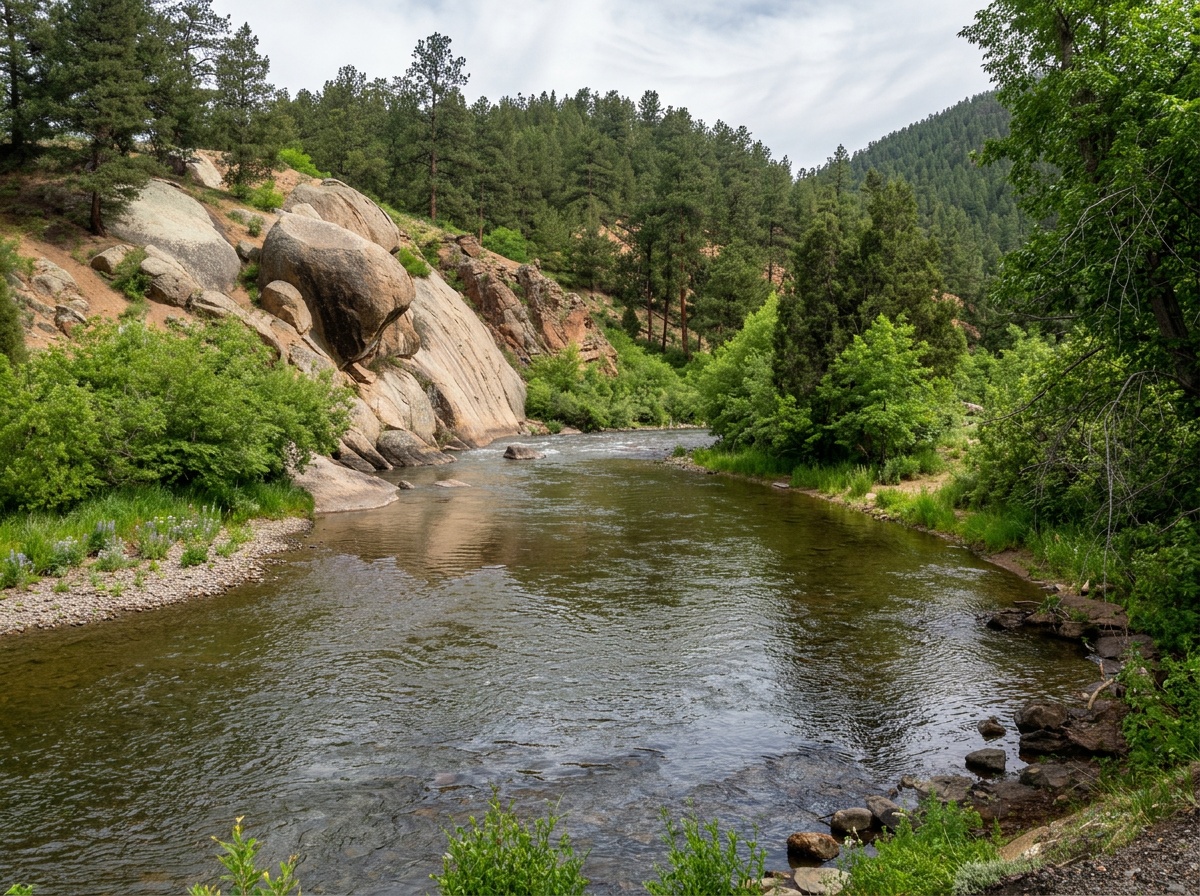
The lower North Fork of the South Platte runs from below Foxton Road down toward its meeting with the main South Platte above Strontia, and there's plenty of water to fish along the way. It's a medium-sized freestone with riffles, runs and pockets that look really good. Because it doesn't draw much of a crowd, it's a fine place to spend a day in relative solitude. The trout here are brown trout. Go in knowing they run small and aren't especially numerous. They don't get as big or as plentiful as on the Middle Fork of the South Platte just across the way, so the fishing can be hit or miss.
Read the complete overview
Two things hold this river back. Flows are inconsistent and can swing from trip to trip more than the water's appearance suggests. The drainage's mining history has also left its mark on insect life, which is lighter than on richer nearby rivers. Together, those go a long way toward explaining why the fish stay on the small side. That doesn't make the river empty of food. Midges, Blue-Winged Olives, caddis, golden stoneflies and summer terrestrials all have a place in the fishing year, and small nymph and dry-fly opportunities follow what you actually see trout eating. Streamers are the best all-around technique, though, because a small Woolly Bugger lets you cover a lot of good-looking water quickly and find the willing fish. The browns that do make it are good fighters and fun to catch.
Getting to the water from the Foxton Road side is easy, and a leashed dog is welcome. Public and private water mix as you head downstream, so use signed public access and the section map rather than assuming the bank stays open all the way to the confluence. You can fish here in every season when weather and flows allow, with spring through fall usually the most comfortable and productive stretch of the year.
Rain and snowmelt drive this river, and the flows here are inconsistent from trip to trip, so clarity and fish location can change with storms and spring runoff.
Big enough to break into individual runs, seams and pockets, but you can reach plenty of good water from the near side without a difficult crossing.
The casting is manageable. The challenge is reading variable flows and staying patient when the fish are scattered.
Public approaches below Foxton Road get you to the water quickly; watch for private gaps as you work downstream.
Expect to cover water. With low numbers of fish, this is a river for moving and exploring rather than parking on one run.
Brown Trout The brown trout here run small, but the ones that make it are good fighters and fun to catch.
Fit
Is the Lower North Fork Right for Your Trip?
Who'll enjoy this water and who should look elsewhere
- A quiet medium-river day for brown trout when you're happy to trade numbers for solitude.
- Covering lots of good-looking public water with a small streamer, or exploring runs and pockets with nymphs and a dry-dropper.
- An easy-access outing where a leashed dog is welcome.
Related water
More of the North Fork
The upper section offers the same river character on a different stretch

- You want high fish counts or reliably larger trout.
- You're counting on uninterrupted public bank access from Foxton Road all the way to the confluence.
Alternative rivers
Nearby South Platte Alternatives
Different water in the same basin when you want a change of pace or conditions
 Tailwater flows on the main South PlatteSouth Platte River - DeckersA medium-sized tailwater below a reservoir that fishes in all four seasons. Expect more technical fishing there, which makes it a good change of pace from the North Fork's freestone water.It's rated hard, so expect technical nymphing and small flies for selective trout rather than relaxed streamer prospecting.
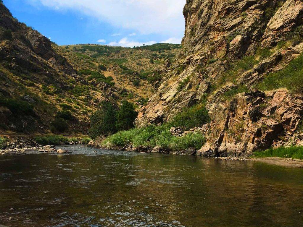 Freestone canyon water in the same basinSouth Platte River - Waterton CanyonAnother medium freestone on the South Platte, fishable in all four seasons, for anglers who enjoy reading runs and pockets.It's rated hard, so plan on more demanding presentations than the lower North Fork usually asks for.
Find your next river
Pick the river before you pack the truck.
Some days call for a quiet creek. Others call for room to cast or a shot at a bigger fish. Find the water that fits the day you want.
- Compare 250+ Colorado rivers and sections by season, fish size, difficulty and access.
- See over 5,000 mapped access points and get directions.
- Save favorite waters and keep a backup plan handy.
Conditions
Current Flows and Weather on the Lower North Fork
Check the live gauge trend and forecast before you go, since flows here change more than the river's looks suggest
Check the official gauge before leaving
A fresh reading is unavailable. Use dated history only as context.
Open the official gauge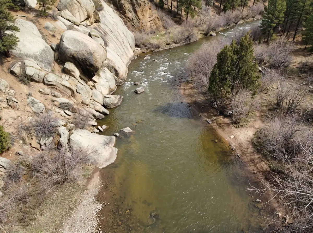
Readings are from the North Fork at Bailey, upstream of this section. Use them for context, then check the lower reach when you arrive.
Streamflow in CFS
Flow history is unavailable. Check the official gauge before leaving.
View all flow readings
| Date | Streamflow (CFS) |
|---|---|
| 2026-10-22 | 137 |
| 2026-10-23 | 138 |
| 2026-10-24 | 135 |
| 2026-10-25 | 135 |
| 2026-10-26 | 110 |
| 2026-10-27 | 75.8 |
| 2026-10-28 | 73.4 |
| 2026-10-29 | 95.3 |
| 2026-10-30 | 136 |
| 2026-10-31 | 138 |
| 2026-11-01 | 138 |
| 2026-11-02 | 142 |
| 2026-11-03 | 138 |
| 2026-11-04 | 137 |
| 2026-11-05 | 136 |
| 2026-11-06 | 128 |
| 2026-11-07 | 112 |
| 2026-11-08 | 110 |
| 2026-11-09 | 114 |
| 2026-11-10 | 70.7 |
Past Weather and the 7-Day Forecast
Foxton area: section point forecast
Station daily weather summary
- Precipitation
- 0 inLiquid equivalent
- Snowfall
- 0 in
- Avg. wind
- 1 mph E
- Observed sky / weather
- —
- Pressure
- —
Observation sources
Temperature: STRONTIA SPRINGS DAM. daily_station_report Source
Precipitation: STRONTIA SPRINGS DAM. Reported daily precipitation (liquid equivalent) and snowfall, in inches. Source
Wind: GW5596 BUFFALO CREEK. Mean station observations, 8am–6pm local Source
Pressure: GW5596 BUFFALO CREEK. Mean observed sea-level pressure, 8am–6pm local Source
Observed sky / weather: GW5596 BUFFALO CREEK. Qualitative station reports across available hours of the listed local date; not measured cloud percentage. Source
Daily station values are shown where available. Other fields retain their observation sources. 79 hourly station reports.
Observed detail unavailable
- Precipitation
- —Liquid equivalent
- Snowfall
- —
- Avg. wind
- 1 mph ENE
- Observed sky / weather
- —
- Pressure
- —
Observation sources
Temperature: GW5596 BUFFALO CREEK. day_spanning_observations Source
Precipitation: GW5596 BUFFALO CREEK. Hourly reports overlap; a daily precipitation total is unavailable. Source
Wind: GW5596 BUFFALO CREEK. Mean station observations, 8am–6pm local Source
Pressure: GW5596 BUFFALO CREEK. Mean observed sea-level pressure, 8am–6pm local Source
Observed sky / weather: GW5596 BUFFALO CREEK. Qualitative station reports across available hours of the listed local date; not measured cloud percentage. Source
Nearby GW5596 BUFFALO CREEK station observations: . High and low summarize available temperature samples, not certified daily extremes. Station conditions can differ from the canyon. 92 hourly station reports.
Observed detail unavailable
- Precipitation
- —Liquid equivalent
- Snowfall
- —
- Avg. wind
- 1 mph NNE
- Observed sky / weather
- —
- Pressure
- —
Observation sources
Temperature: GW5596 BUFFALO CREEK. day_spanning_observations Source
Precipitation: GW5596 BUFFALO CREEK. Hourly reports overlap; a daily precipitation total is unavailable. Source
Wind: GW5596 BUFFALO CREEK. Mean station observations, 8am–6pm local Source
Pressure: GW5596 BUFFALO CREEK. Mean observed sea-level pressure, 8am–6pm local Source
Observed sky / weather: GW5596 BUFFALO CREEK. Qualitative station reports across available hours of the listed local date; not measured cloud percentage. Source
Nearby GW5596 BUFFALO CREEK station observations: . High and low summarize available temperature samples, not certified daily extremes. Station conditions can differ from the canyon. 93 hourly station reports.
Observed detail unavailable
- Precipitation
- —Liquid equivalent
- Snowfall
- —
- Avg. wind
- 2 mph SE
- Observed sky / weather
- —
- Pressure
- —
Observation sources
Temperature: GW5596 BUFFALO CREEK. incomplete Source
Precipitation: GW5596 BUFFALO CREEK. Hourly reports overlap; a daily precipitation total is unavailable. Source
Wind: GW5596 BUFFALO CREEK. Mean station observations, 8am–6pm local Source
Pressure: GW5596 BUFFALO CREEK. Mean observed sea-level pressure, 8am–6pm local Source
Observed sky / weather: GW5596 BUFFALO CREEK. Qualitative station reports across available hours of the listed local date; not measured cloud percentage. Source
Nearby GW5596 BUFFALO CREEK station observations: . High and low summarize available temperature samples, not certified daily extremes. Station conditions can differ from the canyon. 84 hourly station reports.
Observed detail unavailable
- Precipitation
- —Liquid equivalent
- Snowfall
- —
- Avg. wind
- 3 mph SSE
- Observed sky / weather
- —
- Pressure
- —
Observation sources
Temperature: GW5596 BUFFALO CREEK. day_spanning_observations Source
Precipitation: GW5596 BUFFALO CREEK. Hourly reports overlap; a daily precipitation total is unavailable. Source
Wind: GW5596 BUFFALO CREEK. Mean station observations, 8am–6pm local Source
Pressure: GW5596 BUFFALO CREEK. Mean observed sea-level pressure, 8am–6pm local Source
Observed sky / weather: GW5596 BUFFALO CREEK. Qualitative station reports across available hours of the listed local date; not measured cloud percentage. Source
Nearby GW5596 BUFFALO CREEK station observations: . High and low summarize available temperature samples, not certified daily extremes. Station conditions can differ from the canyon. 89 hourly station reports.
Observed detail unavailable
- Precipitation
- —Liquid equivalent
- Snowfall
- —
- Avg. wind
- 1 mph ESE
- Observed sky / weather
- —
- Pressure
- —
Observation sources
Temperature: GW5596 BUFFALO CREEK. incomplete Source
Precipitation: GW5596 BUFFALO CREEK. Hourly reports overlap; a daily precipitation total is unavailable. Source
Wind: GW5596 BUFFALO CREEK. Mean station observations, 8am–6pm local Source
Pressure: GW5596 BUFFALO CREEK. Mean observed sea-level pressure, 8am–6pm local Source
Observed sky / weather: GW5596 BUFFALO CREEK. Qualitative station reports across available hours of the listed local date; not measured cloud percentage. Source
Nearby GW5596 BUFFALO CREEK station observations: . High and low summarize available temperature samples, not certified daily extremes. Station conditions can differ from the canyon. 87 hourly station reports.
Observed detail unavailable
- Precipitation
- —Liquid equivalent
- Snowfall
- —
- Avg. wind
- 3 mph SSE
- Observed sky / weather
- —
- Pressure
- —
Observation sources
Temperature: GW5596 BUFFALO CREEK. day_spanning_observations Source
Precipitation: GW5596 BUFFALO CREEK. Hourly reports overlap; a daily precipitation total is unavailable. Source
Wind: GW5596 BUFFALO CREEK. Mean station observations, 8am–6pm local Source
Pressure: GW5596 BUFFALO CREEK. Mean observed sea-level pressure, 8am–6pm local Source
Observed sky / weather: GW5596 BUFFALO CREEK. Qualitative station reports across available hours of the listed local date; not measured cloud percentage. Source
Nearby GW5596 BUFFALO CREEK station observations: . High and low summarize available temperature samples, not certified daily extremes. Station conditions can differ from the canyon. 79 hourly station reports.
Chance Light Snow
Snow chance41%Mostly Clear
Precipitation chance0%- Avg. wind
- 3 mph NNE
- Cloud cover
- 56%
- Pressure
- 29.96 inHg
Sunny
Precipitation chance0%Partly Cloudy
Precipitation chance0%- Avg. wind
- 3 mph ENE
- Cloud cover
- 24%
- Pressure
- 30.12 inHg
Partly Sunny then Chance Light Snow
Snow chance28%Chance Light Snow then Mostly Cloudy
Snow chance28%- Avg. wind
- 4 mph NE
- Cloud cover
- 58%
- Pressure
- 30.07 inHg
Sunny
Precipitation chance3%Mostly Clear
Precipitation chance0%- Avg. wind
- 3 mph E
- Cloud cover
- 14%
- Pressure
- 30.19 inHg
Mostly Sunny
Precipitation chance3%Partly Cloudy
Precipitation chance3%- Avg. wind
- 4 mph SW
- Cloud cover
- 35%
- Pressure
- 29.98 inHg
Mostly Sunny
Precipitation chance13%Partly Cloudy
Precipitation chance13%- Avg. wind
- 5 mph NW
- Cloud cover
- 35%
- Pressure
- 29.97 inHg
Mostly Sunny
Precipitation chance6%- Avg. wind
- 8 mph NNW
- Cloud cover
- 26%
- Pressure
- 29.83 inHg
Weather sources
National Weather Service · GW5596 BUFFALO CREEK. Wind and cloud averages use 8am–6pm local time. Forecast pressure: MET Norway, averaged daytime sea-level pressure in inches of mercury (CC BY 4.0). Past station reports do not include forecast rain chances or exact cloud percentages; a dash means unavailable.
Unlock the full guide
Know where to fish and what to tie on.
Put the forecast to work. Compare streamflow history on gauged waters, then open the full fishing plan for the section you pick.
- See where to start and how to fish each season.
- Match local hatches and fill your box with the recommended flies.
- Open the access map and get directions before you leave.
Gallery
Photos of the Lower North Fork
Get a feel for the runs, pockets and setting before you make the drive
River Explorer Pro
Make this your next fishing trip.
Unlock River Explorer Pro and make your next fishing trip your best adventure yet.
- Find where to get on the water with interactive access maps and directions.
- Plan around recent weather and streamflows where gauges are available.
- Pack the right flies with seasonal tactics, hatch charts and pattern recommendations.
- Compare 250+ Colorado rivers and sections and save a backup stretch.