
Overview
Fishing the North Fork of St Vrain Creek in Wild Basin
Four trout species in a hike-in mountain creek inside Rocky Mountain National Park.
The North Fork of St. Vrain Creek in Wild Basin is a hike-in creek inside Rocky Mountain National Park. You walk to this water rather than pull up beside it. It's a small, cold freestone stream: plunge pools, short riffles, boulder pockets and quiet edges, with good fish holding in places you can often cover in one or two casts. Rainbows, browns, cutthroat and brook trout are all possible here, though any given pool may hold only one or two of them. That mix is part of the fun. You may not know which fish will come up next, and the scenery around you is some of the best on the Front Range.
Read the complete overview
Expect plenty of trout, and expect them to be small. The difficulty here comes less from fussy fish than from everything around them. You walk in, you get close without being seen, and you make short, accurate casts in tight water where a drift may last only a few seconds. Dry flies are the best technique for most of the season. A buoyant dry, alone or with a light nymph under it, will find willing fish in most pockets, as long as you aren't dragging it across the current or spooking the pool before your first cast. The trail is popular, so the water closest to the trailhead and the obvious viewpoints sees the most people. Your willingness to keep walking is often what puts you in front of fish that haven't seen many flies.
These are small trout in cold mountain water, so release them carefully and quickly. Barbless hooks make that easier. Keep the fish wet, slip the hook out and let it swim away from your hand. Wild Basin sits inside the national park, so park entry requirements, including a park pass, apply. Treat this as a spring-through-fall hiking fishery that rewards a light pack, a short rod-length mindset and patience with the approach.
Freestone creek fed by snowmelt, so flows rise and fall with snowpack and weather rather than releases from a dam.
Small. Short casts, tight pockets and pools you can often cover from a single spot.
Medium. The trout are usually willing, but the hike, the approach and short, accurate casts in tight water take some skill.
Hard. You reach the water on foot from Wild Basin trails inside the national park, with park entry requirements. This isn't drive-up water.
Many trout in the creek. Brook trout, cutthroat, browns and rainbows are all present in the St. Vrain system, though not in equal numbers.
Rainbow Trout, Brown Trout, Cutthroat Trout, Brook Trout Small. Come for numbers, variety and scenery rather than big fish.
Fit
Is the Wild Basin Section Right for Your Trip?
It rewards anglers willing to hike and make short casts, but it won't suit a drive-up or big-fish plan.
- You want a hiking-oriented small-creek day in Wild Basin with a mix of modest trout.
- You like short casts and careful approaches in scenic public park water.
- You enjoy fishing dry flies to willing trout in pocket water from spring through fall.
Related water
Other St Vrain Creek Sections to Fish
The same creek with roadside pull-offs or easier town water when Wild Basin doesn't fit your day.
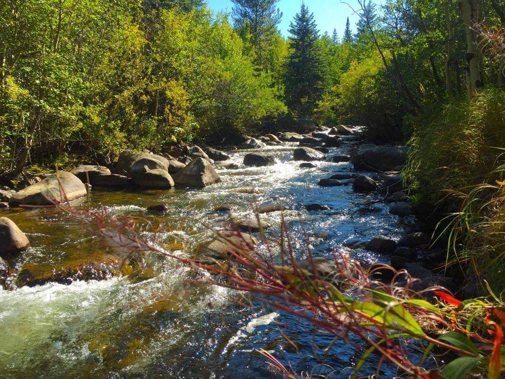 Roadside solitude on the same creekSt Vrain Creek - Middle ForkThe Middle Fork is the same kind of small freestone St. Vrain water, with a few pull-offs along Highway 7 and the Peak to Peak Highway. It gets little pressure and offers good solitude, so it's a nice choice when Wild Basin's trail traffic is more than you want.It's tight-quartered water with more willows and branches than most beginners will appreciate, so expect short roll casts and some time pulling flies out of the brush.
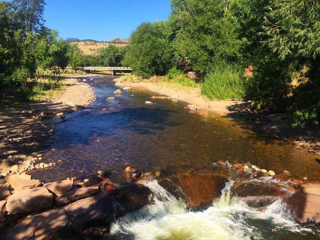 Easier access and lots of fishSt Vrain Creek - Town SectionThe Town Section in Lyons is loaded with fish, it's easier water to fish and much easier to reach than Wild Basin, and its lower elevation makes it a good option when the high country is still snowed in or getting cold. Late evening can be an especially productive time to fish there.You trade the mountain scenery and quiet for the noise of a town, which some anglers don't like.
- You want drive-up access, large trout or a dependable winter trip.
- You'd rather make long casts in open water than work tight pockets.
- You want to bring your dog; this isn't the trip for that.
Alternative rivers
A Different Water When Wild Basin Isn't Fishing
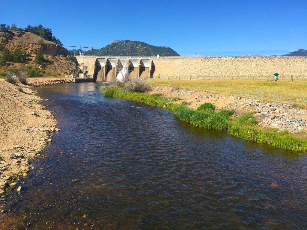
A nearby tailwater for winter or for days when snowmelt has the creek out of shape.
Find your next river
Pick the river before you pack the truck.
Some days call for a quiet creek. Others call for room to cast or a shot at a bigger fish. Find the water that fits the day you want.
- Compare 250+ Colorado rivers and sections by season, fish size, difficulty and access.
- See over 5,000 mapped access points and get directions.
- Save favorite waters and keep a backup plan handy.
Conditions
Current Flows and Weather in Wild Basin
Before you commit to the hike, check whatever flow information is available, note when it was last observed, and look at the weather. This creek fishes best between about 5 and 75 cfs.
Current streamflow is unavailable
Check the latest reading at the gauge before you head out.
Open the official gaugeReadings are from the North St. Vrain near Allenspark. Use them as context and check local levels at your fishing spot.
Past Weather and the 7-Day Forecast
Allenspark area: section point forecast
Observed detail unavailable
- Precipitation
- —Liquid equivalent
- Snowfall
- —
- Avg. wind
- —
- Observed sky / weather
- —
- Pressure
- —
Observation sources
Temperature: COPELAND LAKE. day_spanning_observations Source
Precipitation: COPELAND LAKE. Hourly reports overlap; a daily precipitation total is unavailable. Source
Wind: COPELAND LAKE. Mean station observations, 8am–6pm local Source
Pressure: COPELAND LAKE. Mean observed sea-level pressure, 8am–6pm local Source
Observed sky / weather: COPELAND LAKE. Qualitative station reports across available hours of the listed local date; not measured cloud percentage. Source
Nearby COPELAND LAKE station observations: . High and low summarize available temperature samples, not certified daily extremes. Station conditions can differ from the canyon. 19 hourly station reports.
Observed detail unavailable
- Precipitation
- —Liquid equivalent
- Snowfall
- —
- Avg. wind
- —
- Observed sky / weather
- —
- Pressure
- —
Observation sources
Temperature: COPELAND LAKE. day_spanning_observations Source
Precipitation: COPELAND LAKE. Hourly reports overlap; a daily precipitation total is unavailable. Source
Wind: COPELAND LAKE. Mean station observations, 8am–6pm local Source
Pressure: COPELAND LAKE. Mean observed sea-level pressure, 8am–6pm local Source
Observed sky / weather: COPELAND LAKE. Qualitative station reports across available hours of the listed local date; not measured cloud percentage. Source
Nearby COPELAND LAKE station observations: . High and low summarize available temperature samples, not certified daily extremes. Station conditions can differ from the canyon. 19 hourly station reports.
Observed detail unavailable
- Precipitation
- —Liquid equivalent
- Snowfall
- —
- Avg. wind
- —
- Observed sky / weather
- —
- Pressure
- —
Observation sources
Temperature: COPELAND LAKE. incomplete Source
Precipitation: COPELAND LAKE. Hourly reports overlap; a daily precipitation total is unavailable. Source
Wind: COPELAND LAKE. Mean station observations, 8am–6pm local Source
Pressure: COPELAND LAKE. Mean observed sea-level pressure, 8am–6pm local Source
Observed sky / weather: COPELAND LAKE. Qualitative station reports across available hours of the listed local date; not measured cloud percentage. Source
Nearby COPELAND LAKE station observations: . High and low summarize available temperature samples, not certified daily extremes. Station conditions can differ from the canyon. 18 hourly station reports.
Observed detail unavailable
- Precipitation
- —Liquid equivalent
- Snowfall
- —
- Avg. wind
- —
- Observed sky / weather
- —
- Pressure
- —
Observation sources
Temperature: COPELAND LAKE. incomplete Source
Precipitation: COPELAND LAKE. Hourly reports overlap; a daily precipitation total is unavailable. Source
Wind: COPELAND LAKE. Mean station observations, 8am–6pm local Source
Pressure: COPELAND LAKE. Mean observed sea-level pressure, 8am–6pm local Source
Observed sky / weather: COPELAND LAKE. Qualitative station reports across available hours of the listed local date; not measured cloud percentage. Source
Nearby COPELAND LAKE station observations: . High and low summarize available temperature samples, not certified daily extremes. Station conditions can differ from the canyon. 15 hourly station reports.
Observed detail unavailable
- Precipitation
- —Liquid equivalent
- Snowfall
- —
- Avg. wind
- —
- Observed sky / weather
- —
- Pressure
- —
Observation sources
Temperature: COPELAND LAKE. day_spanning_observations Source
Precipitation: COPELAND LAKE. Hourly reports overlap; a daily precipitation total is unavailable. Source
Wind: COPELAND LAKE. Mean station observations, 8am–6pm local Source
Pressure: COPELAND LAKE. Mean observed sea-level pressure, 8am–6pm local Source
Observed sky / weather: COPELAND LAKE. Qualitative station reports across available hours of the listed local date; not measured cloud percentage. Source
Nearby COPELAND LAKE station observations: . High and low summarize available temperature samples, not certified daily extremes. Station conditions can differ from the canyon. 20 hourly station reports.
Observed detail unavailable
- Precipitation
- —Liquid equivalent
- Snowfall
- —
- Avg. wind
- —
- Observed sky / weather
- —
- Pressure
- —
Observation sources
Temperature: COPELAND LAKE. incomplete Source
Precipitation: COPELAND LAKE. Hourly reports overlap; a daily precipitation total is unavailable. Source
Wind: COPELAND LAKE. Mean station observations, 8am–6pm local Source
Pressure: COPELAND LAKE. Mean observed sea-level pressure, 8am–6pm local Source
Observed sky / weather: COPELAND LAKE. Qualitative station reports across available hours of the listed local date; not measured cloud percentage. Source
Nearby COPELAND LAKE station observations: . High and low summarize available temperature samples, not certified daily extremes. Station conditions can differ from the canyon. 11 hourly station reports.
Observed detail unavailable
- Precipitation
- —Liquid equivalent
- Snowfall
- —
- Avg. wind
- —
- Observed sky / weather
- —
- Pressure
- —
Observation sources
Temperature: COPELAND LAKE. incomplete Source
Precipitation: COPELAND LAKE. Hourly reports overlap; a daily precipitation total is unavailable. Source
Wind: COPELAND LAKE. Mean station observations, 8am–6pm local Source
Pressure: COPELAND LAKE. Mean observed sea-level pressure, 8am–6pm local Source
Observed sky / weather: COPELAND LAKE. Qualitative station reports across available hours of the listed local date; not measured cloud percentage. Source
Nearby COPELAND LAKE station observations: . High and low summarize available temperature samples, not certified daily extremes. Station conditions can differ from the canyon. 6 hourly station reports.
Sunny
Precipitation chance6%Partly Cloudy
Precipitation chance0%- Avg. wind
- 28 mph W
- Cloud cover
- 10%
- Pressure
- 30.09 inHg
Mostly Cloudy
Precipitation chance0%Partly Cloudy then Chance Snow Showers
Snow chance33%- Avg. wind
- 4 mph SSW
- Cloud cover
- 70%
- Pressure
- 29.94 inHg
Chance Snow Showers
Snow chance38%Chance Snow Showers
Snow chance43%- Avg. wind
- 15 mph WSW
- Cloud cover
- 54%
- Pressure
- 29.77 inHg
Slight Chance Snow Showers then Mostly Sunny
Snow chance19%Partly Cloudy
Precipitation chance6%- Avg. wind
- 8 mph W
- Cloud cover
- 37%
- Pressure
- 30.06 inHg
Mostly Sunny
Precipitation chance0%Partly Cloudy
Precipitation chance5%- Avg. wind
- 4 mph WSW
- Cloud cover
- 24%
- Pressure
- 30.06 inHg
Chance Snow Showers
Snow chance53%Chance Snow Showers
Snow chance53%- Avg. wind
- 3 mph WSW
- Cloud cover
- 62%
- Pressure
- 30 inHg
Mostly Sunny
Precipitation chance14%- Avg. wind
- 4 mph WSW
- Cloud cover
- 39%
- Pressure
- 30.22 inHg
Weather sources
National Weather Service · COPELAND LAKE. Wind and cloud averages use 8am–6pm local time. Forecast pressure: MET Norway, averaged daytime sea-level pressure in inches of mercury (CC BY 4.0). Past station reports do not include forecast rain chances or exact cloud percentages; a dash means unavailable.
Unlock the full guide
Know where to fish and what to tie on.
Put the forecast to work. Compare streamflow history on gauged waters, then open the full fishing plan for the section you pick.
- See where to start and how to fish each season.
- Match local hatches and fill your box with the recommended flies.
- Open the access map and get directions before you leave.
Gallery
Photos of the North Fork St Vrain
A look at the scenery and the size of the water you'll be fishing.
River Explorer Pro
Make this your next fishing trip.
Unlock River Explorer Pro and make your next fishing trip your best adventure yet.
- Find where to get on the water with interactive access maps and directions.
- Plan around recent weather and streamflows where gauges are available.
- Pack the right flies with seasonal tactics, hatch charts and pattern recommendations.
- Compare 250+ Colorado rivers and sections and save a backup stretch.