
Overview
Smith Fork of the Gunnison: A Quiet Small-Creek Trip Near Crawford
A hike-in freestone with spooky rainbows and browns, thick brush and real solitude
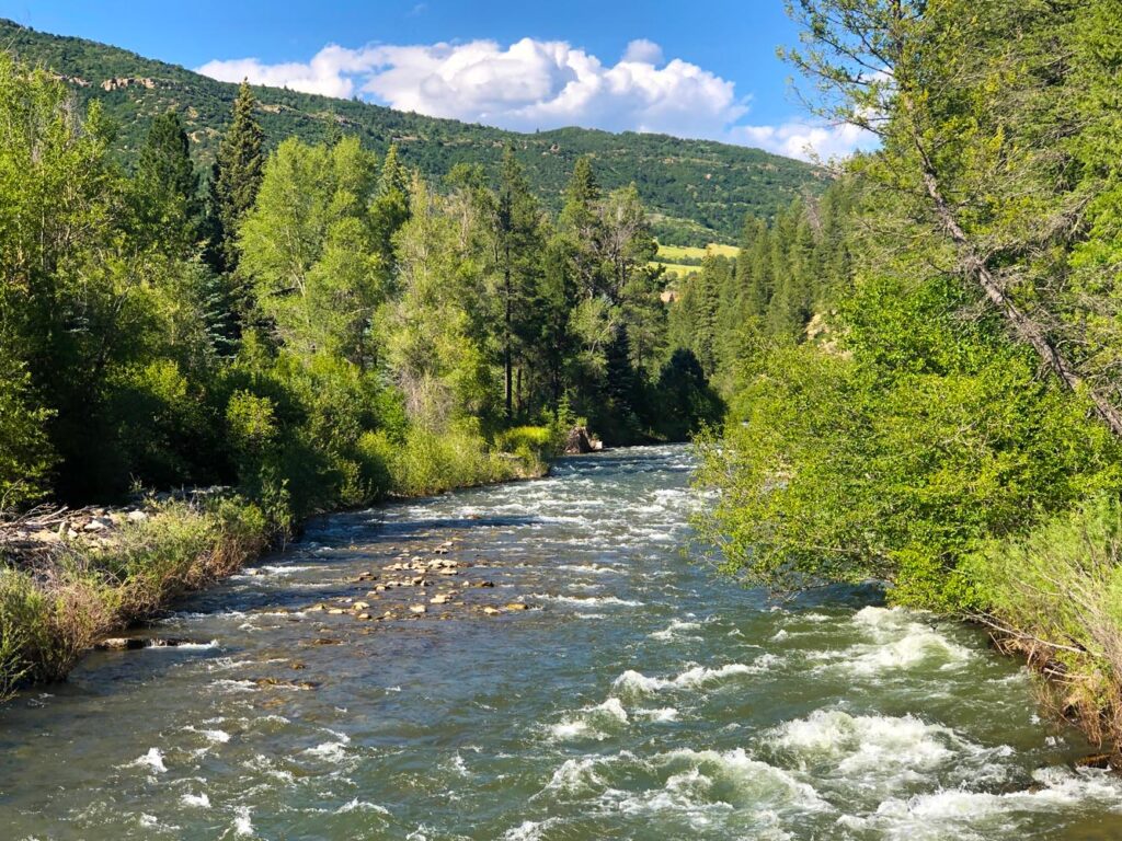
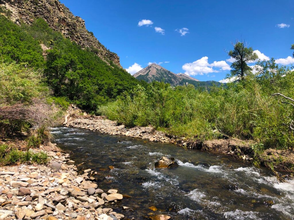
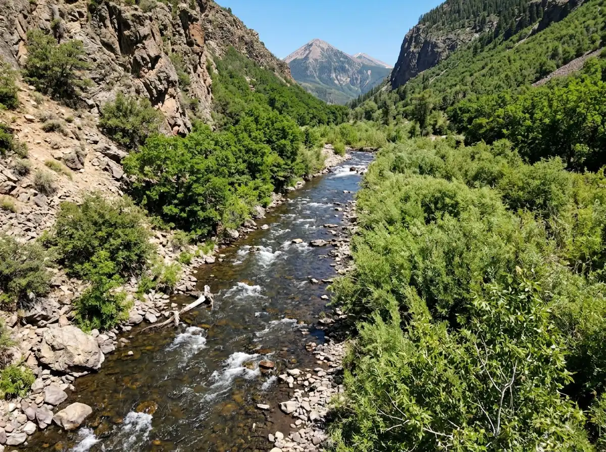
The Smith Fork of the Gunnison is one of the least accessible forks of the river because of the hike-in and private property issues. It's a small freestone creek on the Crawford side, with Needle Rock rising north of the valley as a handy landmark. There's enough water for a small group of anglers to cover in a day or two, but not much beyond that. Getting around is half the trip. The foliage is thick, so bushwhacking is a must through pinyon pine, sagebrush and thickets. Give cattle plenty of room, and keep a dog close or leashed.
Read the complete overview
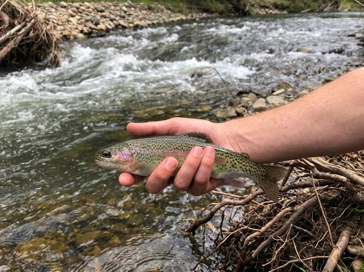
The fish are rainbow and brown trout. They run small, the numbers are moderate, and the difficulty sits in the middle. The few times I've fished it, the fishing has been decent, and if you enjoy chasing new water and solitude, the Smith Fork is a good option. Be stealthy as you fish. These trout don't see many anglers, but they're still spooky in the often clear water, so a quiet approach and short, accurate casts matter more than a long fly-box rotation.
A dry-dropper is the best way to cover most of the creek, and the deeper pools give you a chance at nymphing or euro-nymphing. Bring two rods, or a modular setup that lets you switch between both. Summer and fall are the seasons to fish it. Early summer is the best time, once runoff recedes and the flow runs clear and stable, but before the water gets too low. If fall has been warm in a low-water year, measure the water temperature before you fish, because warm low water stresses trout, and move on if it's too warm. Treat it well and enjoy a real gem of solitude.
A runoff-fed freestone creek. It fishes best once snowmelt clears and settles, and it can get low and warm late in a dry year.
Small water that a small group can cover in a day or two: pockets, short runs and a few deeper pools, mostly fished with short casts.
Medium. The casts are short, but thick brush, clear water and spooky fish make accuracy and a quiet approach count.
Hard. Expect a hike, bushwhacking through pinyon, sage and thickets, and private land. Use signed public access or get permission.
Some. The fishing has been decent with moderate numbers, so fish each good pocket carefully.
Rainbow Trout, Brown Trout Small rainbow and brown trout, well suited to a light rod and close-range fishing.
Fit
Is the Smith Fork Right for Your Trip?
Solitude and pocket water come with a hike, bushwhacking and limited access
- A short, quiet, brushy outing with a little hiking and some close-range casting.
- You enjoy exploring new water and want real solitude on a lightly fished creek.
- You like dry-dropper fishing in pocket water and switching to a nymph rig for a few deeper pools.
- You're comfortable bushwhacking and reading water from the bank before you step in.
Related water
Similar Creeks in the Anthracite Drainages
Two freestone options with the same summer and fall window and a different approach
 Easier small creekAnthracite Creek Main SectionIt's another small freestone creek with the same summer and fall window, rated easy, so it works well if you want small-creek fishing with less difficulty than the Smith Fork.It sits in a separate North Fork drainage with its own approach, so plan it as a different day out rather than an add-on to a Crawford trip.
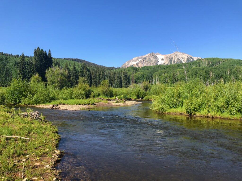 More room to castRuby Anthracite Creek - Main SectionIt's a medium-size freestone with the same medium difficulty and summer and fall window, which gives you more water and casting room than a brushy small creek.Bigger water means less of the tight pocket fishing the Smith Fork is known for, and it's a separate North Fork drainage with a different approach.
- An easy public corridor, roadside fishing or a winter trip.
- You're hoping for big fish or high numbers.
- You want enough water for several days of fishing or a large group.
- It's a warm fall in a low-water year and you can't check the water temperature.
Alternative rivers
A Bigger-River Option on the North Fork of the Gunnison
More room to cast and a spring window

Find your next river
Pick the river before you pack the truck.
Some days call for a quiet creek. Others call for room to cast or a shot at a bigger fish. Find the water that fits the day you want.
- Compare 250+ Colorado rivers and sections by season, fish size, difficulty and access.
- See over 5,000 mapped access points and get directions.
- Save favorite waters and keep a backup plan handy.
Weather
Smith Fork of the Gunnison River Weather
Check recent rain and the forecast before you head to the creek.
Plan around the weather
This stretch is ungauged. Use the forecast below and look for changes in water level after rain or snowmelt.
Past Weather and the 7-Day Forecast
Smith Fork near Crawford: section point forecast
Observed detail unavailable
- Precipitation
- —Liquid equivalent
- Snowfall
- —
- Avg. wind
- —
- Observed sky / weather
- —
- Pressure
- —
Observation sources
Temperature: PAONIA 1SW. incomplete Source
Precipitation: PAONIA 1SW. Hourly reports overlap; a daily precipitation total is unavailable. Source
Wind: PAONIA 1SW. Mean station observations, 8am–6pm local Source
Pressure: PAONIA 1SW. Mean observed sea-level pressure, 8am–6pm local Source
Observed sky / weather: PAONIA 1SW. Qualitative station reports across available hours of the listed local date; not measured cloud percentage. Source
Nearby PAONIA 1SW station observations: . High and low summarize available temperature samples, not certified daily extremes. Station conditions can differ from the canyon. 42 hourly station reports.
Observed detail unavailable
- Precipitation
- —Liquid equivalent
- Snowfall
- —
- Avg. wind
- —
- Observed sky / weather
- —
- Pressure
- —
Observation sources
Temperature: PAONIA 1SW. incomplete Source
Precipitation: PAONIA 1SW. Hourly reports overlap; a daily precipitation total is unavailable. Source
Wind: PAONIA 1SW. Mean station observations, 8am–6pm local Source
Pressure: PAONIA 1SW. Mean observed sea-level pressure, 8am–6pm local Source
Observed sky / weather: PAONIA 1SW. Qualitative station reports across available hours of the listed local date; not measured cloud percentage. Source
Nearby PAONIA 1SW station observations: . High and low summarize available temperature samples, not certified daily extremes. Station conditions can differ from the canyon. 45 hourly station reports.
Observed detail unavailable
- Precipitation
- —Liquid equivalent
- Snowfall
- —
- Avg. wind
- —
- Observed sky / weather
- —
- Pressure
- —
Observation sources
Temperature: PAONIA 1SW. day_spanning_observations Source
Precipitation: PAONIA 1SW. Hourly reports overlap; a daily precipitation total is unavailable. Source
Wind: PAONIA 1SW. Mean station observations, 8am–6pm local Source
Pressure: PAONIA 1SW. Mean observed sea-level pressure, 8am–6pm local Source
Observed sky / weather: PAONIA 1SW. Qualitative station reports across available hours of the listed local date; not measured cloud percentage. Source
Nearby PAONIA 1SW station observations: . High and low summarize available temperature samples, not certified daily extremes. Station conditions can differ from the canyon. 52 hourly station reports.
Observed detail unavailable
- Precipitation
- —Liquid equivalent
- Snowfall
- —
- Avg. wind
- —
- Observed sky / weather
- —
- Pressure
- —
Observation sources
Temperature: PAONIA 1SW. incomplete Source
Precipitation: PAONIA 1SW. Hourly reports overlap; a daily precipitation total is unavailable. Source
Wind: PAONIA 1SW. Mean station observations, 8am–6pm local Source
Pressure: PAONIA 1SW. Mean observed sea-level pressure, 8am–6pm local Source
Observed sky / weather: PAONIA 1SW. Qualitative station reports across available hours of the listed local date; not measured cloud percentage. Source
Nearby PAONIA 1SW station observations: . High and low summarize available temperature samples, not certified daily extremes. Station conditions can differ from the canyon. 44 hourly station reports.
Observed detail unavailable
- Precipitation
- —Liquid equivalent
- Snowfall
- —
- Avg. wind
- —
- Observed sky / weather
- —
- Pressure
- —
Observation sources
Temperature: PAONIA 1SW. day_spanning_observations Source
Precipitation: PAONIA 1SW. Hourly reports overlap; a daily precipitation total is unavailable. Source
Wind: PAONIA 1SW. Mean station observations, 8am–6pm local Source
Pressure: PAONIA 1SW. Mean observed sea-level pressure, 8am–6pm local Source
Observed sky / weather: PAONIA 1SW. Qualitative station reports across available hours of the listed local date; not measured cloud percentage. Source
Nearby PAONIA 1SW station observations: . High and low summarize available temperature samples, not certified daily extremes. Station conditions can differ from the canyon. 48 hourly station reports.
Observed detail unavailable
- Precipitation
- —Liquid equivalent
- Snowfall
- —
- Avg. wind
- —
- Observed sky / weather
- —
- Pressure
- —
Observation sources
Temperature: PAONIA 1SW. incomplete Source
Precipitation: PAONIA 1SW. Hourly reports overlap; a daily precipitation total is unavailable. Source
Wind: PAONIA 1SW. Mean station observations, 8am–6pm local Source
Pressure: PAONIA 1SW. Mean observed sea-level pressure, 8am–6pm local Source
Observed sky / weather: PAONIA 1SW. Qualitative station reports across available hours of the listed local date; not measured cloud percentage. Source
Nearby PAONIA 1SW station observations: . High and low summarize available temperature samples, not certified daily extremes. Station conditions can differ from the canyon. 36 hourly station reports.
Observed detail unavailable
- Precipitation
- —Liquid equivalent
- Snowfall
- —
- Avg. wind
- —
- Observed sky / weather
- —
- Pressure
- —
Observation sources
Temperature: PAONIA 1SW. day_spanning_observations Source
Precipitation: PAONIA 1SW. Hourly reports overlap; a daily precipitation total is unavailable. Source
Wind: PAONIA 1SW. Mean station observations, 8am–6pm local Source
Pressure: PAONIA 1SW. Mean observed sea-level pressure, 8am–6pm local Source
Observed sky / weather: PAONIA 1SW. Qualitative station reports across available hours of the listed local date; not measured cloud percentage. Source
Nearby PAONIA 1SW station observations: . High and low summarize available temperature samples, not certified daily extremes. Station conditions can differ from the canyon. 47 hourly station reports.
Partly Sunny
Precipitation chance0%Mostly Cloudy
Precipitation chance8%- Avg. wind
- 4 mph SW
- Cloud cover
- 68%
- Pressure
- 30.1 inHg
Chance Snow Showers
Snow chance41%Chance Snow Showers then Mostly Cloudy
Snow chance35%- Avg. wind
- 3 mph W
- Cloud cover
- 89%
- Pressure
- 30.16 inHg
Sunny
Precipitation chance0%Mostly Clear
Precipitation chance1%- Avg. wind
- 3 mph SW
- Cloud cover
- 18%
- Pressure
- 30.36 inHg
Mostly Sunny
Precipitation chance4%Mostly Cloudy
Precipitation chance4%- Avg. wind
- 3 mph S
- Cloud cover
- 42%
- Pressure
- 30.16 inHg
Mostly Sunny
Precipitation chance13%Partly Cloudy
Precipitation chance13%- Avg. wind
- 3 mph WNW
- Cloud cover
- 42%
- Pressure
- 30.28 inHg
Mostly Sunny
Precipitation chance7%Partly Cloudy
Precipitation chance14%- Avg. wind
- 3 mph WSW
- Cloud cover
- 37%
- Pressure
- 30.22 inHg
Partly Sunny then Slight Chance Snow Showers
Snow chance18%- Avg. wind
- 3 mph SW
- Cloud cover
- 52%
- Pressure
- 29.94 inHg
Weather sources
National Weather Service · PAONIA 1SW. Wind and cloud averages use 8am–6pm local time. Forecast pressure: MET Norway, averaged daytime sea-level pressure in inches of mercury (CC BY 4.0). Past station reports do not include forecast rain chances or exact cloud percentages; a dash means unavailable.
Unlock the full guide
Know where to fish and what to tie on.
Put the forecast to work. Compare streamflow history on gauged waters, then open the full fishing plan for the section you pick.
- See where to start and how to fish each season.
- Match local hatches and fill your box with the recommended flies.
- Open the access map and get directions before you leave.
Gallery
Smith Fork Photos
A look at the brush, sage and clear pockets you'll be fishing
River Explorer Pro
Make this your next fishing trip.
Unlock River Explorer Pro and make your next fishing trip your best adventure yet.
- Find where to get on the water with interactive access maps and directions.
- Plan around recent weather and streamflows where gauges are available.
- Pack the right flies with seasonal tactics, hatch charts and pattern recommendations.
- Compare 250+ Colorado rivers and sections and save a backup stretch.